
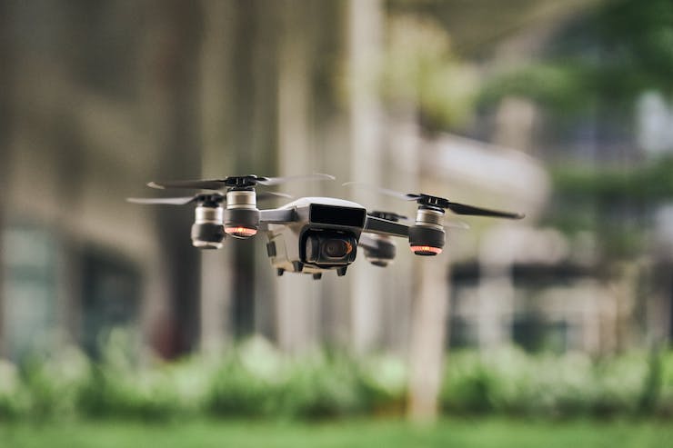
Drone Manufacturers, the FAA, and NASA Working On Geofencing to Keep Drones From Flying In Restricted Areas
This past year, the FAA released more Part 107 licenses than ever before. A Part 107 is the license needed to fly a drone for commercial purposes. This includes drones being used for photography, filming, agriculture, security, mapping, surveying, inspections, construction, emergency, and much more. By the end of 2018 nearly 116,000 new drone pilots received a Part 107, surpassing the FAA’s expected numbers by 10,000. By the end of 2019 this number rapidly increased. There is no denying it, drones are becoming critical commercial tools.
With more and more drones occupying the skies the fear of them causing an accident with a manned aircraft has increased. North American airspace is the most crowded airspace in the world. Luckily there has yet to be an incident where a manned aircraft has collided with a drone. But, there have been many near misses and times when authorized aircraft have had to be grounded because a drone has encroached into restricted airspace. The concern isn’t so much for general airspace as manned aircraft fly at a much higher altitude than drones. The concern is for airspace around airports, runways, and landing pads. It is these areas where a serious accident could happen. The rules laid out in the Part 107 demand that no drone can fly within a 5 mile radius of airports and other restricted airspace. Unfortunately, when flying a drone knowing exactly where the no fly zone line is can be confusing.
That is why drone manufacturers, the FAA, and even NASA are looking into to ways to automatically stop a drone from purposely or accidentally entering a restricted airspace with something called geofencing. Brent Klavon, a board member of the Association for Unmanned Vehicle Systems International and director for commercial drones at Aviation Systems Engineering Co. in Jacksonville explained that geofencing sets up a wireless barrier that will stop a drone in the air. He said, “Think of it as an invisible dog fence. If my dog [with an electronic collar] tries to leave the yard, it gets zapped and turns around. Similarly, a drone would know it’s approaching an invisible fence and it would hit that bumper and return.” In other words a geofence could be set up around a 5 mile radius of an airport. If a drone is being operated nearby and begins to come to close to that geofence, it will automatically be forced to fly away from the restricted zone.
The technology for geofencing is still in it’s emergent state. Klavon explained that it’s similar to a car’s air bag. What was at first a safety measure being worked out is now a standard on all cars. In the future all drones will come equipped with a geofencing system. This system could be installed within the drone, as a box attached to the drone, or as part of the drone’s controller. Geofencing will become such a vital aspect to be integrated into drone systems that NASA has launched a competition to speed up the technology needed to make sure all drones can comply to geofencing principles.
The name of NASA’s competition is SAND (Safeguard with Autonomous Navigation Demonstration). As described on their website, “SAND is an opportunity for small businesses to compete in an autonomous unmanned aerial vehicle (UAV) competition to help NASA address safety-critical risks associated with flying UAVs in the national airspace. Set in a post-natural disaster scenario, SAND will push the envelope of aviation.” Already NASA has begun the work with the creation of Safeguard, a geofencing protocol for drones. Kelly Hayhurst is NASA’s lead inventor at Langley for Safeguard. She explains, “For each of our fences, we set up a buffer in front of the boundaries. When the drone crosses into a buffer, the drone gets a warning that goes to its autopilot that says, ‘You need to take some corrective action.’ It has an opportunity to not go across the fence.” If the drone’s pilot does not take corrective actions Safeguard will send a message to the drones flight termination system and force it to land immediately.
The SAND competition will ask those participating to take Safeguard and apply it in real world scenarios. NASA outlines that the SAND “challenge will address some of the safety critical risks associated with flying UAVs in the national airspace system: 1) flight outside of approved airspace; 2) unsafe proximity to people or property; and 3) critical system failure. ” NASA believes that with a working geofencing system drones will one day be able to fly freely within cities, and even BVLOS (Beyond Visual Line of Sight), allowing drones to reach their ultimate potential. Those participating in SAND are well under way and the competition will commence in May, 2020.
Geofences, invisible dog collars for drones, will be the key to making sure drones can safely occupy airspace. As Klavon pointed out, “This is technology that would be something that manufacturers could be told that they have to have and incorporate into their system so when they sell these drones there’s built-in safety features that could help prevent that mid-air collision.” In the meantime it is up to every drone operator to be diligent about staying out of no fly zones.
|