
Lamar University Researchers Using Drones to Monitor Beach Erosion After Hurricane Season
Each year the Atlantic coastal regions of the United States brace themselves for hurricane season. The season runs loosely from June to November typically hitting the southern states like Florida, Texas, North Carolina, and Louisiana the hardest. Upwards of 100 storms varying in intensity can make landfall each season. It’s estimated that the damages left in the wake of hurricane season can reach up to $28 billion a year. In preparation, residents secure their homes as best as possible and stock up on necessities. Meanwhile, the government and private sectors set up emergency protocols to limit damage, protect citizens, and assist in recovery. To better prepare for hurricanes and the damages they cause, a team of researchers from Lamar University in Beaumont, TX has begun using drones to collect data.
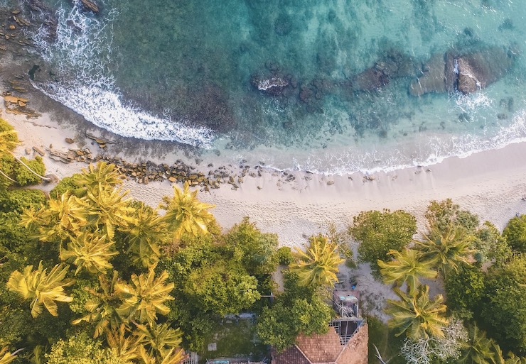
Best known for its excellent nursing programs, Lamar, part of the Texas State University System, has been making strides in the field of Earth and Space Science. Under the leadership of the department’s chairman, Dr. Jim Jordan, research on how hurricanes have impacted coastal erosion along McFaddin Beach began this past September. Located in Jefferson County on the upper coast of the Texas Gulf, McFaddin Beach has become a site of accelerated erosion. Geologically, the beach is of great interest as accumulations of redeposited archeological artifacts are frequently found there. Preservation of the beach is necessary for archeological study. After Hurricane Laura subsided at the end of August, Professor Jordan along with Assistant Professor and Geospatial Center Director Reda Amer and a group of students headed out to McFaddin to assess the damage.
Though Hurricane Laura was one of the deadliest storms to hit the Atlantic coast, it made landfall in Louisiana so the damage left behind in Texas was relatively minimal. This minimal damage provided the team from Lamar with optimal conditions to use a drone to map the beach. After Hurricane Ike in 2008, McFaddin Beach was severely damaged. By 2017, restorations were finally made to the beach. Images taken from planes and satellites already exist, but they only show a partial picture of the erosion rates. A drone equipped with a thermal camera on the other hand can give geologists much more detailed data. As Professor Jordan said of the drone, ” Our coverage area is smaller but with greater detail. Satellites yield a pixel size of 30 meters by 30 meters or about 100 feet by 100 feet. Our drones’ pixels are only about 1 inch square.”
The detailed thermal images collected by the drone were then uploaded to a system to manifest 3D digital maps that show precise locations of damage erosion concentrations. These maps were compared to those taken by satellite and led the team to discover that the 20 miles of coastal repairs made had been mostly successful. However, there were clear areas that were not able to stand up to the forces of Laura resulting in the degradation of vegetation and breaches of a clay berm, both of which are part of erosion restoration practices.
As of now, the drone has only been used once to map McFaddin Beach. With at least 2 months left of the 2020 Hurricane season, experts are predicting a lot more activity to come. Professors Jordan and Amer intend to use the drone to survey McFaddin Beach over the extent of the year. Each subsequent set of data collected by the drone will provide the researchers with geospatial clues as to how the beach naturally protects itself, as well as the forces of gradual and sudden erosion on the coast. The goal is to use the drone’s data to create better plans for protecting and restoring the beach. “We have to do something for our environment and for our community,” Professor Amer said. “We are trying to find the scientific methods to minimize the erosion rates so we can keep our lands.” With tools like drones at their disposal the possibility of restoring McFaddin Beach, and other areas experiencing advanced erosion, can be met.
|