
Mining Companies Are Using Drones to Map and Plan the Best Ways to Make Mines More Efficient, Safer and Cheaper
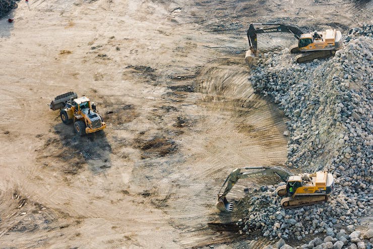
Most people don’t realize just how much we rely on mining companies to supply us with the raw materials needed for everyday uses. Mined materials are used in everything from the construction of roads and buildings, to materials for electronics and cars. Not to mention the need to mine for power sources as well. Mining is not simply digging into the earth and gathering up what you find. It requires precision and detailed planning and can be very dangerous if mistakes are made. Whether it is surface or underground mining to be done, drones have come a long way in streamlining the mining process.
Drones are able to help mine managers run efficient mines. An efficient mine translates into higher yields of materials and money, a smaller ecological footprint, and safer conditions for miners. Before ever breaking ground, a concise map of the area needs to be constructed. Drones are able to supply mine managers with maps that go well beyond simple measurements. With GPS, LIDAR, 3D, and thermal imaging capabilities, a map taken by a drone will give miners total situational awareness of a dig site. Recently Kespry, one of the biggest mining and aggregate drone companies, announced some new improvements to their service models.
Founded in 2013 by Parker Clark and Paul Doersch in the San Francisco Bay Area, Kespry has been serving customers throughout North America, Europe, and Australia. They provide drone mapping and reading services so “organizations capture, analyze and share insights about their businesses, providing the information they need to accelerate operations,” as explained on the company’s website. Kespry’s Summer 2020 updates include an improved haul roads feature, DJI Phantom 4 RTK compatibility, and seamless data transfer.
For miners, having a safe haul road is imperative. It is the passage by which materials are transferred. The haul road, or haulage, needs to support massive amounts of weight and friction. If the haulage begins to wear, catastrophic events could happen. The haulage is often one of the most detailed aspects of a dig site to ensure safety and efficiency. Now managers can program into a system exactly where they want to build a haul road. With a press of a button, a drone will autonomously map out the site in question, providing instant feedback as to the proper dimensions for the building of the path. Once the haul road is complete, the data is stored and the drone can be sent up to remap periodically to ensure that it is maintaining safe conditions.
So as to make their platform available to users everywhere, Kespry has two drone models they utilize. A custom Kespry drone or the DJI Phantom 4 RTK. As the Phantom 4 RTK has become one of the most popular mapping drones, they have added it to their arsenal of tools. Not only is Kespry using the Phantom 4 RTK, but they have made their software available to any company already with this drone in their possession. Kespry realizes that many mining companies have their own full time licensed drone operators. Now whether your company has a drone operation, or is looking to hire one, Kespry can provide both hardware and software packages to customize a service.
But perhaps the most impressive upgrade is that Kespry will partner with providers like Dronebase to make collected data available quicker than ever. While drones have gone a long way in speeding up the process by which maps are created, getting those maps in a format that is usable can still take weeks. This means that mine managers still have to plan sites months or weeks in advance, often with wasteful downtime. With the support of Dronebase, all data is instantly uploaded to the Kespry Cloud. The cloud translates data into 2D and 3D maps in a fraction of the time. As a spokesperson for Kespry said, “By working with providers such as Dronebase, Kespry customers can access global pilot networks to fly their missions, and have results in 48-72 hours.”
Faster analytics, drone compatibility, and accurate site planning lead to a safe and efficient mine site. With these conditions, dangerous yet necessary mining operations can continue at a higher rate and standard than ever before. Kespry is providing these services to miners throughout the world in a seamless manner so that they can get to what needs to be done, providing the world with the raw materials it needs.
|