
Police Department In Lafayette, Indiana Using Drones to Map Out Accident Scenes So They Can Quickly Reopen the Roadways
Throughout the United States, police departments have been gradually developing drone programs to assist with daily protocols. At one time, drones were strictly military tools, then they became recognized for their recreational and commercial possibilities. Now the benefits they provide to police and emergency workers are tremendous. This past January, Capt. Robert Hainje from the Tippecanoe County Sheriff’s Office in Lafayette, IN went to Washington D.C. for the annual Transportation Research Board meeting to share his findings on drone use in the Traffic Law Enforcement: Innovative Tools Policy, and Countermeasures for Law Enforcement presentation.
The Tippecanoe County Sheriff’s Office began its drone program in November of 2016 with an off the shelf drone that cost the department $3,000 to $4,000. The drone is equipped with a forward facing 4K-resolution, thermal camera. The drone can be used during the day or night, and even in inclement weather. They have used the drone to track suspects, search for missing persons, investigate crime scenes, and often to map crash sites. It was the use of drones at crash sites that was the key point Capt. Hainje discussed in his D.C. presentation.
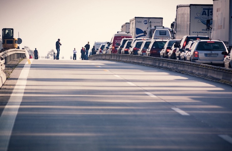
When a roadside crash happens, the delay caused in investigating it can be very dangerous. Officers need to be in the middle of traffic where they can easily be injured. A roadway can not be reopened until a thorough map of the scene is compiled. This traditionally means hand measuring and photographing the site. In some situations, aerial images are required that would mean having to wait for a very expensive fixed wing aircraft or helicopter to arrive on the scene. It is the longest portion of a crash investigation and the entire process can take hours. These traffic jams in turn lead to a 64% increased rate of secondary crashes.
The quicker officers can gather the needed evidence for prosecutors, families, and insurance agencies, the quicker they can reopen the roadway keeping themselves and citizens safe. With a drone, this is possible and cost efficient. The department has 6 officers who are trained and FAA licensed to operate the drone and can be on site within minutes. Once they have arrived at the site of an accident the drone can be instantly sent up to take detailed photographs. The drone is flown over the crash in a grid pattern capturing about 100 images in 2 second intervals. From the time the drone arrives at a crash to the time it is packed back into its case, the entire process takes anywhere from 15-30 minutes. Normal traffic can resume and hours of expensive manpower are saved.
A little over a year after the department initiated the drone program, they entered into a collaboration with nearby Perdue University. Known for being leaders in technological advancements, Perdue’s Department of Civil Engineering was perfectly poised to bring the Tippecanoe County Sheriff’s Office drone program to the next level. Led by Professor Ayman Habib the procedure for collecting data has been expedited. The images are uploaded to a software program the knits everything together in minutes so officers can be on their way. A 3D digital map is created of the site that can then be sent to any parties in need. Added to the digital maps, the team from Perdue has also begun creating 3D printed models of crash scenes. “We’re able to accurately reconstruct those scenes and provide valid information to the prosecutor’s office and to families that are questioning what happened in those crashes,” Capt. Hainje said. These models, both digital and physical, become great tools for future training purposes as well.
In 2018, the department used the drone to map 20 crash sites. The drone was used an additional 15 times in support of other law enforcement procedures in Tippecanoe and the surrounding counties. For any criminal investigations or search and rescue missions, the department is required to first obtain a warrant to use the drone. These warrants are rushed so the officers can use the drone to the best of their abilities. However, when it comes to using the drone to map and reconstruct the scene of an accident, the drone operator only needs to have a flight plan in place. When Capt. Hainje spoke in Washington he highlighted all of these benefits, encouraging other police and emergency departments to adopt drone programs into their repertoires. The more tools like drones that police officers have at their disposal, the better they can protect and serve their communities.
|