
The Birth of Under Water Drones
When we think of drones, we normally picture a standard UAV, an airborne drone with either rotors or wings. But in actuality, that is a very limited description of a drone. Really a drone can be any unmanned aircraft ,ship, or vehicle that can navigate remotely or autonomously. So yes, a drone can be a flying machine like the DJI Phantom, or even a land bound drone like the SpotMini by Boston Dynamics. The point is, drones are machines that come in all different sizes and configurations. One such drone is the Slocum Glider, an underwater drone.
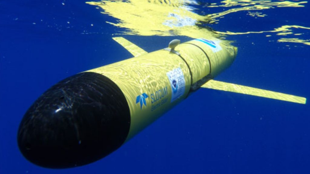
Developed for Teledyne Marine, a company that specializes in providing marine solutions, the Slocum Glider is a six foot long bright yellow drone that looks like a submarine torpedo. Named in honor of the first man to single-handedly sail around the world, Joshua Slocum, this drone is built to travel long distances, over great periods of time in the ocean collecting data. With it’s web based piloting tools, the Slocum Glider can be remotely controlled from anywhere in the world. It is powered by a buoyancy propulsion drive that allows it to spend months at sea before needing to be recovered and is equipped with upwards of 40 data collecting sensors. And what makes them a marine researcher’s best friend is their durability in extreme ocean conditions. According to the Teledyne Marine specs on it, “No matter the sea state, gliders are capable of continuous sampling without risking personnel or costly assets. Slocum gliders routinely operate around the world in extreme weather conditions.”
This is why assistant professor of marine sciences at the Skidaway Institute of Oceanography, Catherine Edwards, and several other marine scientists enlisted the help of the Slocum Glider to monitor Hurricane Florence. Previously, forecasters were reliant on information gathered by satellite to track the trajectory of a hurricane. But because a satellite can only gather slivers of information at a time, the data is often less than perfect. Because of the elaborate sensors on the Slocum Glider, a far more complete hurricane trajectory image can be created. With a better image of the strength of an impending storm and it’s trajectory, forecasters can better prepare civilians as well as government and rescue personnel.
Typically the Slocum Glider has been being used to map the ocean along the US East Coast and Caribbean waters. It is used to measure ocean temperatures to predict smaller scale storms. It is also being used to measure pH and salinity levels, clarity, and the presence of plankton, all as indicators of ocean health. This underwater drone is helping scientists to gather information that was previously only available through patchy satellite imagery. With this drone researchers can finally unlock some of the mysteries of our ocean depths.
|