
The Country of Nepal is Using Drones to Map Housing Developments and Plan Evacuation Routes
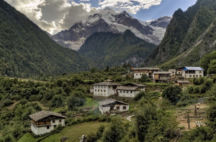
The south Asian country of Nepal is perhaps best known for being the home of the majestic Himalayans, including earth’s highest point, Mount Everest. Nepal’s capital, Kathmandu, is one of the fastest growing cities in Asia with an average population increase of 4% a year. Nestled in the Kathmandu Valley, the city is home to over 6.5 million people. In 2015, Nepal suffered through 2 major earthquakes less than a month apart from each other. On April 25, 2015, a 7.8 magnitude quake occurred in the Gorkha District injuring 22,000 people and killing another 9,000. Then on May 12, while many were still living in temporary shelters from the first earthquake, a 7.3 magnitude quake struck along the same fault line. More than 3,200 people were injured and over 150 people died.
The combined factors of trying to recover from these catastrophic events and the country’s rapid population growth, have led the government to recognize the need for better urbanization planning. To best build cities and developments, detailed mapping is needed to be done. However, existing satellite images were proving inaccurate. After having long opposed the use of drones, the Nepalese government changed its stance and enlisted the help of Flying Labs and other local drone specialists to properly map the country. Flying Labs facilitates drone networks throughout the world with local experts. Flying Labs has hubs in Asia, Africa, and Latin America. In Nepal, the Flying Labs hub is supported by the digital mapping and geodata company Naxa.
Naxa, which is the Nepalese word for maps, was co-founded by Geomatics Engineers Uttam Pudasaini, Arun Bhandari, and Upendra Oli. As explained on Naxa’s website, “We conduct drone flights for spatial data collection in large scale. Drone image processing and data analysis are our technical competencies. We perform flight planning, capture aerial datasets and image processing for UAV based data collection and mapping projects.” Together Naxa and Flying Labs have been using drone technology to map Nepal for urban planning and disaster relief.
While the drone mapping projects have proven successful, many obstacles had been met in terms of flying safely in crowded areas. That is until things changed this year in the wake of the worldwide response to the Coronavirus. For the first time in years, the skies and streets have been virtually free of traffic opening up the possibility for frequent drone flights. Uttam said that in the past getting clearance to fly any drones in the Kathmandu Valley has been extremely difficult because of the Tribhuvan International Airport. With the valley only being 100sq km, finding a safe way to share airspace with an airport that sees an average of 130,000 flights a year has been problematic. As flights have come to a near halt over the last few months, Uttam seized the opportunity to gather as much geodata as possible. “If it [were] not for COVID-19, it would have been challenging to map dense core urban areas like these,” Uttam said. “At another time, it would have taken weeks of preparation.”
With skies clear of airplanes and people safely quarantining in their homes Naxa and Flying Labs were able to fly drones over 2 municipalities within Kathmandu and one a bit outside of the valley. Uttam, along with support from experts and volunteers, used SenseFly eBee drones by the Parrot Group that are specifically designed for automated mapping missions. Light weight and easy to use, eBee drones provide a complete system for mapping an area of 4.6 sq miles per flight. Over the course of 21 flights in just a few hours, an area of 35 sq km was mapped with 1,828 high resolution images. These images were then digitally compiled to be used for a wide range of uses.
The digital maps that Naxa and Flying Labs were able to create this past March will help city planners develop housing and emergency plans. The drones don’t just supply data on where to build housing, but information on the infrastructure on existing buildings. Inspectors can study the data to see if the roof of a building is sound, or if another building may be prone to flood damage. For emergency purposes, the drone data will be used to plan for evacuation routes during the annual monsoon season. And, in response to the lessons learned form the 2015 earthquakes, Naxa uses the drone collected data to “develop disaster information management platforms that can store, manage and visualize risk, hazard and resource data to provide better insights for better disaster preparedness,” as stated on the website.
Though Kathmandu is a rapidly expanding urban environment, access to drone technology has been limited. With the help of Flying Labs, companies like Naxa have been granted the opportunity to use drones to better the lives of those who call Kathmandu home. It is undoubtedly unfortunate that Nepal and the world have had to quarantine because of the spread of COVID-19. But, the silver lining that Uttam recognized as an opportunity to gather critical data could potentially save lives in the event of future disasters.
|