
Underwater Drones Finding Sunken Ships Under the Golden Gate Bridge
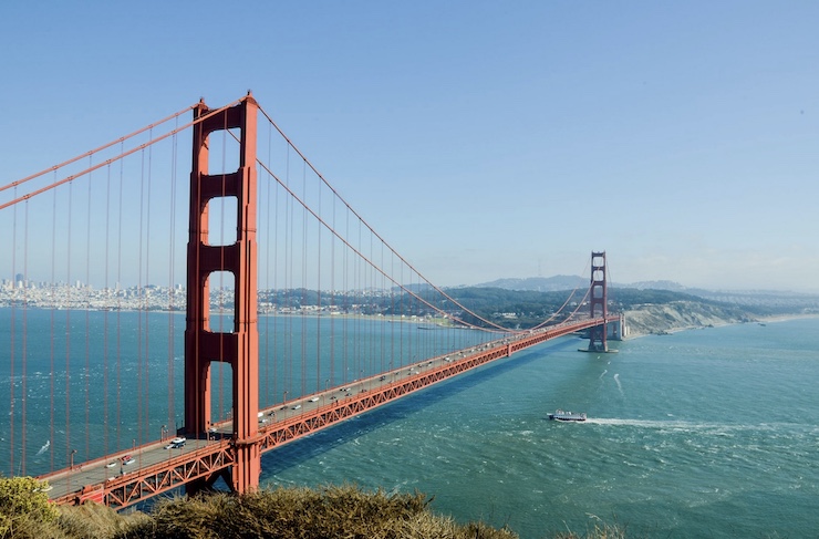
On January 5, 1933, construction on the Golden Gate Bridge commenced. Engineered by Joseph Strauss, the bridge took 4 years to complete and cost more than $35 million. When the bridge opened to the public on May 27, 1937, it was the world’s longest and tallest suspension bridge spanning 4,200ft and reaching 746ft into the air. Today the Golden Gate Bridge is one of the most recognizable landmarks in the United States of America and has been declared as one of the Wonders of the Modern World. Before the bridge was built, the only way to travel from across the San Fransisco Bay was by ferry. Nearly 50 years before the completion of the bridge, one such ferry was sunk directly below the bridge’s expanse.
The SS City of Chester was a steamboat that was ferrying 90 passengers across the bay on August 22, 1888. It was a foggy morning, and the ship was caught in a strong tidal current. Crossing the 202ft long Chester’s path was the massive British ocean liner, the RMS Oceanic. The Oceanic was too large to alter its course, and the tidal current wouldn’t allow the Chester to evade a collision. As an eyewitness aboard the Oceanic stated, “Into her we crashed with irresistible force, cutting her just as though she was a cheese.” It only took 6 minutes for the SS City of Chester to sink down to the bottom of the bay taking 16 lives with her.
Over the years, there had been several missions to locate the remains of the sunken ship. The U.S. Coast and Geodetic Survey, the predecessor of the National Oceanic Atmospheric Administration (NOAA), believed to have found the sunken ship while charting the bay’s harbor. There was no way to raise the shipwreck or confirm the find, and the SS City of Chester was mostly forgotten. In May of 2013, while researching the sunken wreckage of the freighter Fernstream, NOAA’s Office of Coast Survey Navigational Response Team 6 (NRT6) stumbled upon what appeared to be the Chester. James Delgado, Director of NOAA’s Maritime Heritage, tasked NRT6 to use the agency’s cache of technological tools to examine the possibility of finally reclaiming the lost ship.
The NOAA has been using drones in its 9 key areas of study for years now. These areas include studying weather, climate, fisheries, oceans and coasts, satellites, marine and aviation, sanctuaries, charting, and technological innovation. Drones have become pivotal tools for meeting the mission goals of all NOAA objectives. Drones are used to gather data on water salinity and levels, atmospheric and climate changes, monitoring fisheries and endangered species, and creating detailed maps of the mysterious ocean floor. The NOAA uses the Saildrone, a long endurance drone that glides across the water’s surface along with a wide range of multi rotor and fixed winged aerial drones. Another drone they use is the Slocum glider built by the Woods Hole Oceanographic Institute.
The Slocum glider looks like a bright yellow torpedo, but instead of rear propellers, it navigates using buoyancy and fixed fins. Also a long endurance drone, the glider can operate at depths up to 1,000 meters. It is equipped with a range of sensors that collect data. NRT6 used multiple sonar systems to scan the location where the City of Chester rested. After spending nearly 9 months pouring over the data collected by the drone, a complete picture of the sunken ship was formed.
The drone data revealed that the SS City of Chester was sitting upright 216ft below the water surface. According to historical documents, the ship lay directly below the site of the collision. The drone images captured the exact dimensions of the ship and showed that it had been mostly buried by the ocean floor. A follow up drone scan revealed the fateful gash in the ship’s side inflicted by the RMS Oceanic, confirming that it was the SS City of Chester. Because the ship has been buried by mud and debris, it has been preserved intact. However, these factors prevent the possibility of raising the ship.
The research collected by NRT6 has been put on display by the NOAA and the ship’s seabed grave is a protected site. As Mr. Delgado pointed out, the world’s oceans are living museums that need to be protected. “Connecting to the history of the Chester is sad in one way, but we were also connecting to scientific history on a different level,” said NOAA NRT6 team leader Laura Pagano. It took more than 120 years for the technology to advance enough to find the SS City of Chester’s final resting place. Since the San Fransisco Bay was discovered by Gaspar de Portolà in 1769, hundreds of ships have fallen due to the bay’s famous fog, rocky reefs, and strong currents. With drones, it may be possible to rediscover more secrets hiding beneath the Golden Gate Bridge.
|