
University of California Natural Reserve System Using Drones To Study the Aftereffects of Wildfires
Each year, more than 100,000 researchers and students go to one of the many reserve sites that make up the University of California Natural Reserve System (NRS). The NRS represents the world’s largest university reserve system with 41 research sites covering 47,000 acres of land and 50 miles of protected coastal shorelines. Throughout the NRS samples of nearly every type of Californian ecosystem can be found. As their website goes on to explain, “The NRS offers outdoor laboratories to field scientists, classrooms without walls for students, and nature’s inspiration to all.” One of the many areas of study conducted at NRS sites is how wildfires occur and affect the landscape of California.
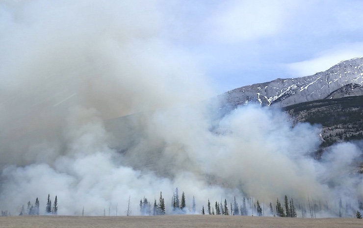
From spring through autumn, the dry, hot, windy weather of California creates the perfect breeding grounds for wildfires. Over the last decade, these fires have gotten progressively worse due to climate change, wood fuel found throughout forested areas, and increased electrical wires needed to support growing populations. This year’s wildfire season has been an intense one, the worst in recorded history in California. As of November 2020, more than 9,000 wildfires have destroyed 4,359,517 acres, about 4% of the total acreage of California. The worst of these fires happened in August during which more than 16,500 acres of NRS land was consumed.
While these fires are devastating, researchers at NRS can learn quite a lot from them. “Although the burns are tragic, in many ways, they present an unparalleled opportunity to understand how California’s ecosystems recover from wildfire,” says Peggy Fiedler, executive director of the NRS. “Our teams will gather baseline information that can guide recovery efforts on our reserves and across the West.” To collect this data NRS researchers have turned to drones to rapidly, safely, and accurately gather information.
As the Director of the Environmental Information and Technology Program at NRS, as well as leading the California Heartbeat Initiative (CHI), Becca Fenwick is responsible for finding ways to implement technology based research tools at NRS sites. As stated in her bio, “Becca manages a geographically-dispersed IT team who work with reserve staff, researchers, and the public to support all of the needs that come with using technology in the great outdoors. In partnership with researchers at Berkeley and UC ANR IGIS, Becca has been spearheading the development of CHI, a long term environmental monitoring program on the UC NRS and RECs using UAVs, environmental sensors, and satellite imagery to look at the health of the state’s ecosystems.”
Becca uses a wide range of drones to conduct her research, including her favorite the eBee X fixed wing mapping drone by SenseFly. These drones are the perfect tool to study the burned areas of the NRS sites as much of the areas are covered with hills and ravines that are difficult to traverse. Being able to collect images through a bird’s eye point of view not only keeps researchers safe but allows them to rapidly create topographical detailed maps. This past October, Becca sent a drone up to map a 200 acre section of one of the NRS sites, UC Berkeley’s Hastings Natural History Reservation. The Hastings site saw more than 600 acres of land destroyed by fires over the summer. The drones Becca used to map Hastings will provide NRS researchers with a bevy of data sets.
The data collected by the drones will help researchers understand how wildfires spread throughout different landscapes. It will also show them how these ecosystems change and heal after such devastation. It will show them how underground water channels reroute and how that impacts the regeneration of soil and vegetation. It will give them a picture of how insects and small animals adapt to changes in their environment. All of this information can then be used to study how an ecosystem can heal and how we humans can build models to further ensure the health of these post wildfire ecosystems.
Becca plans on using her drones to map 8 other NRS sites over the coming weeks. Each of the sites that she will be mapping with the drones has unique characteristics that will help create a complete picture of how wildfires travel through and change different landscapes. As Kathleen Wong, a spokesperson for NRS pointed out, they know they cannot stop wildfires from happening altogether, but they can better understand them and how to respond to the fires. “The bottom line is that the state is going to be facing, and is already facing, more frequent wildfires on its natural landscapes,” Wong said. “Getting a better understanding of what these fires do to ecosystems and the soil is going to be important to understand how to best manage these impacts.”
|