
University Student Working With Drones to Help Solve Out of Control Wildfires
For Jennifer Fowler, science has always been intriguing. “I knew I wanted to be in science when I was in 8th grade working on my first science fair project: a motorized go-cart,” Jennifer said. When she became a university student, she specialized in the physics of flying machines. Today Jennifer is the Director of the Autonomous Aerial Systems Office at the Univerisity of Montana and the Assistant Director of the Montana Space Grant Consortium.
One of the programs Jennifer runs through the university is a Part 107 (the exam to become a licensed commercial drone pilot) course. The course is offered once each quarter and is held at a Northstar Jet hanger at the nearby Missoula International Airport. The course costs $740 and includes everything you would need to prepare for the exam, such as course materials, simulator time, and actual flight time. An additional $175 would be paid directly to the FAA (Federal Aviation Administration) for the actual exam.
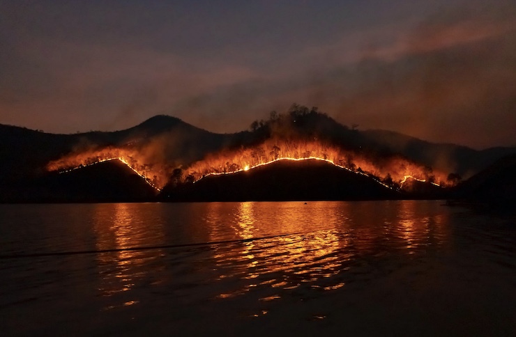
But as expressed in Jennifer’s university bio, “Her particular research interests lie in acquisition of higher resolution atmospheric profile data and its impact on forecast accuracy.” Jennifer has joined Dr. Carl Seielstad, a fire scientist for the National Center for Landscape Fire Analysis (FireCenter) in the College of Forestry and Conservation at The University of Montana, in a project that uses drones to predict and manage wildfires. Climate change has led to an increase in wildfires throughout the world in the last few years. As of July 2021, there were 30,875 wildfires recorded for the year spanning more than 1.4 million acres. With the lack of rainfall in much of the western US, it stands to reason that the nation could be facing yet another historic wildfire season.
Looking to solve out of control wildfires, Jennifer has equipped drones with an array of sensors. These highly tuned sensors can measure wind speed and direction, along with temperatures and humidity levels. These readings are all geotagged and transmitted in real time to researchers on the ground. All drone data is also stored to be compared for database sets. “If we can figure out where these fires are going to go and even give a better heads-up on what structures are in danger and when people need to evacuate,” Jennifer said, “I see a future where we can really make improvements and help.
Of course, there are some limits as to what Jennifer can do with the drones right now. Drone regulations are impeding Jennifer’s research from reaching the next level. One of these regulations is that drones can’t be flown over 400ft. Jennifer explains that this is an OK starting point, but when it comes to collecting data for weather and fire forecasting it is not a high enough elevation to get all the necessary information. Another drawback is the limited flight times drones have because of battery capacity. However, Jennifer is also working with WiBotic to develop alternate charging and power options for drones.
Ultimately, Jennifer and the team from the University of Montana want to give firefighters the information they need to protect themselves, the land, and the communities they serve. “They would really like to have better forecast,” Jennifer said of firefighters, “just to really know, you know, when can we attack these lines a little bit more efficiently and where can we move resources. They just don’t know all the time what’s going to happen.” This coming October, Jennifer will be joining a controlled burn with her drones to further test her predictive research.
|