
Can Detection and Prevention Drones Stop a Wildfire Before It Starts?
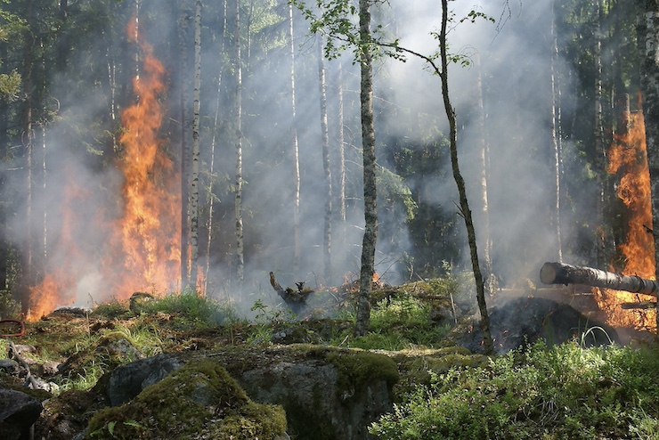
Seasonal wildfires destroy millions of dollars worth of property annually, primarily in the western United States. Fires also wreak long-term environmental damage, while endangering wildlife as well as humans. Efforts to respond to these devastating blazes, which are becoming more frequent and damaging due to climate change, are improving. After years of resistance, state fire-fighting agencies are beginning to welcome UAVs into the mix of traditional methods that includes satellites, fixed wing aircraft, helicopters and field crews.
But most of these state agencies still focus on wildfire containment not on detection and prevention. Fortunately, thanks to some pioneering efforts at the University of California at Davis, that emphasis is beginning to shift, with drones squarely at the center.
Zhaodan Kong, a professor at the UC Davis Department of Mechanical and Aerospace Engineering and his colleague, Dr. Anthony Wexler, are collaborating in the development of a hybrid system that combines ground-based sensors that can identify the soil, temperature and wind conditions that facilitate a wildfire with a fleet of mobile UAVs that can swoop in with payloads of their own cameras and chemical sensors to sweep the designated area for further indications of a fire, including elevated rates of particulate matter and carbon dioxide in the air.
When these combined ground and air-based sensor readings reach a designated threshold, an automatic warning signal is sent to CALFire, the state’s fire–fighting monitoring agency, to allow for a rapid reaction response, nipping the incipient wildfire threat in the bud. That’s the theory, at least – but it remains to be fully tested.
The advantage of their new hybrid system, Kong and Wexler say, is its ability to go beyond the current means of purely visual detection of wildfires that tends to come too late to stop a fire before it starts. The current detection system, while extensive, has some important gaps. AlertCalifornia, for example, manages some 1,000 cameras set up on towers in areas throughout the state considered especially vulnerable to wildfire, but those cameras can only detect fires within their field of view.
NASA’s fire-sensing algorithms scan for fires from high-altitude satellites but their images are too distant and grainy to determine a fire’s exact location and size – and clouds and bad weather often blur or obstruct what can be seen. And manned aircraft only launch in response to signs of smoke and must fly and establish visual confirmation of a fire before further action is taken. These combined systems simply aren’t enough.
Kong and Wexler say there is some persistent bureaucratic resistance to the idea that additional wildfire detection methods are needed but the continuing rise in the number, scope and severity of seasonal blazes – which reached record highs in 2022 – is awakening authorities to the need to explore new methods. They emphasize that current detection systems are vital and must be preserved, but a new hybrid system is desperately needed to help close some persistent gaps in surveillance.
The two researchers recently proposed their ideas to the National Science Foundation and California Climate Investments for funding. Approval of their request is still pending.
“We are going to use the ground sensor network to predict the high risk, and then the UAVs to patrol the area to find the fire, and then we are going to alert the authorities and fly out,” says Kong. “It has to be satellites, watchtowers, UAVs, manned aircraft, ground sensors, all the mechanisms working together in order to have a system to predict and detect wildfires.”
|