Could Drones Become Our Next-Generation “Storm Chasers”?
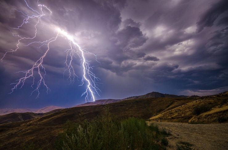
Drones are well-known for providing compelling video footage of the devastation wreaked by extreme weather events, including tornadoes and hurricanes. But can these same unmanned aircraft teach us more about how these storms develop, analyze their trajectory and help us limit the prospective damage? Apparently, they can.
Surface and underwater drones are already being used extensively in hurricane prediction and monitoring, with superior results. But chasing tornadoes has proven far more difficult. In fact, research on tornadoes is still in its infancy; very little is actually known for certain about why some storms become tornadoes and others do not; in addition, key features of tornadoes including their notorious barrel spins, still aren’t fully understood.
The problem is twofold: access and safety. Tornadoes and twisters can form suddenly, and being on hand and close enough to record their movements isn’t easy – or always safe. Because their trajectory can be unpredictable, storm chasers have to be careful about how they pursue them. Helicopters and road vehicles, unlike remotely piloted drones, have humans aboard them, and cannot always take quick evasive action.
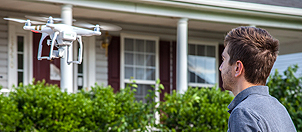
Another obvious advantage of drones is simply their vantage point. Above the tree line and even higher, they can assess a tornado’s movements from multiple angles, detecting key differences between its base and apex. Using sensors and zoom and thermal imaging cameras, drones can record numerous atmospheric features of a tornado as well as its surrounding environment – all in real time.
Until now, researchers have relied upon satellites, helicopters and hot air balloons for high altitude tornado research, but each method has significant operational and safety limitations. The weather surrounding tornadoes tends to limit the visual quality of satellite imagery, and hot air balloons can perish while recording a storm; helicopters simply can’t get close enough or hover long enough safely near a raging tornado to obtain the needed data.
It turns out that getting inside the eye of the tornado – a feat that drones can readily accomplish – is not that useful to researchers. What is useful is the use of drones to collect detailed data on the temperature, pressure and wind speed of the environment above the tornado as well as the environment operating at the ground level, which researchers now believe is critical to why some extreme thunderstorms may produce tornadoes while others do not.
In the past radar was unable to detect movements at the lowest ground level, largely because of the geometric limits of its beams near the land surface. Researchers now believe that the interaction of specific atmospheric conditions and certain surface terrains – especially hills and forests – trigger the formation of tornadoes, but even with mountains of new data now being collected with the help of drones, hypotheses are still being tested without firm conclusions.
Atmospheric scientist Adam Houston at the University of Nebraska-Lincoln says getting to the bottom of the causes of tornado formation won’t be easy. His research team has been pairing drone-based data with data collected by radar and other techniques in the field as part of the university’s TORUS project since 2019.
Another atmospheric scientist, Leigh Orf of the University of Wisconsin-Madison, is focused on deciphering what accounts for the distinctive barrel rotation – or twisting – of tornadoes. Drones have helped create simulation models that reveal how small areas of rotation – or non-tornadic vortexes – again, operating near the ground level, suddenly combine to jump start a full-scale tornado.
Both researchers acknowledge that progress is slower than expected. Part of the problem is that topographic and atmospheric conditions differ greatly between tornado-prone regions like the Great Plains and others in the Southeast. However, the larger problem is the need for closer and more sustained empirical observation of tornadoes in real time, which is where drones can surely help – provided more research funding is available to finance larger studies.
Even if drone tornado research hasn’t yet proven helpful in tornado prediction, drones do play another highly useful role assessing post-tornado damage to homes and the environment, and in emergency rescue operations for residents that find them trapped or otherwise in peril.
Drones can hover over damaged properties and use thermal imaging cameras and sensors to calculate the property damage to roofs and walls but also home interiors that might not be immediately visible to inspectors. Many homes remain completely inaccessible on foot but a drone can reach immediately after the disaster to make a proper liability assessment. Drones can speed up insurance claims but they can also identify survivors who may be unconscious or injured and alert first responders to the need for a rescue operation.
Last week, Imagine Aerial, a drone company based in Syracuse, New York, was tapped by local authorities to help survey damage from the 140-mph tornadoes that ravaged Lewis and Oneida counties in August. Company CEO Gavin Snyder sees drones as a powerful addition to the storm chaser “toolbox” allowing local communities to better protect themselves from advancing tornadoes and better able to move on with their lives once these devastating storms pass.
Another drone company, Seattle, WA-based DataWing Global, has estimated that insurers can significantly reduce their response times and lower costs by 40% if they use drone technology for their damage assessments. The company guarantees a 4-hour response time to act upon a post-storm insurance claim and 12-18 hours to provide a full damage assessment compared to 60-90 days for a standard field assessment. The global drone insurance claims market is currently estimated at $1.4 billion annually but is expected to grow at a 8.1% CAGR to reach nearly $2 billion annually by 2027.
|
Previous Drone News:
« Drones Can Play a Useful Role in Livestock Management
Thanks to Drone Deliveries, “The Mail Must Go Through” Is More Than Just a Slogan »