
Data Capture Services
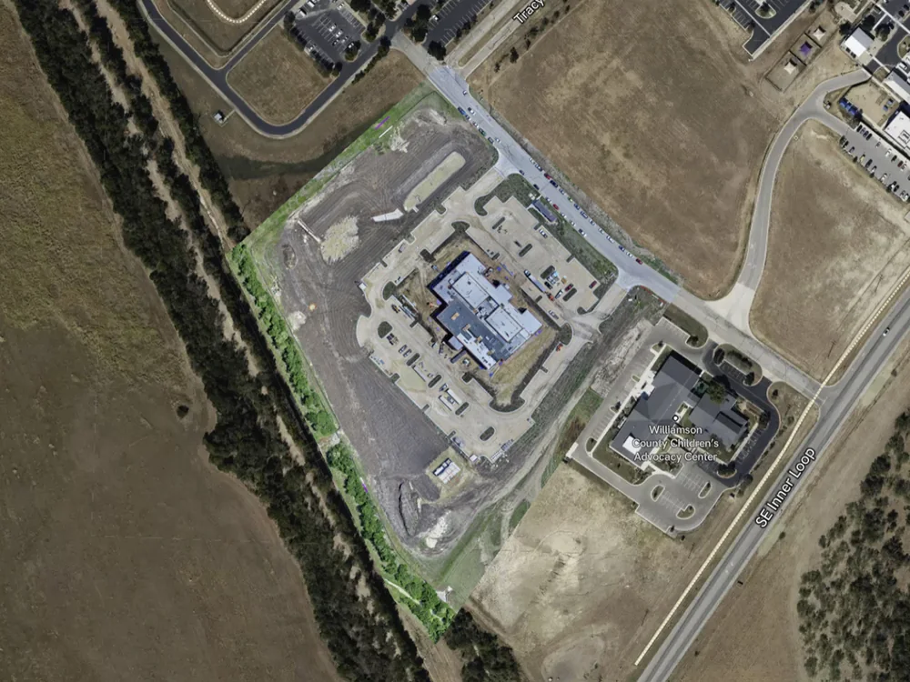
DroneVideos.com provides professional drone data capture services for construction companies, developers, engineers, architects, land planners, and commercial real estate teams across all 50 states. Our solutions help project stakeholders monitor site activity, compare progress over time, analyze cut and fill volumes, create detailed 3D models, and maintain a permanent historical record of project development.
Unlike traditional drone photography, data capture services generate actionable project intelligence. Every capture is securely hosted and organized into interactive progress reports that allow teams to review current conditions, compare historical milestones, and collaborate remotely from anywhere.
Every future capture at the same location is automatically added to the existing Hosted Progress Report, creating a continuously growing project archive and historical record.
Hosted Progress Reports
Hosted Progress Reports are the primary deliverable included with every Data Capture package. Every future capture at a location is automatically organized into a centralized project dashboard, making it easy to review site activity, compare milestones, track changes, and monitor progress throughout the life of a project.
Rather than receiving isolated files after every flight, clients receive a living project record that becomes more valuable with each visit. Each capture is added to the same Hosted Progress Report, allowing owners, contractors, engineers, consultants, and stakeholders to review project history from one centralized location. Click here to view a live Hosted Progress Report
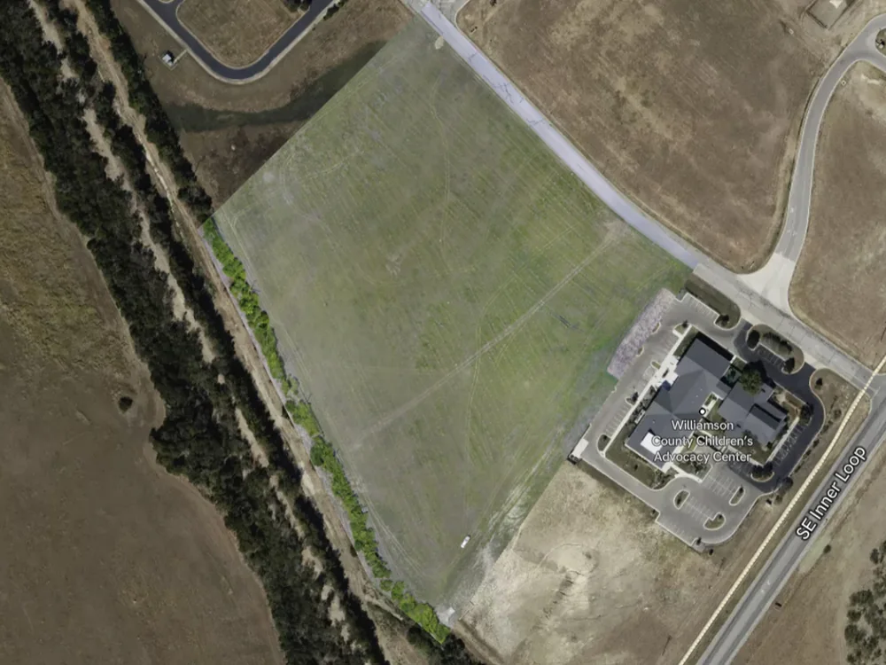
Early captures establish a clear visual baseline for the project. As work begins, Hosted Progress Reports help teams document initial site conditions, track mobilization, review grading progress, and create a historical record that can be referenced throughout the full construction timeline.
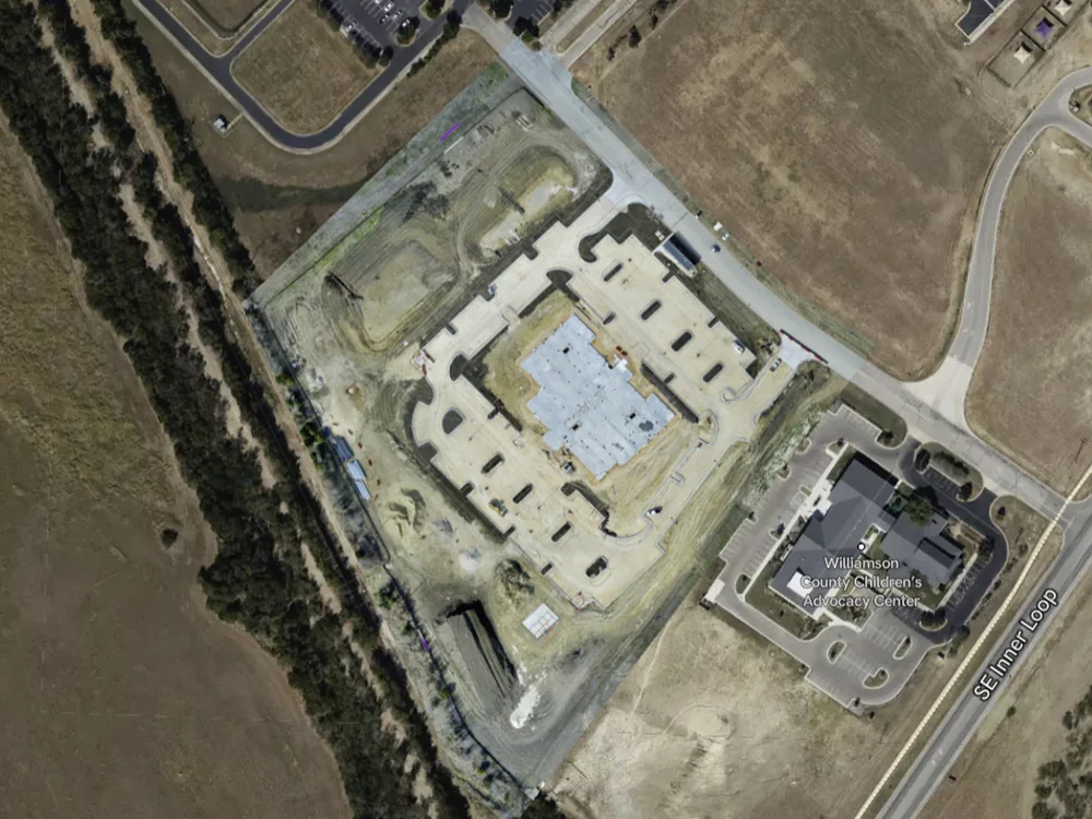
As construction progresses, teams can compare specific areas before and after major milestones, verify completed work, monitor site changes, and provide remote stakeholders with a clear view of project activity without requiring repeated site visits or disconnected file sharing.
Hosted reports become increasingly valuable as projects advance. Teams can compare current conditions against earlier captures, review historical milestones, use visual documentation for project updates, and maintain a permanent record of site progress. Future captures are automatically added to the same report, creating a continuously growing project archive.
| VIEW DATA CAPTURE PACKAGES & PRICING → |
VIEW LIVE HOSTED REPORT SAMPLE → |
Topographic Map Package
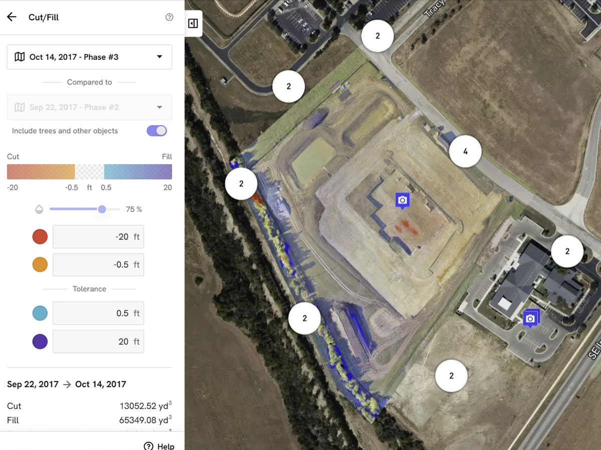
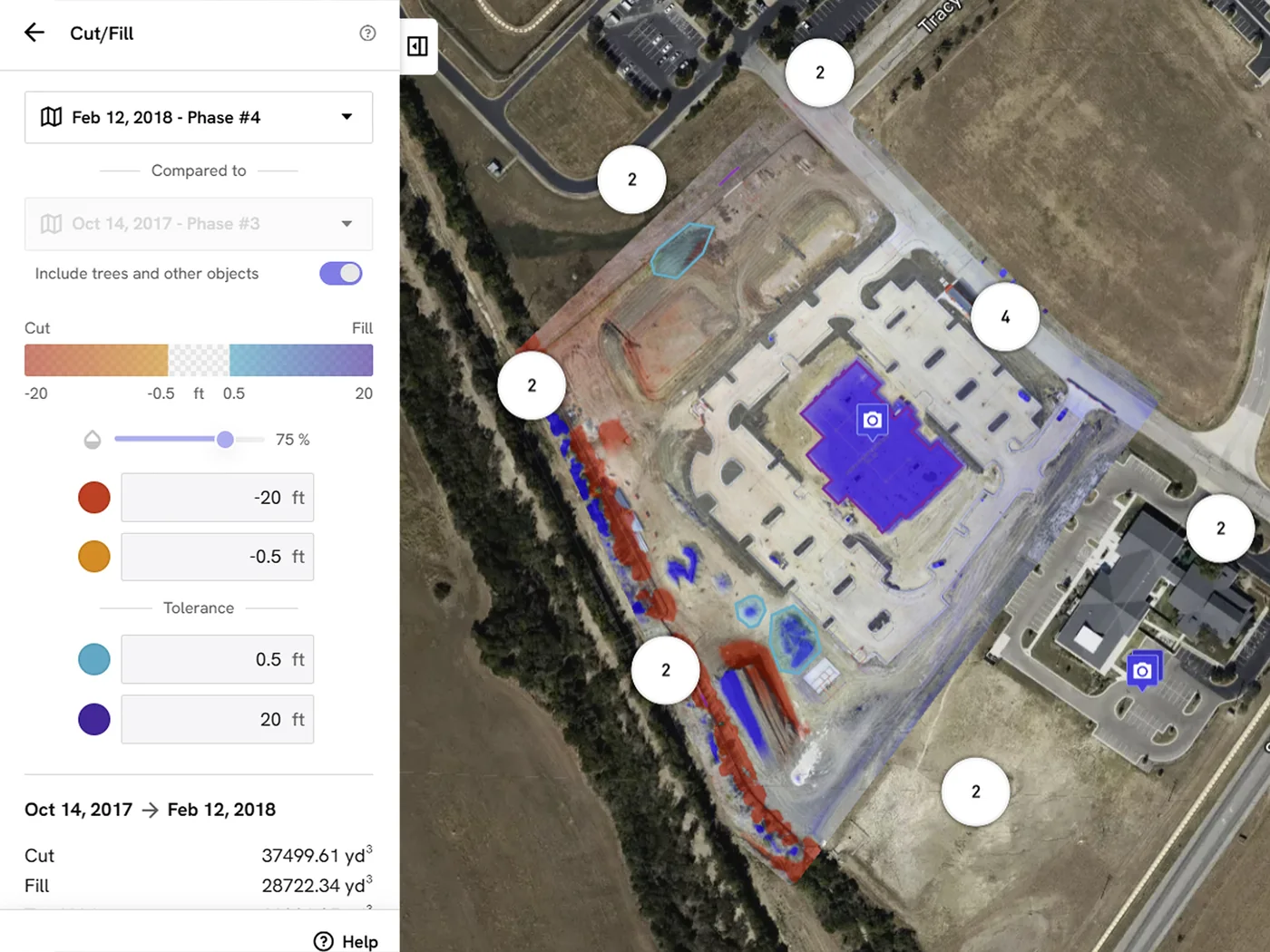
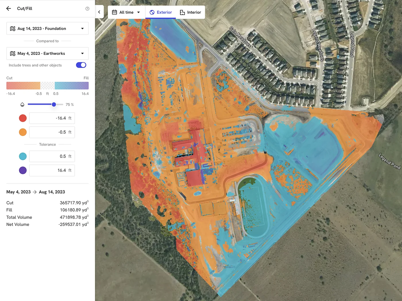
Perfect for land development, earthwork, grading, utility installation, and site preparation projects. Our Topographic Map Package delivers high accuracy topographic maps with elevation data, cut and fill analysis, design overlays, and hosted progress reporting. Topographic maps are ideal for: Land Development, Earthwork, Grading, Utilities, Site Preparation, and Construction Projects.
Project teams can compare site conditions over time, verify grading progress, monitor earth movement, and identify deviations from design plans without requiring frequent site visits. Hosted Progress Reports automatically organize future captures into the same project dashboard, allowing before-and-after comparisons, progress tracking, and historical reporting from a single location.
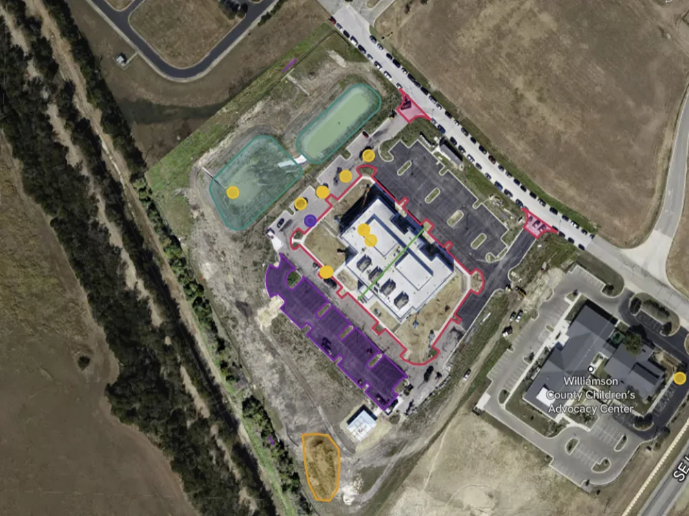
Progress Report Tracking
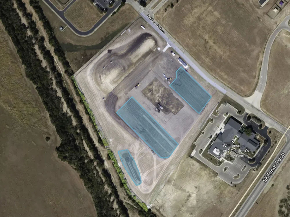
Review specific project areas inside hosted reports to monitor visible changes, confirm site activity, and keep owners, contractors, and consultants aligned.
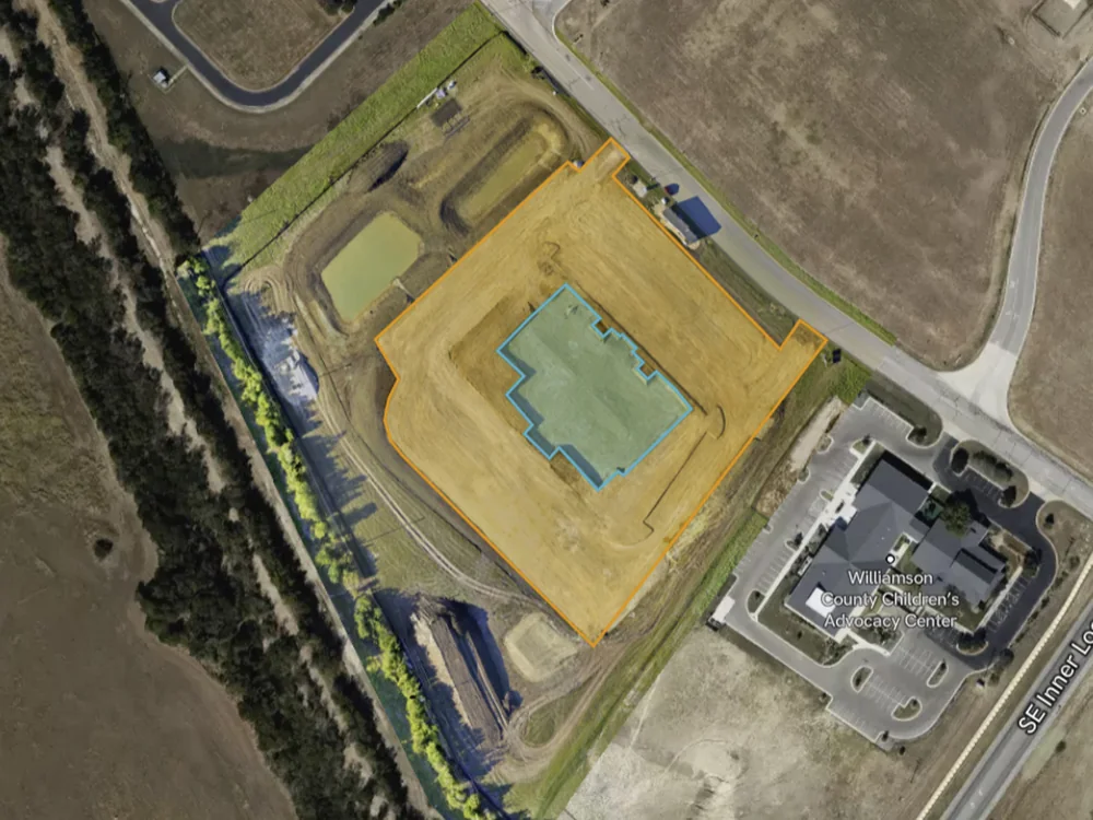
Interactive Design Overlays
Use interactive design overlays to compare planned work against actual conditions, identify site changes, and support faster project decisions from anywhere.
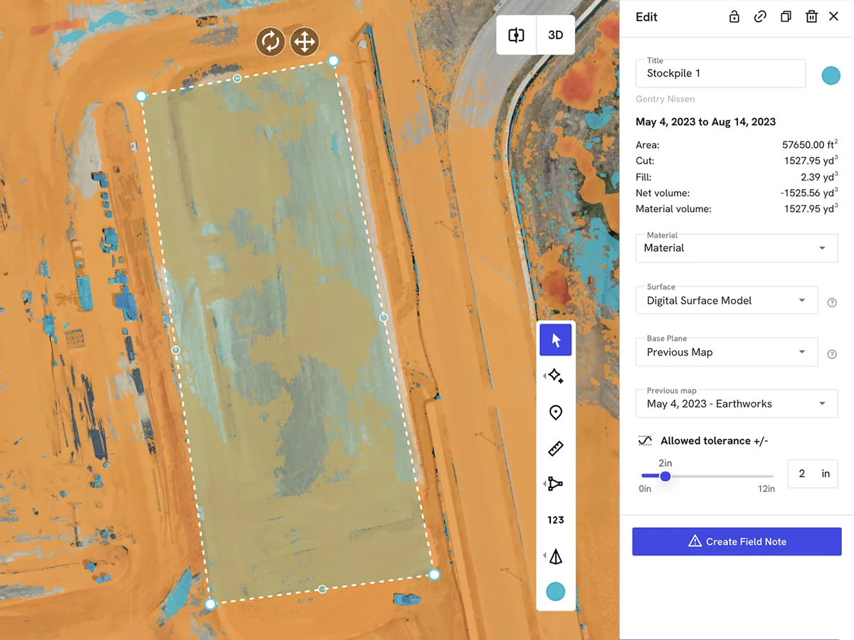
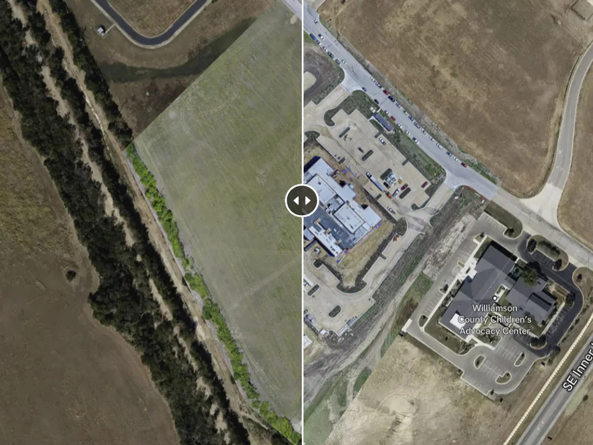
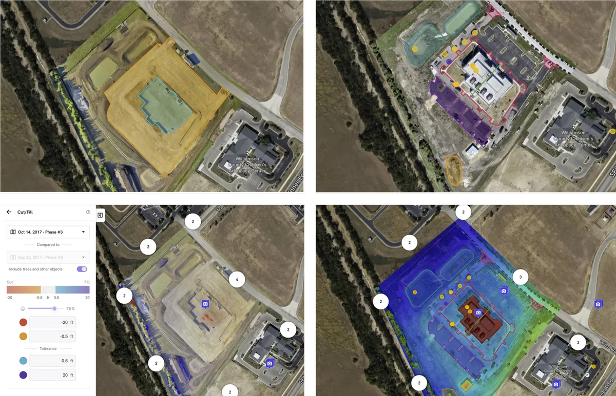
Before & After Comparisons
Compare specific project areas before and after construction milestones to review elevation changes, validate grading work, and document visible site progress. These comparisons help teams confirm completed work, monitor earth movement, support cut and fill review, and maintain a permanent visual record inside the Hosted Progress Report. For land development and site preparation, this gives owners, engineers, contractors, and stakeholders a clear way to understand what changed, when it changed, and how the project is progressing over time.
Included Features In Topographic Map Package
- ✓High Accuracy Topographic Maps
- ✓High Resolution Aerial Mapping
- ✓Topographic Elevation Models
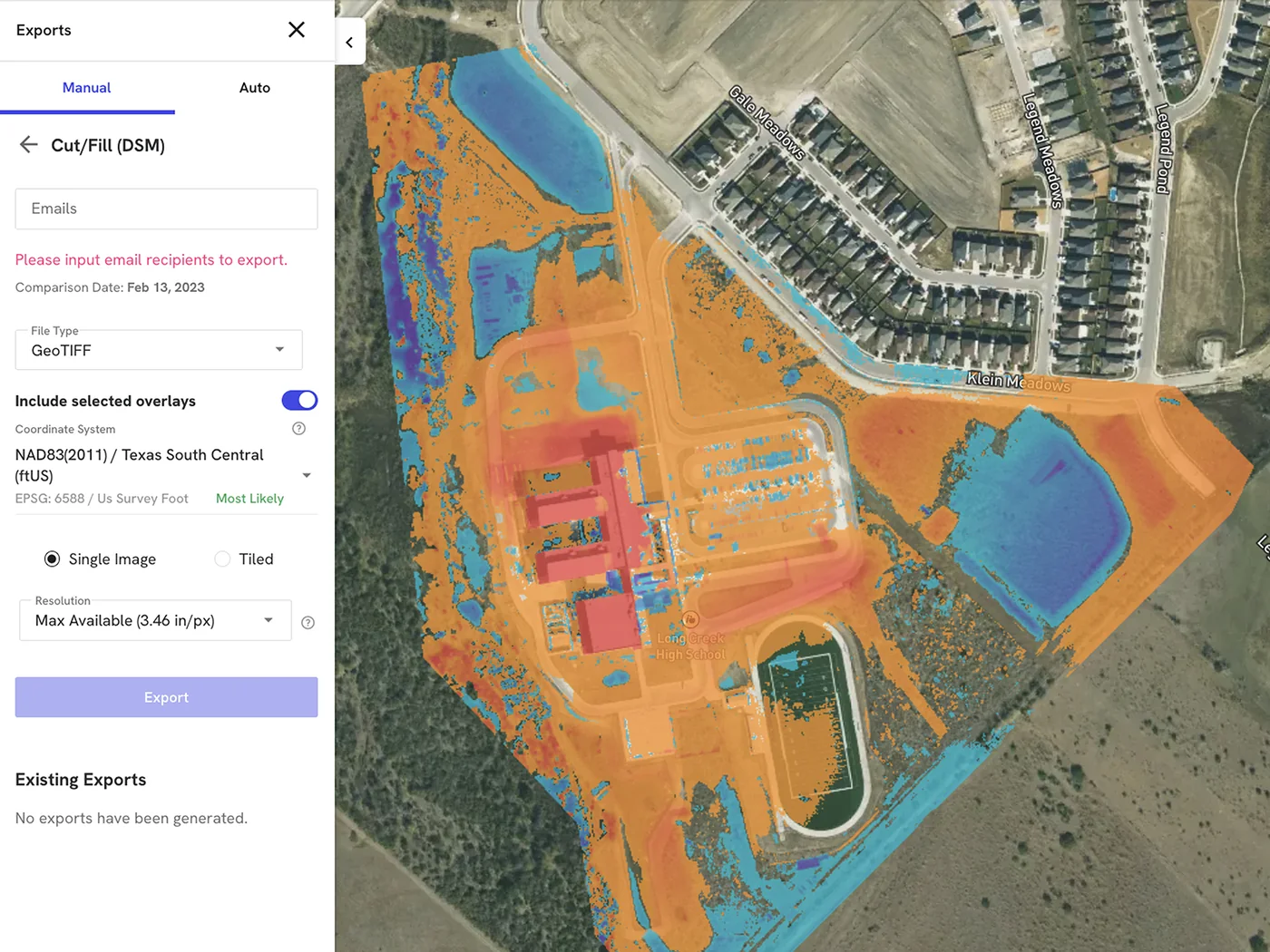
- ✓Cut & Fill Analysis
- ✓Hosted Progress Reports
- ✓Compare Specific Areas Before & After
- ✓Interactive Design Overlays
- ✓Historical Site Comparisons
- ✓Progress Tracking Dashboards
- ✓Nationwide Scheduling
Price: $1,500
Ready to monitor grading, earthwork, and site development progress?
ORDER TOPOGRAPHIC MAP PACKAGE →
3D Facade Model Package
Perfect for buildings, structures, renovations, facade inspections, construction monitoring, and asset management projects.
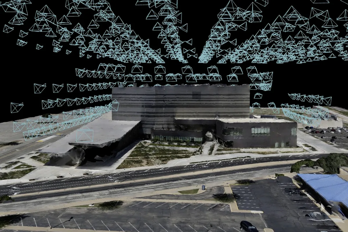
Our 3D Facade Model Package delivers high accuracy 3D models that allow teams to inspect structures remotely and compare changes over time.
3D facade models are ideal for: Buildings, Structures, Facade Inspections, Renovation Projects, Construction Monitoring, and Asset Management. These interactive models provide a permanent digital twin of the project, allowing architects, engineers, contractors, and owners to review conditions without repeated site visits.
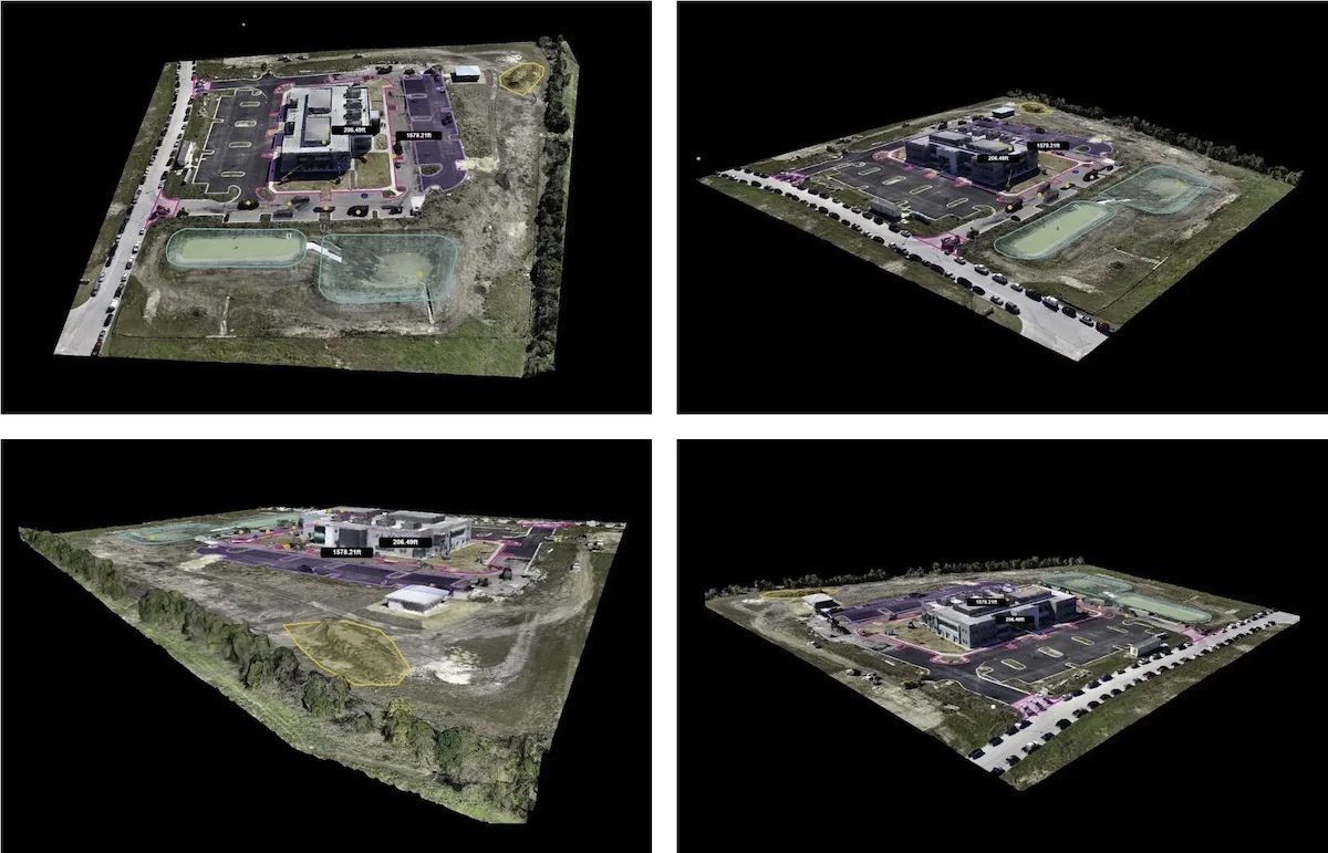
Building Digital Twin
Create an interactive 3D model of the building exterior so teams can review facade conditions, site context, and project details remotely.
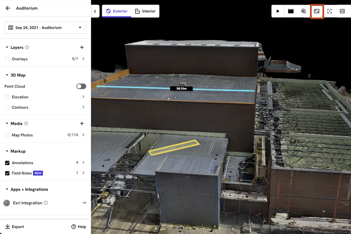
Measurement Review
Use 3D measurement tools to review building elevations, rooftop areas, facade distances, and project conditions without repeated site visits.
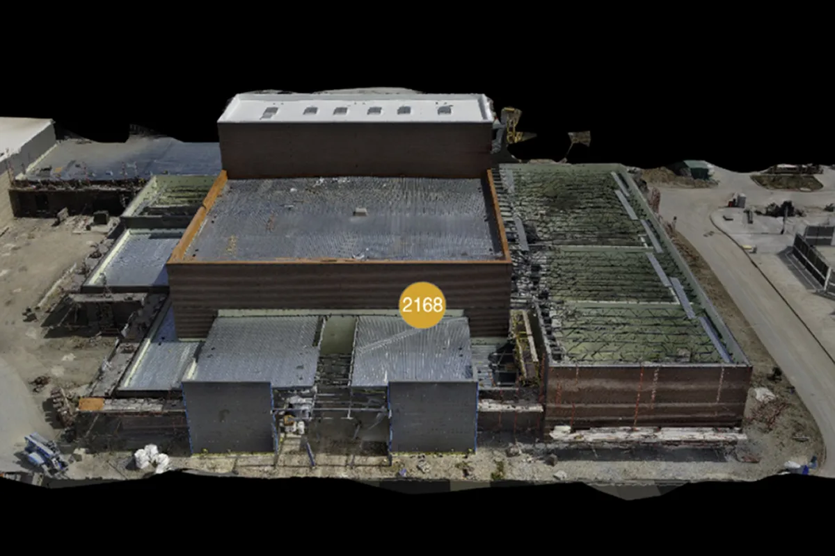
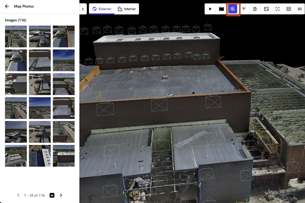
Photo Documentation
Organize project images inside the hosted model so teams can review mapped photo locations, inspect details, and document conditions.
Interactive Tools
Navigate the 3D model, turn layers on or off, take measurements, and review marked areas inside the hosted project dashboard.
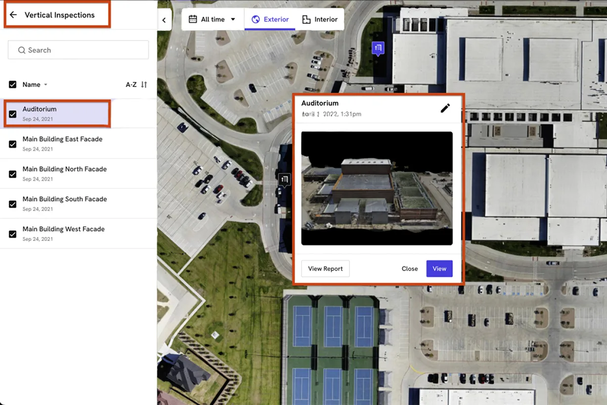
Vertical Inspections
Map vertical inspection areas across the property so stakeholders can quickly locate facade reports, inspection points, and building updates.
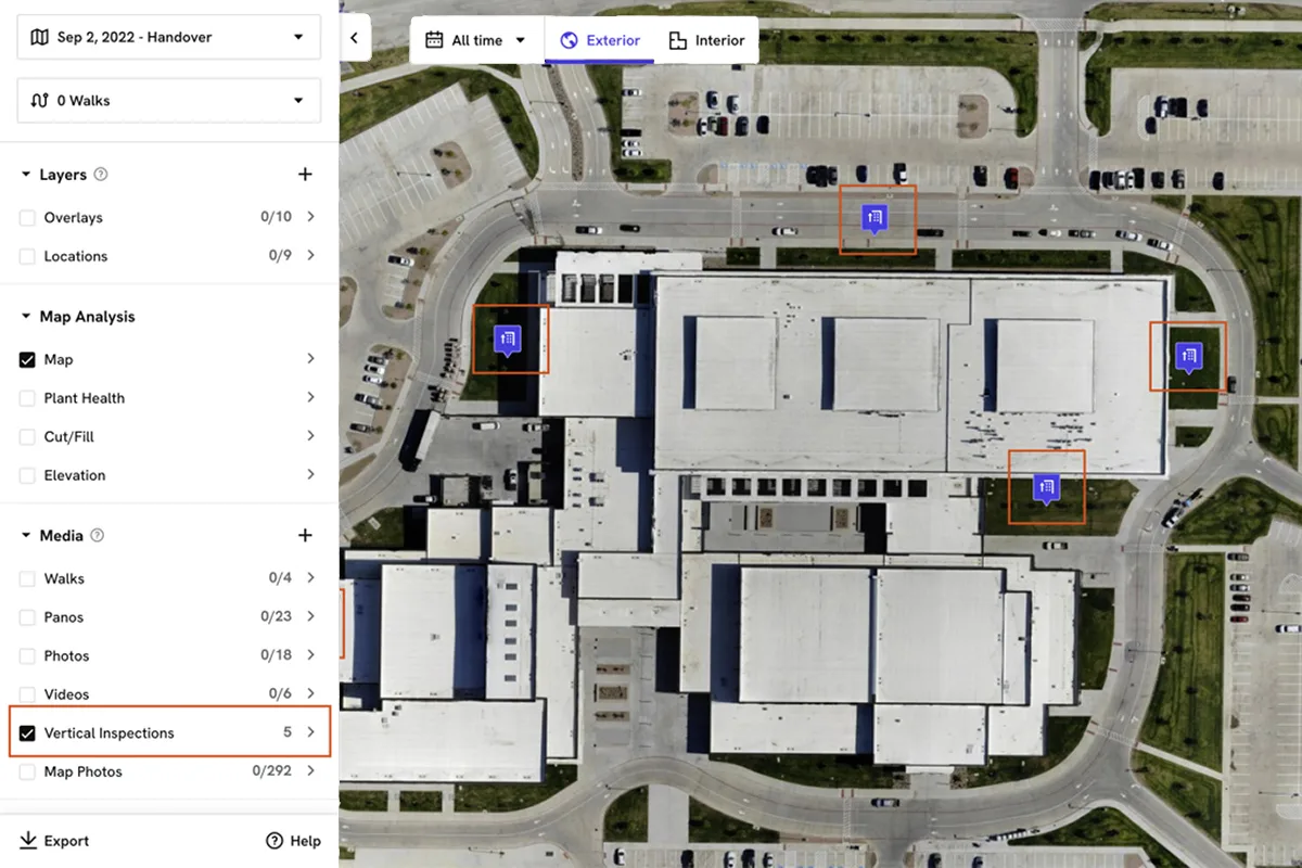
Inspection Reports
Open saved inspection points with photos, notes, and report links to help teams review specific facade areas and track documented conditions.
Hosted Progress Reports automatically organize every future capture into the same project dashboard, allowing stakeholders to compare structural changes before and after construction milestones.
Includes fully immersive 3D data with design overlays, measurement tools, and before-and-after comparisons for building updates, facade monitoring, inspections, and long term project documentation.
Included Features In 3D Facade Model Package
- ✓High-Accuracy 3D Models
- ✓Digital Twin Creation
- ✓Hosted Progress Reports
- ✓Historical Comparisons
- ✓Measurement Tools
- ✓Compare Specific Areas Before & After
- ✓Interactive Design Overlays
- ✓Interactive 3D Visualization
- ✓Vertical Facade Inspection
- ✓Nationwide Deployment
Price: $1,500
Ready to create a digital twin of your building or project?
ORDER 3D FACADE MODEL PACKAGE →
Data Capture Combo Package
The Data Capture Combo Package combines the Topographic Map Package and 3D Facade Model Package into a single solution. This package is ideal for developers, construction firms, engineers, owners, and project teams seeking complete visibility into both site conditions and structural progress.
3D Facade Model
Topographic Map
Ideal For: Comprehensive Land Development Projects, Commercial Construction, Mixed-Use Developments, Industrial Facilities, Infrastructure Projects, and Large-Scale Building Projects.
All captures are automatically organized into a centralized Hosted Progress Report, allowing stakeholders to compare historical milestones, monitor progress, review site conditions, and track project performance throughout the entire lifecycle of a project.
Includes everything available in both the Topographic Map Package and 3D Facade Model Package, consolidated into a single Hosted Progress Report.
Project teams can review topographic data, compare grading progress, inspect structures, measure site changes, and collaborate through a centralized reporting platform that becomes more valuable with every future capture.
Every future capture at the same location is automatically added to the existing Hosted Progress Report, creating a continuously growing project archive and historical record.
Included Features In Data Capture Combo Package
- ✓Topographic Map Package
- ✓3D Facade Model Package
- ✓Hosted Progress Reports
- ✓Historical Comparisons
- ✓High Accuracy Mapping & Modeling
- ✓Compare Specific Areas Before & After
- ✓Interactive Design Overlays
- ✓Cut & Fill Analysis
- ✓Digital Twin Visualization
- ✓Nationwide Service Coverage
Price: $2,500
Need complete site and building visibility from a single platform?
ORDER DATA CAPTURE COMBO PACKAGE →
360° Orbit Timelapse Add-On
Available as an optional add-on to any Data Capture package, our 360° Orbit Timelapse service uses a preset, repeatable flight path that captures the exact same aerial orbit during every site visit.
Because each flight follows the same route, project teams can create highly professional construction timelapses that clearly illustrate site activity, project milestones, and development progress over time.
Each orbit is delivered in 4K resolution and can be incorporated into project updates, stakeholder presentations, investor reports, marketing materials, and long term project documentation.
Included Features In 360° Orbit Timelapse Add-On
- ✓Preset & Repeatable Flight Path
- ✓100% Reproducible Flight Route
- ✓Hosted 4K Video Delivery
- ✓Progress Tracking Over Time
- ✓4K Orbit Playback
- ✓Timelapse Creation Ready
Price: +$500
Want a repeatable 4K aerial timelapse of your project?
ADD 360° ORBIT TIMELAPSE TO YOUR ORDER →
Why Hosted Progress Reports Matter
The most valuable deliverable is not the map or model itself. It is the Hosted Progress Report that organizes every capture into a single project history.
Every map, model, comparison, overlay, and future site capture is automatically organized into a centralized project dashboard that becomes more valuable over time. Click here to view a live Hosted Progress Report
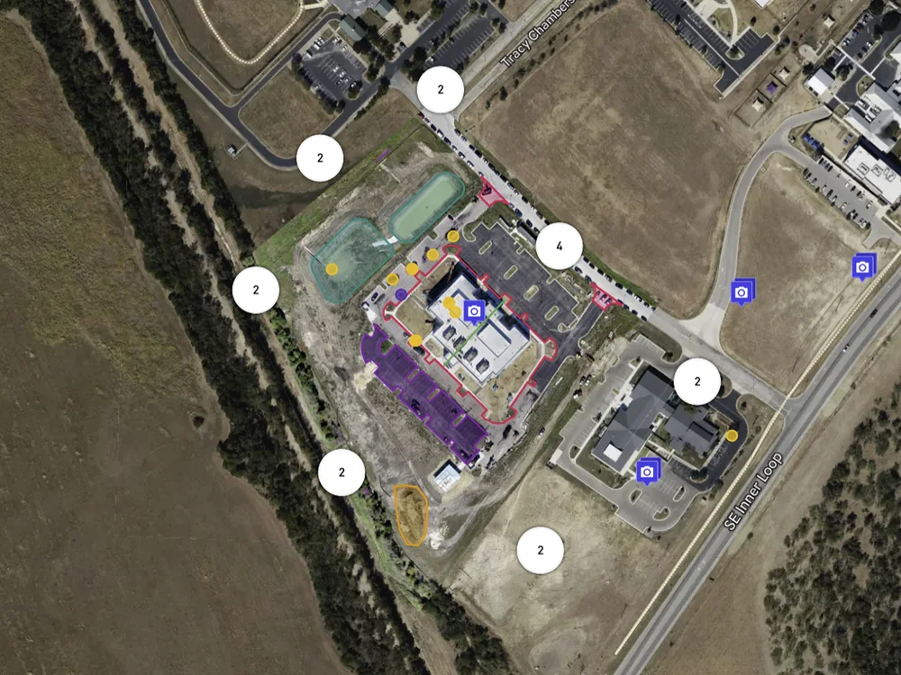
Drone Mapping View
Review drone mapping data, site conditions, and reporting layers from one hosted project view instead of managing disconnected files after every capture.
Central Project History
Organize every capture into one dashboard so teams can review project history, compare milestones, and maintain a permanent visual archive over time.
Progress Timeline
Move through historical captures by date to understand how the site changed, verify completed work, and communicate progress with stakeholders more clearly.
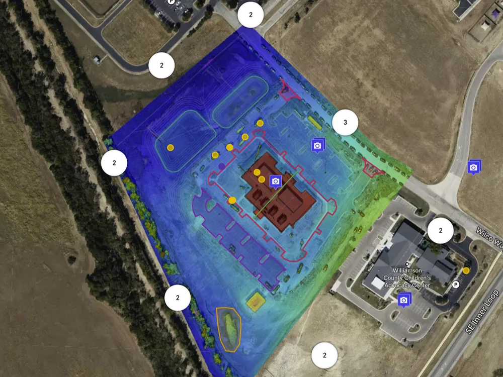
![]()
Interactive Reporting Tools
Use interactive overlays and comparison tools to evaluate specific areas, support remote collaboration, and make faster project decisions from anywhere during construction.
Instead of receiving disconnected files after every drone flight, project stakeholders gain access to a living project record that tracks construction activity, site development, grading progress, building updates, and historical milestones throughout the life of a project.
Project managers, owners, developers, contractors, engineers, consultants, and stakeholders can compare specific areas before and after construction milestones, verify work completed, monitor schedules, identify potential issues, and provide real-time visibility into project performance.
Every future capture at the same location is automatically added to the existing Hosted Progress Report, creating a continuously growing project archive and permanent historical record. This centralized reporting environment is what transforms drone mapping and 3D modeling into a powerful project management and documentation tool.
| VIEW DATA CAPTURE PACKAGES & PRICING → | VIEW LIVE HOSTED REPORT SAMPLE → |
Nationwide Data Capture Services
DroneVideos.com provides professional drone data capture services throughout all 50 states. We can typically schedule projects within 1 to 2 business days and deliver processed data quickly so project teams can make faster, better-informed decisions.
Whether you need topographic mapping, 3D facade modeling, construction monitoring, cut and fill analysis, digital twin creation, or hosted progress reporting, our nationwide network of FAA-certified drone pilots can help.
Our Data Capture Services are designed for organizations that need more than aerial photography. We provide actionable project intelligence, historical reporting, interactive comparisons, design overlays, and centralized project documentation through our Hosted Progress Report platform.
Industries We Serve
- ✓Construction Companies
- ✓Commercial Developers
- ✓Civil Engineering Firms
- ✓General Contractors
- ✓Land Development Teams
- ✓Architects
- ✓Asset Managers
- ✓Infrastructure Projects
- ✓Industrial Facilities
Our nationwide coverage allows us to provide consistent data capture services for projects ranging from small site developments to large-scale commercial, industrial, infrastructure, and construction portfolios.
nationwide for construction, development, engineering, and commercial projects.