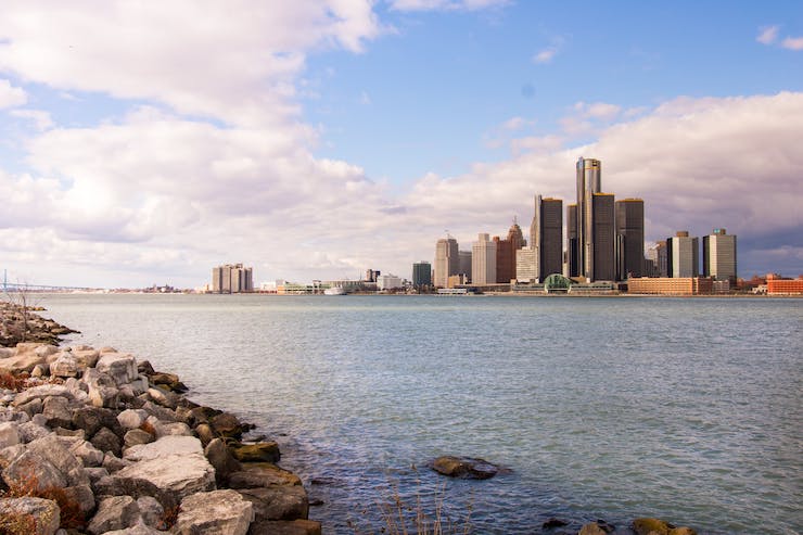
In the early 1920’s, Henry Ford established Ford Motor Company in Detroit, MI. His Model T car quickly became the most popular car in the country because of it’s affordability. Ford was able to supply American customers with a car they could afford after first coming up with the process of using an assembly line to manufacture the cars. It wasn’t long before other car manufacturers were copying Ford’s assembly line methods and Detroit became the home of the “Big Three” car makers. As the home of the “Big Three”, Ford Motor, General Motors, and Fiat Chrysler, Detroit became known as Motor City, one of the most prosperous cities in the United States. Unfortunately, due to many factors like suburbanization and industrial restructuring, Motor city lost more than 60% of it’s population. By 2013, the city of Detroit filled for bankruptcy, the largest city in America to do so. Thankfully, the city’s government was able to mend Detroit’s financial problems by the end of 2014.
Now the city of Detroit is returning to an era of cultural, economic, and financial normalcy. One of the key factors in mending the city has been the city’s embracing of innovative technologies. A city that has been fondly called the Motor City for over a century could one day be known as Drone City instead. While the city of Detroit requires drone operations to follow all FAA regulations, they have long been supporters of drones, welcoming their use before many other cities nationwide. Proof of this support can be seen as a group of drone innovators have begun working on plans to build a drone highway within the city limits of Detroit.
A collaboration between some of Detroit’s top drone and aviation companies have gathered to plan the logistics of a low altitude drone highway. In February of 2020, leaders from PlanetM Landing Zone, Airspace Link, the Detroit Region Aerotropolis Development Corporation, and several others met to begin the development stages that would create a safe way for drones to be flown through metro Detroit by government, commercial, and recreational drone pilots. The proposed highway would be first tested between Metro Airport and Willow Run Airport. The key to getting this drone highway up and flying is the Low Altitude Authorization and Notification Capability (LAANC) that the FAA recently granted to Airspace Link after a 10 month certification program.
Founded in Detroit in 2018, Airspace Link is a drone logistics company, and the first cloud based program that is dedicated to the drone needs of state and local government needs. As they explain, “The rapid growth of the drone industry has outpaced the development of rules and systems to govern their use. The limited ability for citizens and businesses to know where they can safely fly or conduct complex flights are restricted by fragmented, non-existing data and systems for managing local government airspace. The Federal Aviation Administration (FAA) is seeking partners to integrate drones safely into controlled airspace while making air and ground based safety a number one priority before it lifts the restrictive flight rules currently in place. The Airspace Link platform is an all-in-one FAA-certified, cloud-based platform simultaneously connecting all constituents involved in legally flying a drone. State & local governments use the Airspace Link portal to define areas of risk, special ordinance and event restrictions within the community. Drone pilots plan and submit operations to the FAA through Airspace Link, enabling faster approvals and a stronger mitigation plans for complex flights (BVLOS, inspection, package delivery). With the combined data, Airspace Link is building new drone airspace infrastructure (similar to toll roads).”
The platform that Airspace uses is called AirHub for Government or AirHub for Pilots. Essentially, they both work the same way, with the government hub allowing access to areas that would be restricted to commercial or hobby drone pilots. The hubs provide drone pilots with the tools to fly safely for the multitude of jobs in which they are being used daily. To ensure safe flight, government agencies are constantly updating drone regulations and restrictions. The hub allows them to make these changes in one place that is automatically and instantly uploaded to anyone using the Airspace Link flight planning tools. Airspace goes on to explain the process as “Federal and local data is aggregated into comprehensive view of high and low risk areas within your community. Natural drone ‘corridors’ begin organically presenting themselves. These ‘highways in the skies’ are put to work for your drone operations, maximizing safety to both the operation as well as those on the ground.”
This could mean an economic revival for a city like Detroit, a city that was built on the innovation of ground mobility. Now, the city is poised to become innovators in aerial mobility. Devon O’Reilly from PlanetM Landing thinks Detroit is a logical location for this next industrial wave. “Michigan is a great place to start a drone company. We’re at the forefront of the industry,” he said. “We’re hoping to bring economic development and drone companies to southeast Michigan.” The collaboration plans to run a 6 month trial of the drone highway between Metro Airport and Willow Run before expanding further in metro Detroit. As Michael Healander, Airspace Link CEO said, “We’re building infrastructure to manage drones, those flying 400 feet or below and weighing 55 pounds or less. We’re building highways in the sky or toll roads for commercial and recreational drones.” Just like how Henry Ford and the assembly line revolutionized the manufacturing process, Detroit will now be revolutionizing the way drones are flown safely throughout Motor City.
|