
Drones Are Helping to Predict the Future and Save Lives
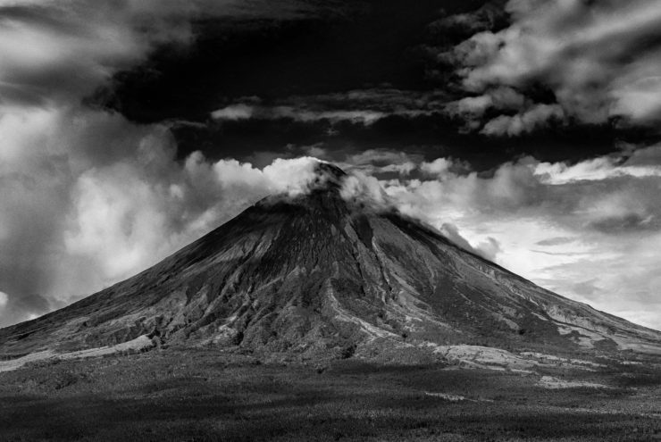
More than 55,000 people have been affected by the devastating eruption of the Agung volcano in Bali. The locals have had to move to temporary shelters as they vacate their homes. Many tourists who were there on vacation have become stranded as no flights were available in or out of the country.
Drones To the Rescue
This catastrophe has however highlighted the use of drones for crisis preparation. Drones are increasingly shifting their use from their traditional roles of being fun toys to more advanced tools. From blood delivery in Rwanda to Amazon drone delivery in the UK, drones are not only becoming part of our day-to-day lives, they are actually saving lives too. In Indonesia, drones are being used to keep track of endangered species, map the growth of some of their most important crops and monitor active volcanoes to predict when they might erupt.
Drones in Indonesia
The use of drones is becoming widespread in Indonesia, with 3D mapping of volcanoes being their first application. A slight increase in temperature can be detected which is usually an indication that the volcano is about to erupt. A drone with sensors that detect the amount of gases being released is also used, with an increase in the gases indicating volcanic activity.
Scientists and engineers are increasing their use of drone technology to monitor the activities on and below the surface of the earth. While it has its own challenges and in some cases is very costly, the amount of information being captured by these drones is immense and of great importance. Crises can be avoided through the collection of information about nature which is then analyzed by scientists and relayed to the people warning them of potential eruptions.
A Computerized Earth
The Internet of Things (IoT) has received a lot of the spotlight lately and rightly so, as it transformed how we collect and analyze data about our surroundings. This recent focus on technology to understand nature, which is being referred to as the Internet of Nature (IoN) is the next phase. Scientists are increasingly using drones to collect data, analyze it and then use it to predict future events.
Drones are playing a big role in the Internet of Nature. When fitted with sensors, the data collected will give scientists the ability to predict potential catastrophes such as volcanoes which will give warning and save lives. A lot still remains to be seen, however, the potential benefits of drone technology to better our crop yield, help us prepare for emergencies, monitor endangered species and save lives will only get better as the technology improves.
|