
After a particularly wet October in 1927, an even wetter November rolled around, leading to the Great Flood of 1927 in the northeastern state of Vermont. It is estimated that more than half of Vermont received more than 6 inches of rainfall, contributing to the deaths of 85 people and $50 million in damages, the equivalent of $903 million today. For many years, although Vermont continued to experience floods regularly, the Great Flood of 1927 was considered the worst the state ever saw. However, with the progressing effects of climate change, flooding in Vermont has worsened.
Flooding from 2011’s Hurricane Irene and then the 2023 Great Flood of Vermont have been compared as equally catastrophic, a direct result of global warming. Johnathan Winter, an associate professor at Dartmouth College’s Department of Geography, revealed that research has shown there to have been a 50% increase in extreme precipitation events between the years 1996 and 2014 in the northeastern United States. This is a trend experts predict will continue to increase by another 52% before the end of the century.
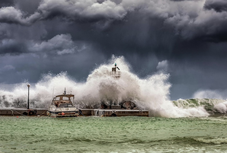
This explains why the July 9-29, 2023, Great Flood of Vermont was particularly devastating. After extended slow-moving, heavy rainfall, flash floods washed through the state. The floods caused 13 fatalities and more than $2.2 billion in damages. Vermont Governor Phil Scott declared the flooding as “historic and catastrophic” and sent a request for emergency aid to President Biden. On July 11, while overseas, President Biden approved FEMA aid to the state of Vermont in less than 24 hours upon receiving the request. A team of researchers from the University of Vermont (UVM) was on hand with a drone to document the historic flash flooding events.
As the UAS (Unmanned Aerial Systems) Team Lead for the UVM Spatial Analysis Laboratory (SAL), Adam Zylka knew that his expertise in drone technology could be pivotal for flood relief efforts. He and his team quickly and frequently used drones to monitor the floodwaters. “Initially, our team actually began to self-deploy because we saw the waters were rising quickly and they might go down soon, and we knew it was really important to capture some of those high water marks and have that data accessible,” Adam said. But he would soon realize that the deployment of the drones would lead to both immediate and long-term results.
Adam graduated from UVM in 2014 with a degree in Environmental Engineering and Geospatial Technologies. He wrote his undergraduate thesis on how drones could be used in response to disasters. He traveled around the world to different natural disaster sites to provide drone assistance before returning to Vermont. Upon his return, Adam became one of the earliest members of the UVM drone team at the SAL. Adam’s academic and professional expertise has led to the continued development of disaster relief via drone in the SAL. The lab’s website explains that “the scope of our work includes ecosystem assessments, biodiversity analysis, land-cover mapping, conserved lands planning, scenario modeling, LiDAR processing, web-based mapping, and even transportation analysis.” It goes on to state that they have developed “a national reputation for its expertise in employing UAS technology for disaster response.”
After collecting data with drones in flooded Montpelier, VT, Adam and the SAL shared everything with the Vermont Center for Geographic Information (VCGI). “We worked really closely with VCGI at the state to spin up and share all of the products that we created, the flood map interfaces that they put together that anyone could access and see the mapping data and the images. We hope it was valuable to more than just the folks that asked for it,” Adam said.
And while Adam has gained plenty of experience in how drones can be beneficial for disaster relief, he was amazed by just how vital the data he collected with his drones would prove to be for the people of Vermont. VCGI used Adam’s drone data to supplement the request for aid Governor Scott sent to President Biden. “We learned that the imagery that we captured helped speed up the disaster declaration from FEMA by about 4 weeks, which was really amazing,” he said. Recovering from the flood took quite some time, but had it not been for drone data, the people of Vermont would have had to wait even longer to reclaim their lives. UVM’s SAL, with Adam’s help, is committed to continuing the development of drone technology for managing and mitigating the impacts of natural disasters.
|