
FAA Bans Flying Drones Near Famous Landmarks
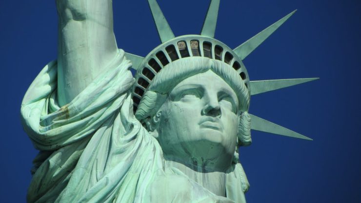 If you were planning to catch a bird’s eye view of the stature of Liberty using a drone on your next visit, you should probably shelve those plans. The Federal Aviation Administration (FAA) has announced that it’s going to restrict drone flights over the statue of liberty and 9 other major landmarks. They are concerned about the latest unauthorized operations over these landmarks and have put in place regulations to restrict Drone flights near them.
The FAA, at the request of the national security and law enforcement agencies is using its authority under Title 14 of the Federal Regulations (14 CFR) code “Special Security Instructions” to restrict any operations of unmanned aerial vehicles within the range of 400 feet around the boundaries of these landmarks.
The FAA said that this is the first time they are placing airspace restrictions for drones over the landmarks. The statement further mentioned that any operator who violates the airspace restrictions will be subject to legal action including potential criminal charges and civil penalties.
This restriction comes just over 3 years after the National Park Service issued a policy memorandum restricting the operation of unmanned aerial vehicles within the park boundaries unless one has a written permission from the superintendent of the park. This policy is still operational in most parks.
Here are the 10 landmarks affected by the FAA’s new regulations:
Statue of Liberty National Monument – New York, NY
Independence National Historical Park – Philadelphia, PA
Boston National Historical Park – Boston, MA
Folsom Dam – Folsom, CA
Grand Coulee Dam – Grand Coulee, WA
Glen–Canyon–Dam – Lake Powell, AZ
Hoover Dam – Boulder City, NV
Mount Rushmore National Memorial – Keystone, SD
Jefferson National–Expansion–Memorial ; St. Louis, MO
Shasta Dam – Shasta Lake, CA
For public information, the FAA has put together an interactive map detailing its flight restricted sites including their previous flight restrictions over airports and military bases. The FAA has also included a link to these regulations in their B4UFLY mobile app. These restrictions will be updated to reflect in the app directly within 60 days. Additional information such as frequently asked questions have also been update on the FAA’s website.
The new regulations take effect October 5, 2017. The FAA is, in fact, considering additional requests from several other federal agencies for restrictions as per the FAA’s 99.7 code. So if you were planning to have a closer view at any famous landmark that is not on this list, you should do so sooner than later before it’s added to the banned list. To stay updated with the FAA restrictions and regulations on the no-fly areas, you should regularly visit the Know Before You Fly website and download the FAA’s B4UFLY mobile app for free on the Google Play store or iTunes App Store to stay up to date on where you can and cannot fly a Drone.
|