Finding Land Mines With the Help of Drones

© Juergen Lumpp
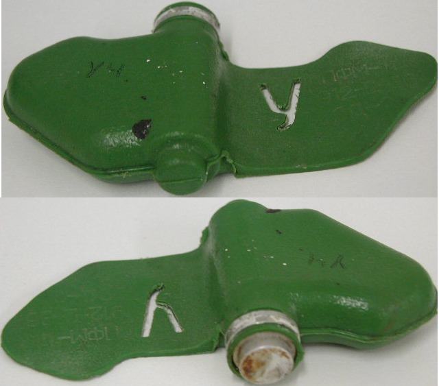
One the nightmares from the Afghan war is still making life difficult for the locals. The landscape is still littered with butterfly mines, which are a type of landmine, that were dropped in the area over the course of several wars. These particularly nasty mines are known to kill and cripple children who mistake the small green bombs for toys. The detonators on these bombs are light and they cannot tell the difference between farmers, combatants or children.
More than a million of these active mines were left on the mountains after the US and Soviet wars in the region. During the Soviet-Afghan War in the 80s, the Soviet military air-dropped many of these mines and let their ‘wings’ gently guide them down. The mines created minefields across mountain passes in an attempt to restrict the enemy’s movements. More than 30,000 Afghan civilians have been killed by these bombs.
Clearing these mines is painstaking work. The survey teams have to interview the local residents and then sweep the affected area twice on foot using handheld ordinance detectors. Removing a single mine from an area can cost up to $1000 and it also costs money to ascertain that a particular area is free of mines. Early tests performed by US researchers have shown that the use of thermal imaging cameras mounted on a drone can cut those costs down. Alex Nikulin, one of the lead researchers on this project, stated that clearing mines means poking every inch of the ground and using drones can tell the mine-sweepers where to poke.
Finding mines with the use of drones means relying on temperature differences between the mines and the surrounding area. Since butterfly mines are made of plastic, they cool and heat up at different rates than the soil. Drones are flown over the suspected area at sunrise or sunset when the temperature differences are easier to detect and they capture images which can be viewed on a computer.
Field trials for this new method were conducted in a New York park. The researchers found that they were able to use this method to clear the area of 78% of the mines. This is not good enough to replace the usual survey teams but it can help them pin down locations that have a high density of mines. This allows the survey teams to focus their manpower on smaller areas.
Thermal imagery is just the beginning. The research team believes that they can develop an algorithm that can automatically detect landmine signatures when looking at the thermal imaging. Such procedures will become more practical when the cost of drones and thermal imaging cameras goes down.
|