
First Data Collecting Weather Drones About to Launch Nationwide
© Meteomatics
Scientists have been using drones to collect data on how hurricanes form and spread. For example, the National Oceanic and Atmospheric Administration (NOAA) deploys the high-altitude Global Hawk to help forecast next-season hurricanes. It recently deployed a fleet of unmanned aerial drones that flew into the eye of hurricanes Maria and Harvey to document the likely trajectory and intensity of these powerful storms. And that’s not all: NOAA’s autonomous solar-powered wind drones, developed in conjunction with the private technology firm Saildrone, are conducting the first year-round surveillance of the world’s oceans from just above the water’s surface.
So far, though, drones haven’t played much of a role in more conventional near-term weather forecasting, the kind that daily news consumers rely upon for mundane guidance on whether to wear a raincoat or take an umbrella to work. But if one enterprise technology company has its way, all that is about to change.
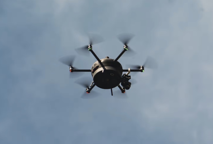
The Swiss based Meteomatics, founded in 2012, has developed a small light hexacopter it calls the Meteodrone that can fly up to 20,000 feet with its onboard sensors to collect temperature, pressure relative humidity, dew point and wind and speed data. The data, once analyzed with the help of a machine-learning algorithm, can be fed to National Weather Service stations but also accessed in real-time by local meteorologists to provide the most up-to-date hyper-local weather forecasting available. And since the Meteodrone drone is equipped to fly at night, its vital morning forecast is based on data just a few hours old.
Current forecasting by local meteorologists is highly prone to error, in part because weather patterns can shift rapidly between surveys based on intermittent data collected by stationary weather stations and towers. Critical weather conditions such as fog and ice that affect road visibility and safety may be missed by conventional detection systems that a drone, circling continuously, can readily detect.
“The benefit of the Meteodrone is being able to get those constant and frequent profiles, particularly when you have interesting or important weather events going on,” Brad Guay, a meteorologist at Meteomatics, told The Washington Post in mid-September.
Federal Aviation Administration approval of the Meteodrone is still pending but the aircraft already has a proven track record – abroad. Since 2017, Meteomatics has been working with the Federal Office of Meteorology and Climatology in Switzerland to collect weather surveillance over the Swiss Alps. Currently 15 “Meteobases” are in place that serve as the drone’s lift-off, landing, and charging stations as well as the communication link to its remote pilot. In all likelihood a similar logistics system will be developed for Meteodrone’s US operations once final FAA approval is obtained, probably in early 2023.
Do you really need that raincoat and umbrella today? Thanks to Meteodrones, consumers may finally kn0w for sure.
|