
Inside the Eye of the Storm: Tracking Hurricane Fiona in Canada
Hurricane Ian isn’t the only extreme weather event wreaking havoc on the North American continent. Further north, in Newfoundland and Nova Scotia, Hurricane Fiona has been pummeling coastal towns destroying homes and property and leaving thousands without power. Residents are calling it the worst hurricane in Canada’s history. But thanks to unmanned wind drones deployed by the National Oceanic and Atmospheric Administration (NOAA) and a private firm, Saildrone, Inc. scientists are learning more about how such hurricanes develop and spread, and how to survive them.
NOAA and Saildrone have been collaborating in extreme weather drone surveillance for well over a year. In their first joint venture in August 2021, they sent five wind drones into the Atlantic Ocean basin – three in the Caribbean and two near the U.S. East Coast, in anticipation of another season of inevitable hurricanes. The idea was to let the autonomous seagoing vessels sail directly into the storms, penetrating their eyewalls and once inside, to have them collect previously unavailable data on how the ocean transfers heat and energy to hurricanes, causing them to intensify.
In their first major test – during Hurricane Michael in August 2021 – the wind drone experiment proved only partially successful as the force of the storm’s 160 mph wind also damaged the drones, interrupting the data collection effort. For Fiona, NOAA and Saildrone are deploying a sturdier 23-foot-long sailing vessel with a lower profile. Its designers say it’s specifically designed to brave and survive the pummeling winds associated with Category 5 hurricanes, which the previous drone was unprepared for.
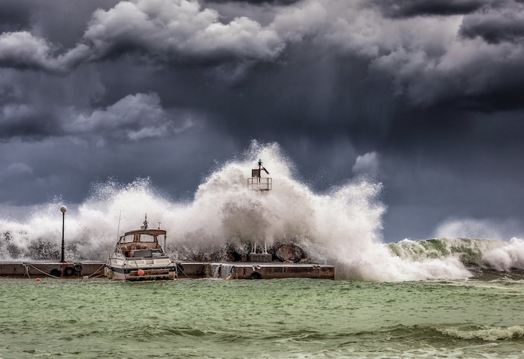
The new drone – six in all – began tracking Fiona as it gathered force near Bermuda and began heading north. The drones captured terrifying images of 50-foot waves in the open sea that buffeted the sea vessels, nearly capsizing them. At its height, Fiona recorded Category 4-level winds of 130 mph, less than Michael, but still strong enough to devastate parts of Nova Scotia, Newfoundland and Prince Edward Island when the storm first reached landfall on September 24.
Subsequent video footage collected by aerial drones have documented Fiona’s devastation to Canadian coasts – hundreds of residents (and counting) displaced, electric power lines down and nearly 500,000 left without service. “I have seen wind that has pulled trees out of the ground, homes swept away by water, homes that have been lost to the ocean,” Rene Roy, editor of the newspaper Wreckhouse Press in Newfoundland, told CNN. “I saw a boat in the middle of a playground. Cabins and swing sets floating by. It is surreal what is happening here.”
Saildrone’s joint mission with NOAA is scheduled to last through October 31. Other wind drones are currently sailing in the Caribbean and Gulf of Mexico where chances of hurricane occurrence are also high. As with Fiona, real-time data is being sent to worldwide weather prediction centers to enhance their operational forecasts. Other partners in the project include NOAA’s National Environmental Satellite and Data Information Service and NOAA’s Environmental Modeling Center.
|