Lessons from a Friendly Drone Search-and-Rescue (SAR) Competition
Search and rescue (SAR) is one of the most popular and widely practiced drone missions. Law enforcement agencies love to tout their SAR successes, in part to dispel the idea that they are engaged in routine surveillance or other sometimes controversial activities. But private drone fliers are also active in SAR missions, sometimes as volunteers, other times as adjuncts to law enforcement. In locales where police drones have not yet caught on, recreational fliers can step up and fill the void – chalking up SAR successes of their own.
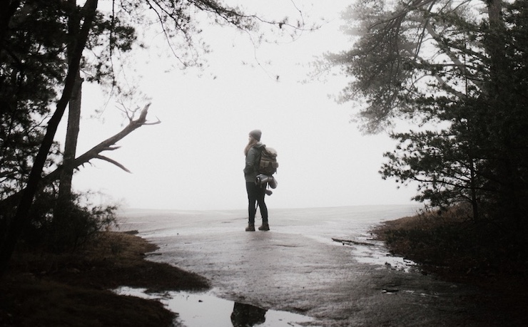
Recently, the friendly folks at the Pilot Institute staged a three-round drone competition in a local wooded area to demonstrate what private SAR fliers can do. Three long-time fliers entered the competition to see which flier could find a lost or a missing hiker the fastest.
All three fliers deployed a DJI Mavic 3 Enterprise drone to perform their mock aerial surveillance missions. All of their drones were equipped with the same standard SAR attachments – a zoom camera, a thermal imaging camera and a compass.
Each round of the competition featured a slightly different scenario, with minimal details provided to the SAR flier. In scenario one, the hiker had set off at dawn in the direction of the sun, with a yellow sleeping bag. The fliers were challenged to first locate the sleeping bag and then the lost hiker, who might be concealed in the woods. In the second scenario, the fliers heard an audio clip of a hiker with a red sleeping who had suffered a broken ankle asking for help. In this case, the lost hiker described a specific location: a “hill with a little snow on it.” In the third scenario,
It was just a friendly competition among drone flying friends, but it revealed some important lessons for SAR missions. First, unless a specific location can be readily identified, flying in a grid pattern over a large unknown area provides the most efficient way of checking and eliminating possible locations of a lost or missing person. In the first round of the competition, the flier using a grid search ended up with the fastest rescue time. In this case the details surrounding the location of the lost person were the vaguest, so a grid search did make the most sense. The other two contestants set off in a more randomly chosen direction and while they did end up finding the lost hiker, they did so more slowly. In SAR, time is of the essence. Selection of the proper search strategy is therefore essential.
A second lesson is that thermal imaging cameras that allow searchers to zero in on a person’s heat signature may not be highly effective during the day time, especially in bright sunlight. In all three rounds of the competition, the sleeping bags and other identifying materials were vibrantly colored and could be detected at a high altitude and their presence then confirmed with the DJI Mavic 3’s high resolution zoom camera.
However, this is the easiest part of the SAR mission. Finding the missing person who may have wandered away or become injured in the dense foliage or brush is more challenging – and proved more so here. In all three cases, the lost hiker, hearing the drone flying overhead, emerged from wooded cover to become more easily identified. In real world scenarios, searchers are not always so lucky. Lost or missing persons may be unconscious and immobile and their location concealed. Without effective thermal imaging, they may not be found in time to save them from severe injury (including hypothermia) or even death.
Some pioneers in the industry are moving to close this gap. New York-based Flyhound Corporation claims to have found an all-weather solution for SAR missions in daylight and darkness. The patented technology, developed by NEC Laboratories Europe, draws upon cutting-edge localization algorithms to track the cellular signals emitted from the mobile devices of lost hikers or victims of natural disasters. While the new technology does require missing persons to have a cell phone or another digital device in their possession, it doesn’t require an active cellular network signal and can even be deployed when cellular network infrastructure is not available or has been disabled.
Another potential hurdle to be surmounted is extending the operational scope of SAR drones beyond remote piloting to include extended BVLOS – and even fully autonomous – missions. Most SAR missions involve drone operators still in visual contact with their drone, even as they monitor the aerial surveillance on a video console. It’s more challenging for SAR drones to look for lost or missing persons at greater distances in the face of potential obstacles that can knock the drone out of commission mid-flight. A SAR drone operating over a vast landscape could benefit from having sense-and-avoid technology onboard to allow the aircraft avert collisions with flora and fauna alike. The drone may have to drop to a lower altitude and maneuver into narrow openings to get a better view of things: zooming in from a high altitude may not be enough.
Many of these technological refinements are well on their way. In the meantime, drones are performing excellent service with existing camera and sensor technology. One head-to-head survey found that the average rescue time for a SAR drone was 8 minutes compared to 73 minutes for a foot patrol – nine times as fast. And that was for SAR missions in a relatively confined area. In the recent competition, all of the experienced drone pilots found their missing hiker in 5 minutes or less. SAR drones offer a huge life-saving advantage, not to mention they’re cheaper, less stressful to families and rescuers, and easier on the environment than conventional field methods.
|
Previous Drone News:
« Amazon Announces the Start of Drone Pharmaceutical Deliveries in College Station, Texas
Who Are the Drone Industry’s Top Performers in 2023? »