National Transportation Safety Board (NTSB) Using Drone to Map Out Tragic Helicopter Crash

Mid afternoon on Sunday, January 26, 2020 news reports of a tragic accident began to break. People around the world read on in disbelief at the information they were receiving, basketball legend Kobe Bryant had been killed in a helicopter accident. At first, people questioned the validity of the reports, how could it be possible for this to have happened? The helicopter that the 41 year old star was in was his own personal Sikorsky S-76B, an aircraft known for it’s high safety record. After the reality of what had transpired began to sink in, everyone wanted to know what caused this helicopter to crash into a Calabasas, CA hillside. Those in the drone community waited with baited breath, hoping that the crash wasn’t caused by an interfering drone. As drones become more common so do the reports of them causing near crashes with manned aircraft.
In the ensuing hours the public learned that his horrific crash claimed the lives of nine people, some only children. It was also released that the crash was most likely caused by pilot error due to fog causing poor visibility conditions. With the news that a drone was not responsible for the crash, many operators quickly took to the sky. Drones and other aircraft began to swarm the Calabasas hillside hoping to get video and photographs of what was sure to become one of the biggest news stories of the year. Home to frequent wildfires, Californian drone operators have become well aware that it is illegal to fly drones over active emergency situations. Though the flames caused by the crash were put out and there was no need for emergency aircraft, the onslaught of drones was too much. So as to protect the investigation teams on the ground, at 10:15pm on Sunday the 26th the FAA issued a NOTAM (Notice To Airmen) restricting any aircraft from flying over the crash site. The NOTAM covers a zone of 5 nautical miles and an altitude of 5,000ft, and will remain in effect until Friday, January 31st at 2:14pm.
Though commercial and private drones have been banned from the area, there was one drone flying with permission from the FAA. To conduct the investigation of the crash the FAA called on the National Transportation Safety Board (NTSB). The NTSB is an independent agency of the United States Federal Government that, as explained on their website, is “Charged with determining the probable cause of transportation accidents and promoting transportation safety, and assisting victims of transportation accidents and their families.” They are the branch that is called to investigate all aviation accidents and incidents. On the morning of January 27 the NTSB was on hand to address the public as to their proceedings.
NTSB Board Member Jennifer Homendy said at this briefing, “We’re here to conduct a safety investigation. And our mission is not just to determine what happened, but why it happened, and how it happened, to prevent this accident, a similar accident from ever happening again.” Member Homendy went on to give a layout of what the NTSB would be doing over the course of the investigation run by Bill English, the Investigator In Charge (IIC). Part of the investigation would be the utilization of the department’s drone to collect data. As Homendy related the drones would serve as “entities that could provide technical expertise that will help us in gathering factual information to help us conduct the investigation.”
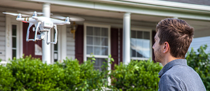
The drone being used by the NTSB is a DJI Phantom 4 Pro V2.0. DJI’s website states, “The Phantom 4 Pro V2.0 is a complete aerial imaging solution, designed for the professional creator. The onboard camera features a 1-inch 20MP CMOS sensor and a mechanical shutter, eliminating rolling shutter distortion. An advanced sensor and impressive processing capture every detail and provide the image data needed for advanced post-production. The Phantom 4 Pro V2.0 camera has an optimized f/2.8 wide-angle lens, ensuring consistently detailed photos and videos that remain vivid and sharp while maintaining color accuracy.” The debris field left behind from this crash is massive. To be able to accurately investigate the NTSB first needed to map out the debris zone. The camera on this drone allowed the NTSB to get a detailed map of the site so they can plan an effective investigation.
The drone also served to show the world the images of the crash. As the drone swept over the steep Calabasas hillside details of the wreckage were made abundantly clear. A single large white and blue part of the craft could be seen, along with one of the helicopter’s wheels. The rest of the helicopter barely recognizable. The investigation has only just begun, and will take time. At the time of the briefing led by Jennifer Homendy the NTSB had only spent one day investigating, most of which was used to map the scene with the drone. As Jennifer opened her statements she expressed how much of the world is feeling in the wake of this tragedy. She said, “Before I go any further I want to once again extend our deepest sympathies to those who lost loved ones in this tragic event. I can’t imagine what the families and friend of those who perished in this accident are going through, but know that our hearts go out to you, and you will be on our minds over the next days, and months, and years ahead.”
|
Previous Drone News:
« The University of Alaska Fairbanks Using Drones to Track Bears and Keep them Away from Oil Fields
Magpie Drone Can Fly Autonomously and Even Choose a Safe Landing Spot »