
Researchers from North Carolina State University Use Drones to Collect and Study Algae Blooms
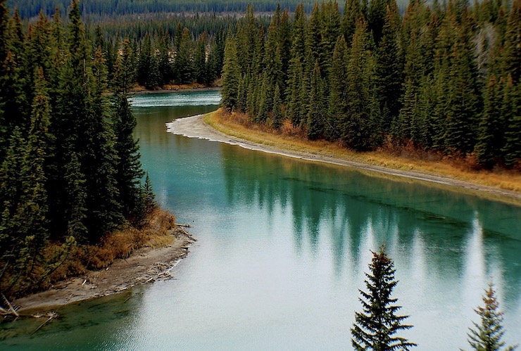
The Chowan River in North Carolina is a slow moving body of water that flows through swamps and wetlands, classifying it as a blackwater river. It has long been a source of fishing for catfish and large mouth bass, as well as being a local recreational hot spot. Since 2019, a harmful algae bloom along the river has put a halt to any fishing or recreational activity in the Chowan River. While all freshwater and marine ecosystems rely on algae as a part of their necessary food chains, when these organisms grow in abundance it throws off the natural balance of the habitat with severe results. An algae bloom will block the production of oxygen and release toxins into the water. As the algae begin to decompose it uses up even more of the remaining oxygen levels in the water. It is often fatal to larger marine animals like seals and manatees and can lead to death in large populations of fish. Humans and pets who swim in waters infested by an algae bloom, or eat shellfish and fish from these waters, can become gravely ill.
Marine scientists have been studying algae blooms around the world to learn how they progress, what causes them, how to predict them, and how to clean them up. Satellite imagery has gone a long way in collecting broad data on these natural phenomenons, but researchers have found it to be a flawed system. Aquatic zones that may be susceptible to algae bloom need more frequent and detailed monitoring than what can be provided by satellite imagery. That is why a doctoral student from North Carolina State University (NCSU) has begun using a drone to study the algae bloom in the Chowan River.
NCSU Department of Marine, Earth, and Atmospheric Sciences (MEAS) Ph.D. student Will Reckling has partnered with the department’s Assistant Professor Ryan Paerl to map and collect samples from the Chowan River using drones. Will has a strong background in drone technology and has devoted both his academic and professional career to the application of drone technology across a wide range of fields. He has a master’s degree in Geospatial Information Science and Technology and is the director of Geospatial Technology at Theorem Geo where he oversees all drone related operations. A native of North Carolina, Professor Paerl has a Ph.D. in Ocean Sciences and began his postdoctoral career at the Scripps Institution of Oceanography. Now at NCSU’s MEAS department, he has established the Paerl Lab that is dedicated to the study of marine bacteria and algae research.
Collecting biological algae samples from a bloom would traditionally be done by sending a team out into the water on a boat. It is a very time consuming process as the boat has to travel at a very slow speed so it doesn’t disturb the algae formation on the water surface. The whole process can take hours and cost a small fortune. With his drone expertise, Will presented Professor Paerl with the idea of using a drone instead. The drone could first be used to map the river, showing the highest concentrations of algae, how the algae are spreading throughout the water, and predict where the bloom may migrate to. Once Will had complied several detailed maps of the Chowan River’s algae bloom, he was ready to use the drone to collect water samples.
Will’s first attempts at sample collection were not very successful. The rotors from the drone caused the algae to disperse, much as it would from the movements of a boat. Will had to design a way for the drone to reach the water surface without imposing gusts of wind from the rotors. “We had to experiment with the length of line that would be suitable to get a water sample and yet not have the rotors impact the surface of the water,” Will said. The line dropped into the water had to be strong enough to carry back the sample without adding weight to the drone that would impede its flight. The rig Will came up with was using an 80 pound fishing line attached to the drone. At the bottom of the line was a plastic mesh net to be used as a harness holding two 50 milliliter collection tubes. The harness needed to be constructed in a way that would allow the tubes to collect samples without disturbing the algae at the surface or spill in retrieval.
Once Will had perfected his drone collection system, it worked perfectly. The entire process took only a matter of minutes to complete compared to the hours it would have taken to collect using samples by boat. The maps created by the drone gave Will and Professor Paerl exact coordinates of where the samples were coming from. The data can be used to study the changes in the algae bloom when compared to future maps. The images Will collects with his drone can be far more informative than anything taken by a satellite. The research in harmful algae blooms is vital. It is estimated that these blooms can have an impact of close to $80 million a year on the US economy alone, not to mention the financial impact on nations reliant on fishing for survival. As marine environments are changing from pollution and global warming, understanding how algae blooms manifest and spread will be needed to keep waters survivable.
|