Researchers Used Drones to Count Birds on Falkland Islands

The Falkland Islands are an archipelago that is about 752 miles from the northern tip of the Antarctic Peninsula and is home to more than 63 species of birds, 16 of which are endemic to the Falklands. However, many of the archipelago’s birds have declined in numbers due to the introduction of invasive predators like Patagonian foxes, brown rats, and cats. Methods to reduce invasive predators on the Falklands have been underway, and scientists are now trying to gather bird population counts to assess conservation measures.
In the May 22, 2021, edition of the scientific journal Ornithological Applications, a team of researchers from North Carolina’s Duke University Nicholas School of the Environment published their findings on using drones to conduct bird population counts. The project was led by Research Tech Maddie Hayes under the supervision of Associate Professor of the Practice of Marine Conservation & Ecology and Director of the Duke Marine Robotics and Remote Sensing Lab, Dr. David W. Johnston. The team traveled to Grand Jason and Jason Steeple Island of the Falklands to gather evidence for the paper titled Drones and Deep Learning Produce Accurate and Efficient Monitoring of Large-Scale Seabird Colonies.
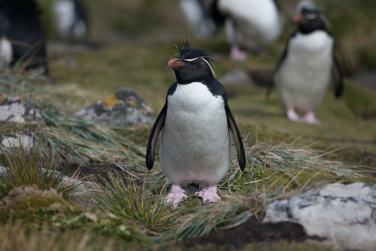
These islands are home to the largest Black-browed Albatrosses and second largest Southern Rockhopper Penguin colonies. Typically, scientists would travel by foot to count the hundreds of thousands of birds on the islands. With such dense populations, accurate calculations are often difficult, with repeat counts needed. The process is time consuming, inaccurate, and can be disturbing to the birds. It can also pose risk to the scientist trying to traverse the rocky terrain.
Using an inexpensive off the shelf drone, Maddie and her team took more than 10,000 individual photos of the mixed populations of albatrosses and penguins, as well as other sea birds interspersed with the study subjects. The next step was to take all of the photos and put them into one large composite image. The composite was then analyzed by an AI program called a convolutional neural network (CNN). “A CNN is loosely modeled on the human neural network, in that it learns from experience,” explained Professor Johnston. “Essentially, the computer identifies different visual patterns, like those made by Black-browed Albatrosses or Southern Rockhopper Penguins in sample images, and over time it learns how to identify the objects forming those patterns in other images such as our composite photo.”
The CNN was able to differentiate from the drone images the larger albatrosses better than the smaller penguins, but still with higher accuracy than by manual counts. In the paper, Maddie reveals that to do what the drone did in 20 minutes to an hour would have taken 9-10 hours to complete manually. The paper goes on to state, “Our method spanned a large area, was effective and accurate, achieving 97.66% and 87.16% accuracy detecting and counting Black-browed Albatrosses and Southern Rockhopper Penguins, respectively, on Steeple Jason and Grand Jason Islands, sites of global importance to both species.” The population count gives conservationists a better impression of the overall health of the Falklands and how to progress with conservation programs. And as Maddie said, drones can make a huge difference. “Using drone surveys and deep learning gives us an alternative that is remarkably accurate, less disruptive and significantly easier,” she said. “One person, or a small team, can do it, and the equipment you need to do it isn’t all that costly or complicated.”
|