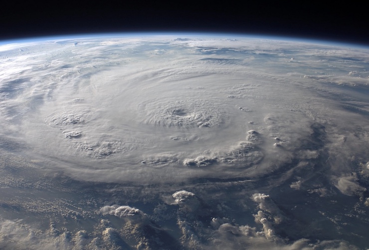
On August 23, 2021, the National Hurricane Center (NHC) first spotted a weather system with the potential to develop into a tropical cyclone in the Caribbean Sea. A few days later, the NHC noted the system was growing in force and would likely develop into a hurricane. By the 26th, the storm had been identified as Hurricane Ida. On the 27th, Ida was deemed a Catagory 1 hurricane, alerting communities along its predicted route to begin hardening against the storm. In less than 24hours, as Ida made her northbound journey, the storm rapidly increased to a Category 4 hurricane.
This phenomenon is called rapid intensification. It turns what would be a dangerous situation into a devastating event. Emergency planners are not left with enough time to inform communities of plans of action. Hurricane Ida went on to become the second most devastating storm to hit Louisiana after Hurricane Katrina. The damages left behind by Ida stretched up the Northeastern coast of the United States. The storm claimed 49 lives and caused more than $50billion in damages.
There is nothing that can be done to stop a storm. Unfortunately, global climate change has been leading to more storms with rapid intensification like Ida. The NHC and National Oceanic and Atmospheric Administration (NOAA) are constantly studying storm systems to help modelers create predictions that can save lives. The primary way this is done is by flying the US Air Force’s Hurricane Hunter through a storm and dropping probes into it. While this has given scientists a bevy of useful information, there are still gaps in understanding.
Meteorologists agree that to best understand how storms change, they need to be studied closer to the surface of the oceans where they develop. In collaboration with NHC and NOAA, Saildrone has been running a research trial that aims to gather data from the eye of a hurricane with bespoke drones. “What drives the hurricane strength is a transfer of heat and moisture from the ocean to the atmosphere,” said Saildron Founder and CEO Richard Jenkins. “We don’t quite understand the dynamics of how that works.”
Saildrone was founded in 2012 and has been committed to developing robust, long endurance, cost efficient drones that study the world’s oceans. Based out of San Fransisco, Saildrones have been used all over the world to create bathymetric maps of the ocean floor, monitor salinity and temperature levels, register wind currents, observe maritime ecosystems, and much more. The bright orange drones look like a small surfboard with a sail on top. The drones can be fitted with a wide range of sensors and cameras to meet mission objectives. A Saildrone can withstand extreme temperatures, wind, and waves. It is built to take a beating, capsize, and right itself to get back to work.
Earlier this summer, Saildrone sent out 5 vessels in the Atlantic Ocean to cross paths with hurricanes. The sensors on board were able to collect atmospheric data unlike any that can be taken from a plane above a storm. The cameras allowed scientists to see what a hurricane truly looks like, and how that relates to the data collected by the sensors. This information can then be used to develop accurate storm models and plans of action. “The oceans are really driving our global weather and climate,” Jenkins said. “Understanding the rate of change is going to really give us deep insights into our future and how we might need to change things.” Drones will enable us to safely study the oceans and their impact on our lives.
|