
In the North Atlantic Ocean, tropical cyclones develop into hurricanes when there is a combination of warm ocean temperatures, a high percentage of moisture in the air, low vertical wind shear, and a pre-existing condition such as an active thunderstorm. Though these storms can happen at any time of the year, the Atlantic hurricane season begins on June 1 and ends on November 30. In late June, Hurricane Beryl became the earliest-forming Category 5 hurricane in recorded history. It was only the second hurricane of the season. On August 5, the fourth hurricane of the season, Hurricane Debby, made landfall in Florida. So far, the 2024 Atlantic hurricane season has caused at least 80 deaths and $5.117 billion in damages.
With so many moving parts in understanding hurricanes, having the right tools to study them is vital. Without these tools, emergency preparations cannot be made to protect lives and property. Luckily, with advancements in drone technology, experts now have a way of tracking and studying hurricanes like never before. One of the biggest advancements in such technology came with the founding of Saildrone by Richard Jenkins in 2012.
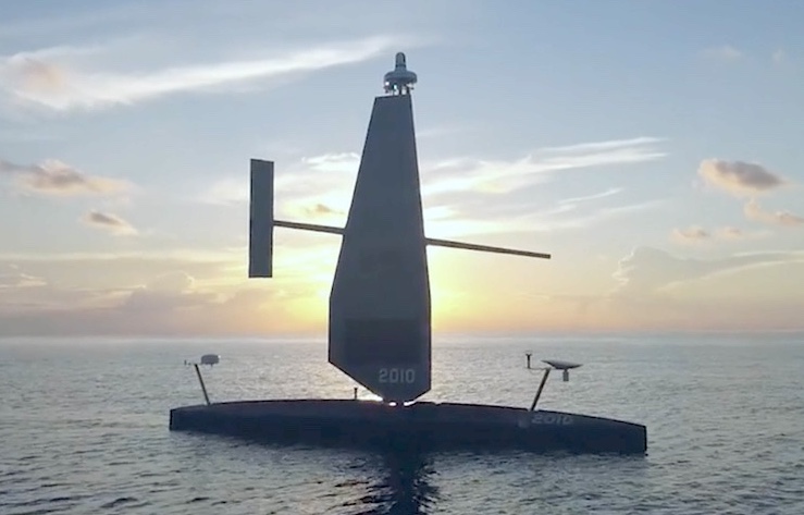
Born and raised in England, Richard became interested in engineering and sailing at a young age. By the time he was 16, he had sailed across the Atlantic Ocean. On March 26, 2009, he set a new world record for the fastest land speed by a wind-powered vehicle, reaching a speed of 126.1 mph in a land yacht he designed. It was the unique design of this land yacht that led Richard to develop his wind-propulsion, solar-powered, autonomous aquatic surface vehicle, the Saildrone.
The purpose of the Saildrone is to collect ocean data. The drone’s onboard sensors are solar-powered, and since the wind powers its propulsion, the drone can remain in the water for up to a year collecting data. In 2013, the Saildrone became the first drone to cross the ocean using only wind power, traveling 2,100 nautical miles over 34 days. In 2014, Saildrone entered into a partnership with the National Oceanic and Atmospheric Administration (NOAA). Since then, Saildrones (identified by the call letters “SD” and a series number) have been continuously traveling the world’s oceans, collecting a wide range of data, including data critical to the study of hurricanes.
For the 2021 Atlantic hurricane season, Saildrone and NOAA sent five drones modified to withstand the extreme conditions of a hurricane into the Atlantic Ocean. On September 30, 2021, SD-1045 became the first drone to venture into a Category 4 hurricane, Hurricane Sam. The drone battled 50-foot waves and wind speeds reaching over 120 mph to send back data that Saildrone and NOAA could use to research hurricanes up close. The program was a huge success, and NOAA announced that it would be repeated for the 2022 hurricane season with another five drones.
As hurricane seasons continue to increase in intensity, the projects carried out by Saildrone and NOAA become more important. Once again, the collaboration launched a fleet of drones for the 2024 season, all of which are monitored and controlled from Saildrone’s home base in the San Francisco Bay Area.
As Hurricane Beryl headed toward the Caribbean, SD-1041 was remotely navigated to meet the storm at its northern edge, about 100 miles south of Puerto Rico. Similarly, a drone was sent to sail into the heart of Hurricane Debby as it began its approach toward Florida. The 11 drones collecting hurricane data are all set to remotely sail to Saint Petersburg, Florida, at the end of the season in November. Along the way, the drones will be transmitting data on wind speed and direction, atmospheric pressure and temperature, wave heights, and even underwater current conditions.
All of the information collected by these drones is used to help fill in the gaps in understanding how hurricanes operate. With this knowledge, officials can develop safety plans to help people protect themselves and their property. “We are proud to have engineered a vehicle capable of operating in the most extreme weather conditions on Earth, to deliver data that can help advance the understanding of these powerful storms and protect our coastal communities,” Richard said. By leveraging cutting-edge drone technology, scientists and researchers are not only gaining unprecedented insights into hurricane behavior but are also enhancing our ability to prepare for and mitigate the impacts of these formidable storms, ultimately safeguarding communities and saving lives.
|