
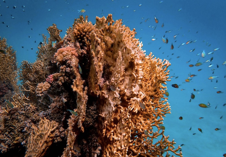
There are 12,292 coral reefs throughout the world’s oceans. The majority of these reefs can be found within the Indo-Pacific region. This includes the world’s largest coral reef system, the Great Barrier Reef, which is made up of nearly 3,000 individual reefs stretching over 133,000 sq miles off the coast of Queensland, Australia. According to the National Oceanic and Atmospheric Administration, coral reefs support an estimated 4,000 species of fish and 800 species of hard corals, along with hundreds of other organisms. Scientists believe that there could be millions of yet-to-be-discovered species supported by healthy reef systems.
The different species found within coral reefs have been found to be beneficial in the development of medical treatments for cancers, infections, arthritis, and numerous diseases. Coral reefs also provide thousands of job opportunities between tourism, research, and fishery management. It is estimated that U.S. fisheries alone bring in over $100 million from fishing off coral reefs while reefs bring in billions of dollars through other ventures worldwide. Coral reefs are also pivotal in protecting shorelines from 97% of the force of waves and storms.
Despite the importance of a healthy reef ecosystem, coral reefs are under threat of deterioration from pollution, habitat destruction, disease, and bleaching. “Since 2009,” Dr. Ove Hoegh-Guldberg, professor of marine studies at the University of Queensland in Australia stated, “the United Nations-supported Global Coral Reef Monitoring Network found that 14% of the corals have disappeared, and things are speeding up.” As the home of the Great Barrier Reef, there are many coral reef research programs coming out of Australian institutions. One such program started in 2018 was to see how drones can be used to study hard-to-reach coral areas.
Most coral reefs are studied by scientists getting up close to them either by snorkeling, SCUBA diving, or using submersible drones. However, as University of Western Australia graduate and research assistant Amy Stone points out, emergent intertidal coral reef systems are an area that has been vastly understudied. Because these reefs are in shallow waters, they are hard to access. It isn’t safe to bring vessels close to the reef as it could damage the corals. Swimming to them to examine is not reliable since great distances may need to be covered.
This is why Amy and her team decided to use a drone to gather data on the intertidal coral reefs of the Rowley Shoals off the Kimberley coast of Western Australia. As the tides change, sections of the Rowley Shoals remain exposed to the sun and air. The dynamic environmental changes the reef experiences between low and high tides have led to the organisms living within the reef system adapting for survival. These adaptations can be crucial in finding ways to protect other reef ecosystems.
Over the course of two days in October 2018, Amy and her team boarded an Australian Institute of Marine Science (AIMS) research vessel to get as close as possible to the reef structures of the Clerke lagoon within the Rowley Shoals. From there, they launched a DJI Phantom 4 Advanced drone to begin mapping the corals. Weighing just over 3 lbs, the drone has a flight time of 30 minutes and can withstand winds of around 22 MPH. The drone’s 1-inch CMOS camera sensor was used to take hundreds of images with high resolution through an additional polarized lens. “As field conditions limited the placement of ground control points (GCPs),” the team explains in their recently published research paper, “drone imagery was geo-corrected using the drone GPS when aligning and stitching together the images to create the orthomosaic.”
The drone images were then used to compare the two main imagery study methods for coral reef data collection: pixel-based (PB) and object-based (OB). The results showed that a drone-enabled PB model had higher rates of accuracy than an OB model. “The findings,” Amy said, “are important because we have lacked comparative studies to know how to best optimize drones as a tool to map coral reefs.” Dr. Ben Radford from AIMS and a senior researcher on Amy’s team explained that this study is just the first step in many to come. “This will aid in conservation efforts and further our understanding of their role within broader reef systems,” he said. “By harnessing drone technology, we can enhance our understanding of these critical ecosystems and inform targeted management strategies.”
|