
Scientists Use Drones to Study Melting Glaciers
Just like any other planet in the universe, the Earth has both a North and South Pole. They are the polar opposites of each other on the earth’s axis. Not only are they geological opposites, they also both store the largest amounts of snow and ice on Earth. Besides the North and South Poles, there is an area that is considered the Earth’s third pole in the Asian high mountains. This 1.7 million square mile region spreads across the Hindu Kush, Karakoram, and Himalayan mountain ranges, and through 10 countries, also known as the Tibetan Plateau. It is the third largest reservoir of snow and ice water, being the source of 10 major rivers like the Indus River.
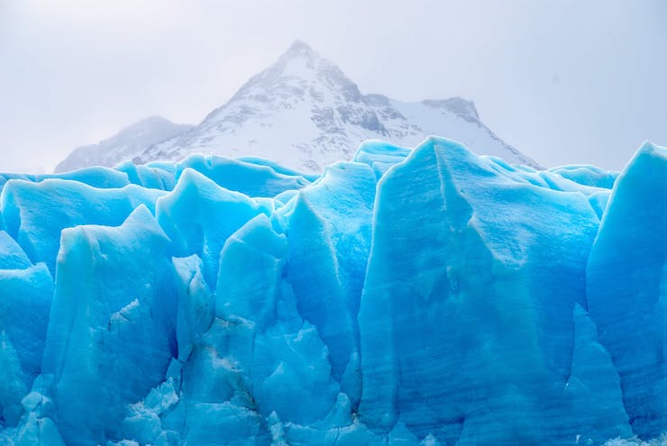
The third pole is home to 14.5% of the world’s glaciers, 85% of the Indus River’s water flow, and the source of water for nearly 1.3 billion people, 20% of the Earth’s population. But similar to what is happening to the glaciers in the North and South Poles, climate change has been effecting the glaciers of third pole too. At the base of Khawa Karpo, a mountain that climbs 22,112 ft above sea level, lies the Mingyong glacier. In a span of just 4 years the glacier retreated 656 feet and is now considered the fastest retreating glacier in the world. On a whole, the glaciers of the third pole are estimated to be melting 7% each year. These changes have a wide range of impact on the people of the area. Everything from flooding to water shortages, and pollution is being effected by the climatic changes of the third pole.
While there is a lot that scientists can assume about the causes and effects of climate change on the third pole, there is still a lot to be learned. Starting in 2014, a team of researchers began using drones to monitor Himalayan glacier melts, a first of it’s kind for this type of study. The team from the International Centre for Integrated Mountain Development (ICIMOD) in Kathmandu and Utrecht University in the Netherlands began using drones to map the Lirung glacier in the Lantang mountains of northern Nepal, an area that little was known about because of how difficult it is to access it. Steven De Jong, one of the researchers, said, “For years we have been using remote sensing to learn about hydrology of the Himalayas but the technology development around unmanned Ariel vehicles and the software to process the images has advanced so much that we can study the dynamics of the glaciers at unprecedented details by using these devices.”
No longer would researchers have to rely on partial images from satellites or manned aircraft. A drone can get into the hard to reach areas and bring back detailed images that can be compared to existing ones for an in-depth understanding of the glacier. In a paper the team published, they stated that the glacier has been losing mass, with a significance of the melt coming from the small lakes at the top and within the glacier. “We’ve shown it is possible in one catchment but given the variety in the region we need to extend this to other areas of the Himalayas,” said Dr Walter Imerzeel another of the researchers.
Since then, there have been many research projects in the third pole, some involving drones. In 2018, another team began a research program using an entirely different kind of drone, a USV (Unmanned Surface Vehicle). In this case it was an autonomous survey boat that was sent out into the glacial lakes to take measurements like none ever taken before. The three lakes being surveyed were the Qihu lake, Jialong Cuo lake, and Galong Cuo lake to measure the storage capacity, depth, and hazard levels of the lakes. Because of the remoteness, high altitude, and extreme temperatures of these lakes, completing the mission was difficult for the human researchers, but not for the drone gliding along the surface of the water.
The drone used for this mission, the SL20, was made by OceanAlpha. According to Huang Cheng from OceanAlpha, “In this survey mission, the advantage of the unmanned boat in prominent. The unmanned boat is very flexible in transportation for it’s small and light enough to be transported by horse or manpower. The unmanned boat can work continuously, reducing the time for surveyors to stay outdoors and reducing the intensity of work. By remotely controlling the unmanned boat through the base station on the bank, the surveyors can enjoy a more comfortable working environment and lower their risk of getting into dangers.”
Though the entire findings on this mission have yet to be published, the team was able to construct a detailed map of all three lakes. Surely the data collected will help scientists get a better understanding of the exact causes of glacial melt in the third pole. Without this knowledge, a plan for aiding the region can not be built. As ICIMOD’s chief scientist, Philippus Wester said, “This is the climate crisis you haven’t heard of.” It is a crisis that is impacting billions of people, but with the help of drones, research for a solution can become a reality.
|