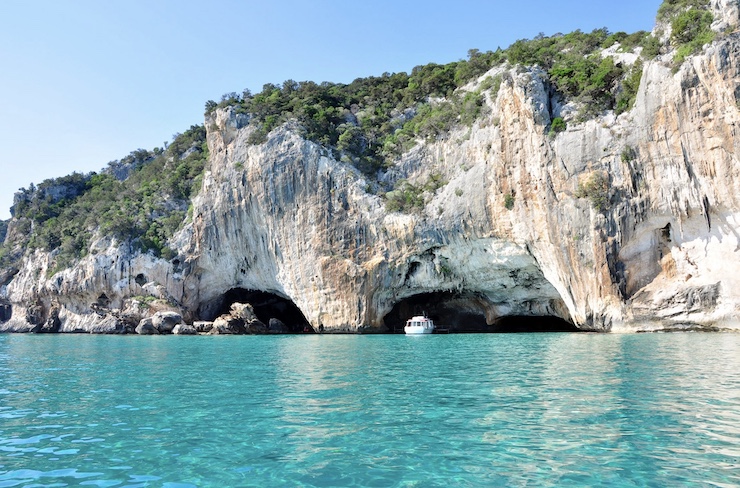
The islands of the Mediterranean Sea are famous for their beauty. With average depths of 4,900ft spanning an area of 970,000 sq mi, the Mediterranean Sea is almost entirely surrounded by land and supports a unique ecosystem. Approximately 17,000 species of marine life forms ranging from microorganisms to animals and plants can be found in the Mediterranean Sea. Of all the living organisms there, 20% are endemic to the region, meaning they are only found in this one biodiverse hotspot. One such example is Posidonia oceanica, also known as Neptune grass, which is a seagrass that can only be found in the Mediterranean Sea.
Posidonia oceanica form in meadows, called Posidonia meadows, along the seafloor and is vital to the ecosystems of the region. These meadows help establish sand dunes, prevent coastal erosion, provide natural filtration systems, remove carbon dioxide from the atmosphere, and support a vast array of life forms. Posidonia oceanica thrives best in the crystal clear waters of the Mediterranean. Under duress from pollution, the meadows begin to die, making them an excellent indicator of pollution levels in the Mediterranean Sea. Unfortunately, Posidonia oceanica has been greatly threatened by boats anchoring in the meadows and waste in the sea.
To protect the Posidonia meadows, certain areas throughout the Mediterranean have become protected zones. In 2017, Es Trenc-Salobrar de Campos Nature Park was declared a protected nature park. Located in the southeast of Mallorca, the largest island of the Spanish Balearic Islands, this park protects 17 habitats and just under 130 species. To better understand what is causing a decline in Posidonia meadows and how to recuperate them, an initiative using drones has begun mapping Es Trenc-Salobrar de Campos.
Being run by the EU’s Interreg Project and the IUCN Mediterranean, the project is called POSBEMED2. Based on frameworks developed the previous year thorough the POSBEMED project, this new project’s mission ” is to catalyze its results to manage the Mediterranean coastline by developing planning strategies that recognize the value of the Posidonia beach-dune environment and integrate them into the overall coastal strategy, while also addressing concerns and educating stakeholders. It further addresses key knowledge gaps, providing information that will enhance management decisions on adaptation, policies, planning, and promotion in Protected Areas,” as outlined on IUCN’s website. To do this, detailed data needs to be collected, prompting the project to turn to drones.
The drone program conducted at Es Trenc-Salobrar de Campos will be a first of its kind in the Mediterranean. The drones will create bathymetric 3D models of the shoreline, dunes, and meadows. The drones will also collect data for sedimentary analysis. As explained in the project’s objectives, “images collected in Es Trenc-Salobrar will help to understand which factors are influencing the seagrass meadows in the water column as well as how the banquets form on the beach. The final results obtained will build the basis of the recommendations and further restoration activities in the site. Furthermore, these learnings will support other similar Mediterranean coastal zones with Posidonia presence in improving their knowledge of these valuable ecosystems and supporting efforts to develop more sustainable management methods.”
While using drones in this capacity may be a first in the Mediterranean, it is far from the first to be using drones to study oceanic ecosystems. Because of how inexpensive yet accurate and easy to use drones are, they have been making tremendous progress in data collection both above and below the water surface. Drones designed specifically for water environments have become a huge branch of the drone development market. However, for the POSBEMED2 project, and other similar studies on sand dunes and coastal erosion, simple off the shelf drones work just fine. Often, these research projects are minimally funded. Researchers need to carefully budget their projects. With an off the shelf drone that costs less than $1,000 not only can researchers budget their finances, but the hours spent per mission segment as well.
POSBEMED2 has received generous funding from several private and public organizations. Their current budget is $2,767,717 Euros, the majority of which has been granted by the European Regional Development Fund. Of the funds raised, only a fraction will need to be allocated for the drone equipment and operators. Still, the data collected by the drones will be invaluable to the researchers. With this critical drone data, the remaining funds can be used to establish a means to protect the diverse ecosystems of the Mediterranean Sea.
|