
Professional Aerial Photography Across All 50 States
Our aerial photography services are built for clients who need clear, useful images from above. Every project is captured by FAA certified and fully insured drone operators using commercial-grade unmanned aircraft equipped with professional digital cameras. Each order is professionally edited and delivered in a clean, ready-to-use format.
Aerial photography gives viewers a perspective that ground-level photography cannot. This elevated viewpoint reveals details not visible from the ground. A single aerial view can show layout, visibility, access, parking, surrounding development, traffic patterns, boundaries, and overall context in one frame. That is one reason aerial photography is so effective for marketing and documentation. It helps buyers, brokers, owners, lenders, developers, contractors, and investors understand a property faster and make more informed decisions.
For DroneVideos.com, aerial photography is not just about flying over a property and taking a few photos. It is about choosing the right altitude, angle, and composition to tell the right story about the subject. A retail center may need to emphasize frontage and surrounding tenants. A construction site may need to show progress, staging, and access. A parcel of land may need to highlight shape, boundaries, nearby roads, utilities, and surrounding uses. Good aerial photography makes those details easier to see and easier to communicate.
- Commercial real estate and residential properties
- Construction progress and site documentation
- Land, farms, and development sites
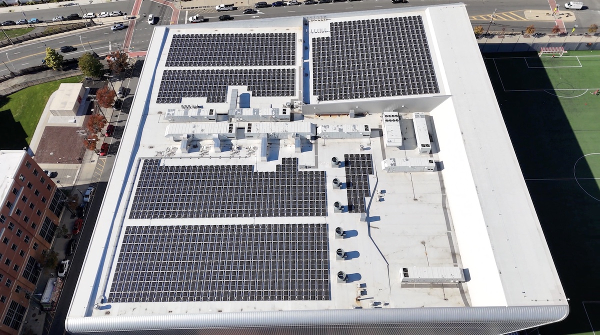
- Roof and structural inspections
- Golf courses and custom projects
- Photos delivered in 2 business days, video in 5
- Flat-rate pricing, all 50 states, zero travel fees
- CEO reviews every project before delivery
Why Aerial Photography Matters
Aerial photography helps people understand a property or project faster than a collection of ground photos alone. Aerial images provide context. They show how a building sits on a site, how a site connects to nearby roads, and how the surrounding area supports the property’s value. When someone views an aerial photo, they can quickly understand scale, layout, traffic exposure, access points, and neighboring uses without needing a long written explanation. That clarity is especially important in real estate and development.
Buyers and tenants often want to know what surrounds a property before they ever visit in person. Owners want to see how an asset presents in the market. Developers and contractors want a visual record that tracks change over time. Lenders and investors want images that help confirm site conditions and location context. Aerial photography gives all of those audiences a faster and more complete understanding of the subject.
Aerial photography also adds polish. Professionally edited digital images can make a marketing package feel stronger and more credible. Clean sky replacements, balanced exposure, crisp framing, and thoughtful composition all improve the final presentation. When an aerial image looks sharp and intentional, it helps build trust in the property and in the brand presenting it.
What Our Aerial Photography Can Capture
DroneVideos.com captures aerial photography that helps clients present and evaluate properties, sites, and projects more effectively. Depending on the assignment, aerial imagery can highlight:
- Property boundaries and overall footprint
- Building placement and site configuration
- Parking layout and vehicle capacity
- Road access, driveways, and entry points
- Traffic flow and road visibility
- Signage exposure from nearby roads
- Loading areas, truck courts, and dock access
- Roof condition and structural features
- Construction progress and staging areas
- Land features, water features, and topography
- Surrounding businesses, neighborhoods, and land
- Overall site context within the surrounding market
For many clients, this is the main reason to order aerial photography. A strong aerial photo can communicate the most important facts about a property in seconds. It can also function like a visual map, helping viewers understand location, shape, movement, and access without sorting through multiple diagrams or pages of explanation.
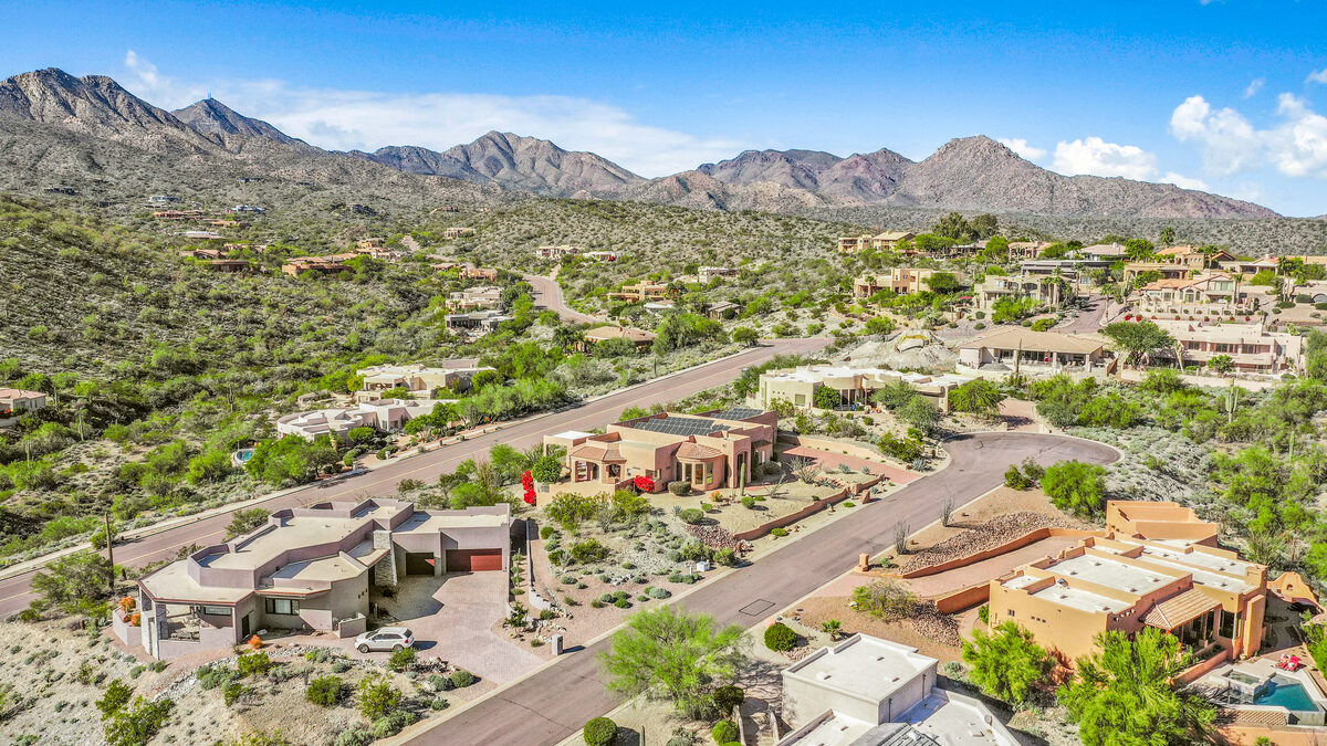
Real Estate Aerial Photography
Commercial and Residential
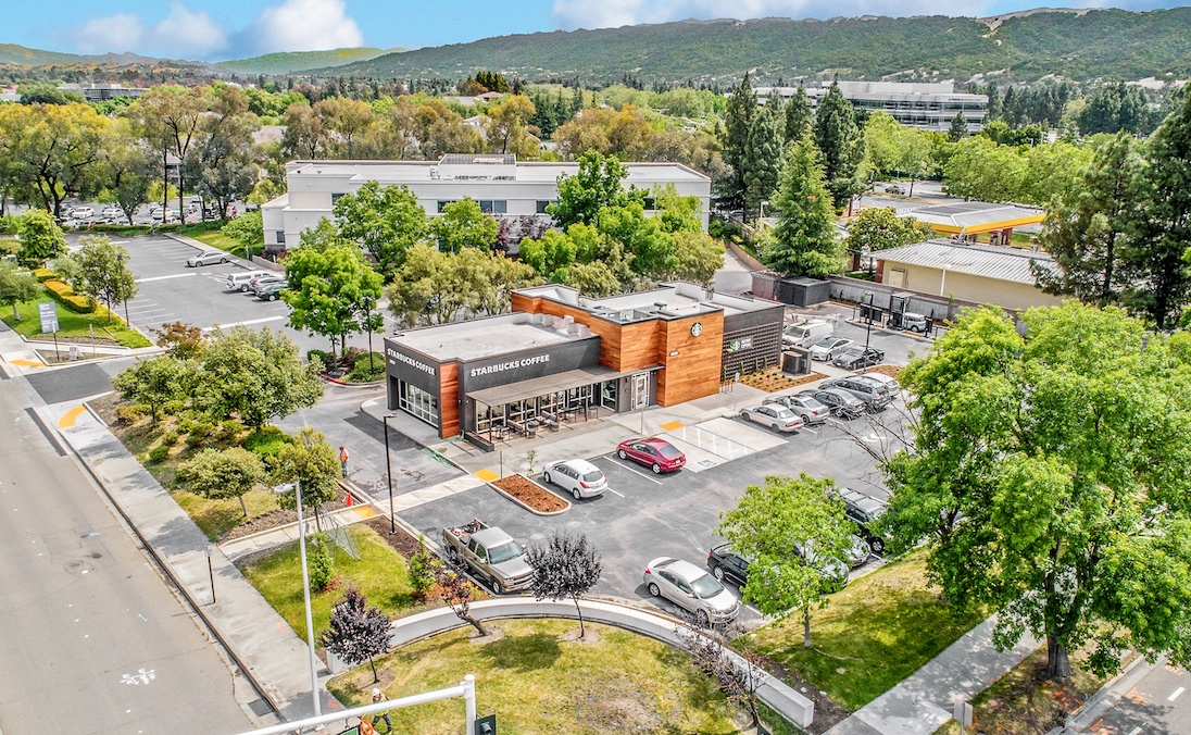
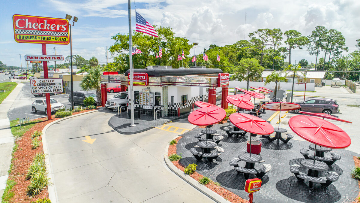
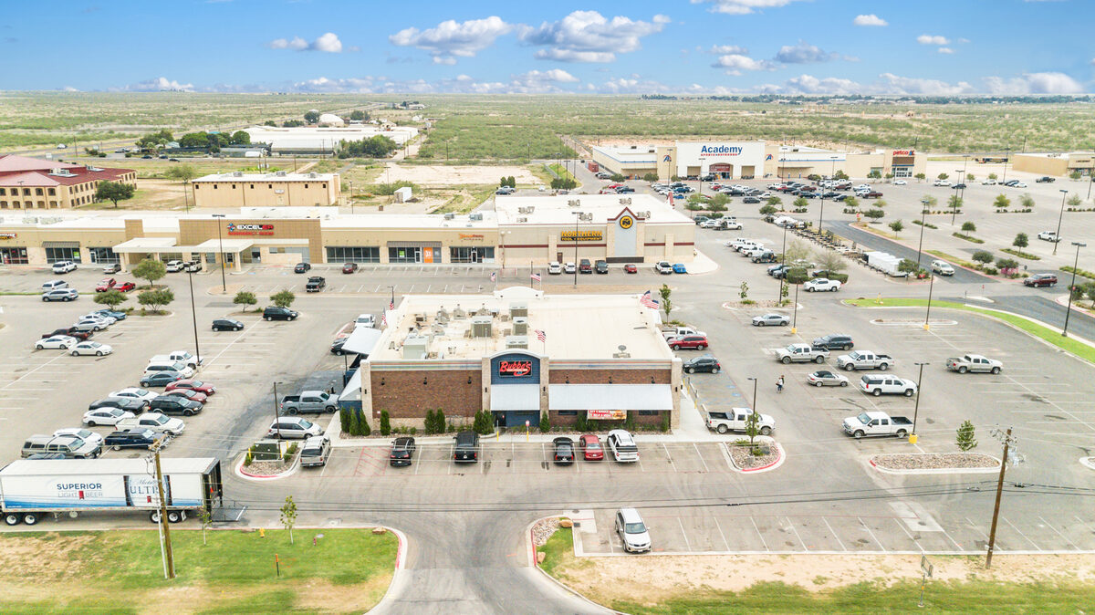
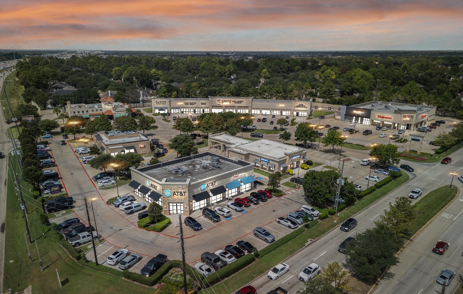
Real estate is one of the most common uses for aerial photography. DroneVideos.com works with commercial real estate brokers, residential agents, owners, developers, lenders, and property managers who need high-quality aerial images for marketing and decision making. Commercial clients use aerial photography for offering memorandums, lease-up campaigns, acquisition due diligence, lender packages, portfolio reporting, investment sales presentations, and website marketing.
Aerial photography is especially valuable in commercial real estate because so much of the story depends on context. An office property may need to emphasize parking, nearby roads, and surrounding development. An industrial site may need to show truck access, loading areas, and its relationship to highways or ports.
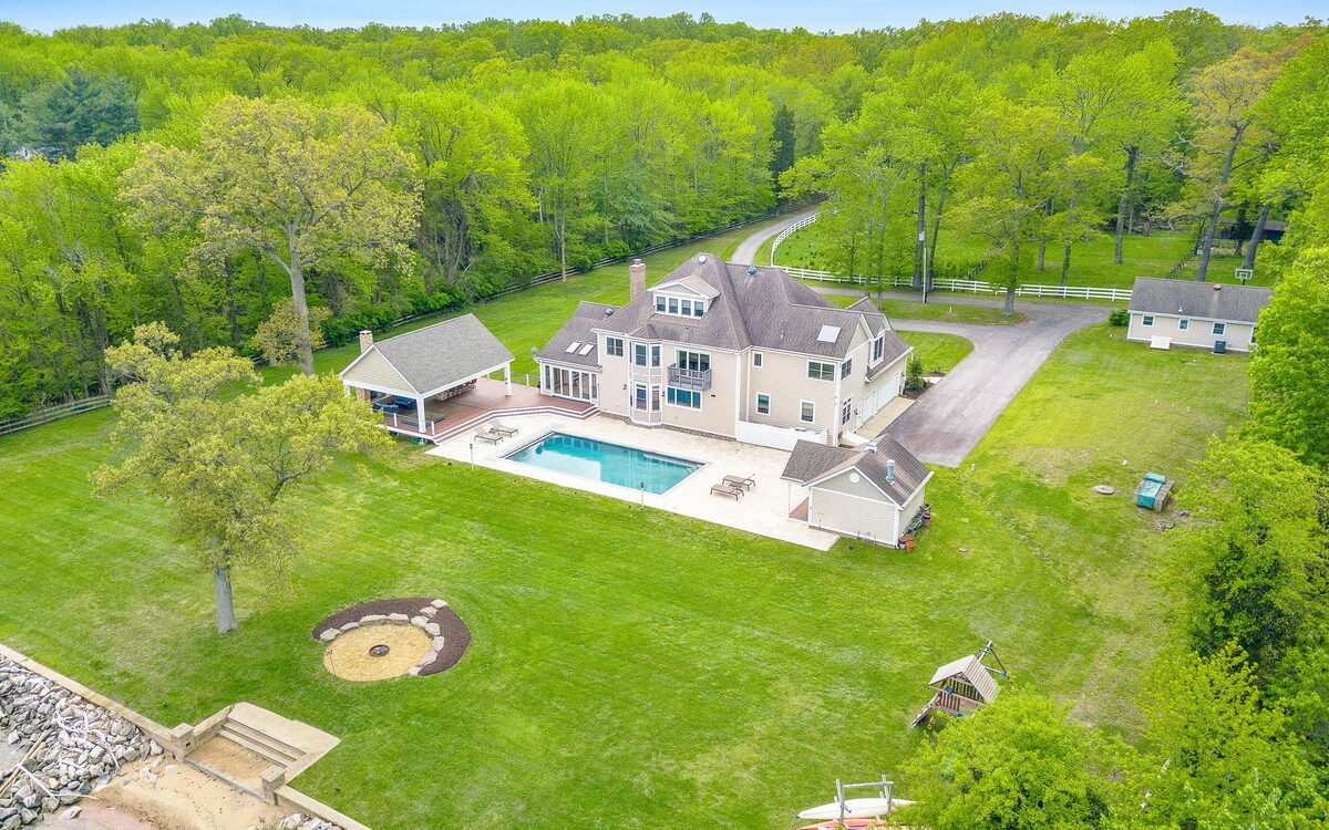
Residential clients use aerial photography to show lot size, neighborhood setting, waterfront access, nearby amenities, and surrounding views. Homes on larger lots, rural properties, estates, and unique locations benefit from aerial images because they reveal features that cannot be fully appreciated from the ground.
Ready to order real estate aerial photography anywhere in the US?
Order NowConstruction Aerial Photography
Progress Documentation and Reporting
Construction companies, developers, and general contractors use aerial photography to document progress over time. Repeat flights create a visual timeline from groundbreaking through completion, which is useful for investor updates, owner reports, marketing materials, and internal records. Aerial photos can show equipment placement, circulation, staging areas, grading progress, structural milestones, and overall site activity in a way that ground photos often cannot.
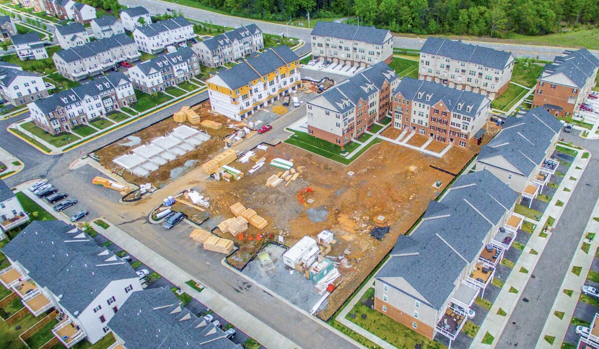
For teams working across multiple projects, aerial photography also creates a consistent reporting tool. Decision makers can review the same kind of update across jobs and compare progress quickly.
Ready to order construction aerial photography anywhere in the US?
Order NowRoof and Structural Inspection Photography
Safer, More Efficient Documentation
Aerial photography can help document roof conditions, structural elements, and other hard-to-reach areas more safely and efficiently. Instead of relying only on ground observation, clients can review high-resolution digital images that show visible conditions in context. This is useful for due diligence, maintenance planning, insurance-related documentation, and pre-sale review.
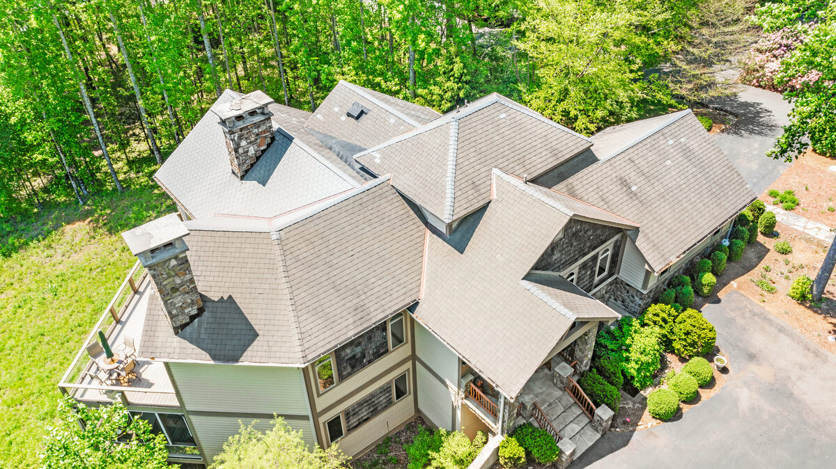
While aerial photography is not a replacement for every type of inspection, it is often an efficient way to identify visible issues, provide access to overhead views, and create a clear visual record that can be shared with owners, consultants, insurers, and maintenance teams. Solar panel installations are another common use case. Aerial photography can document panel placement, identify damaged or misaligned panels, and provide a full overhead view of the array without anyone needing to climb onto the roof.
Ready to order inspection aerial photography anywhere in the US?
Order NowLand, Farm, Golf Course, and Custom Project Aerial Photography
Acreage, Topography, and Specialty Assignments
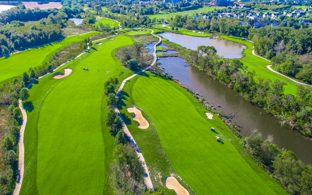
For land, farms, and development sites, aerial photography helps show acreage, shape, access roads, topography, nearby infrastructure, and surrounding land use much more effectively than ground photography alone. Buyers, investors, and planners often need to see how a parcel relates to the surrounding area, and aerial imagery makes that relationship easier to understand.
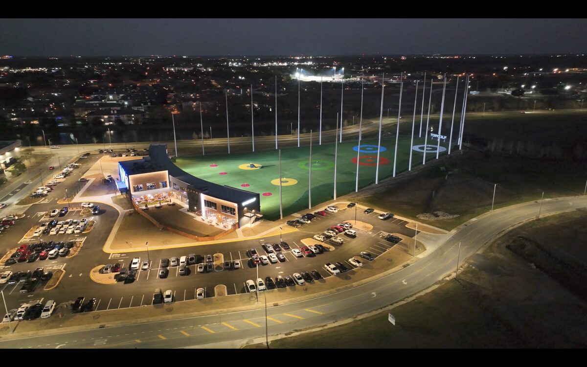
Golf course operators use aerial photography for marketing, layout documentation, promotional materials, and sale preparation. DroneVideos.com also handles custom aerial photography projects for infrastructure, utilities, events, hospitality properties, and other specialty assignments. If the assignment benefits from a clean view from the air, aerial photography can usually provide the right solution.

Ready to order land or custom aerial photography anywhere in the US?
Order NowWho Uses Aerial Photography
Our aerial photography services are used by clients across many industries. The same aerial photo that helps market a retail center can also support a roof review, document a construction milestone, or present a farm for sale.
- Property owners and landlords
- Commercial and residential agents
- Developers and general contractors
- Investors, REITs, and portfolio managers
- Construction companies
- Property managers
- Marketing teams
- Inspection teams and insurance professionals
- Landowners, farmers, and surveyors
- Golf course operators
- Film and video production teams
- Municipalities and multi-location organizations
Types of Aerial Photography We Capture
Different assignments call for different approaches. DroneVideos.com uses multiple aerial photography techniques depending on whether the goal is marketing, reporting, inspection, or broad location context. Varying altitude, angle, and framing creates a more useful final set of images.
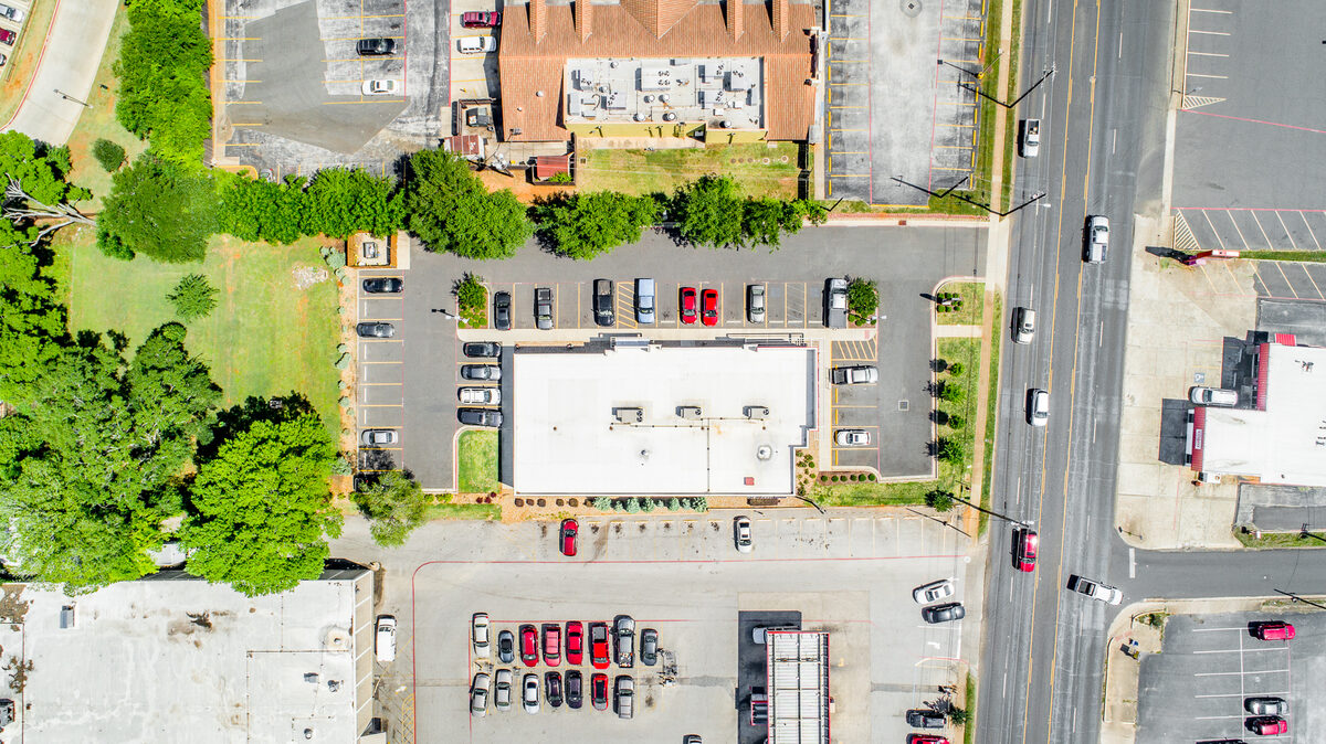
Vertical and Oblique Aerial Photography
Vertical aerial photography is captured with the camera pointing straight down. This is useful for site footprints, parking layouts, roof conditions, boundaries, and map-style visuals. Oblique aerial photography is captured at an angle so viewers can see building facades, signage, entrances, depth, and how the property relates to nearby roads and surrounding development. Most assignments benefit from a combination of both. Vertical views provide clarity, while oblique photographs often tell the marketing story more effectively.
Low Altitude, High Altitude, and 4K Aerial Video
Low-altitude aerial photography is ideal for detailed views of roofs, signage, site elements, and building features. High-altitude aerial photography provides broader coverage and is especially useful for larger land tracts, development parcels, and properties where surrounding context matters. In addition to still photography, DroneVideos.com offers professionally edited 4K aerial video with smooth motion shots, branding, royalty-free music, and optional property outline overlays. For clients who need both stills and motion, combining aerial photos with video creates a more complete package.
How Aerial Photography Is Used
Aerial photography can support multiple business needs from a single shoot. High-resolution files can be downloaded for immediate use, shared internally, inserted into maps and presentations, or printed for meetings and marketing materials. Clients regularly use our aerial images and aerial imagery for:
- Website and listing platform marketing
- Investment sales packages
- Lease-up campaigns
- Lender presentations
- Municipal approvals and entitlement support
- Portfolio reporting
- Construction progress updates
- Inspection and insurance documentation
- Internal reports and owner updates
- Print collateral, brochures, and signs
That versatility makes aerial photography one of the most useful deliverables a client can order. One flight can provide content for marketing, reporting, planning, and communication all at once.
Want To See Real Delivered Work?
Browse our full sample archive, organized by all 50 states and updated daily
Trusted by the Largest CRE Brokerages
See why the largest CRE companies in the U.S. trust our services. Since 2016,
we’ve photographed over 30,000 properties, delivering the quality, consistency, and reliability you can count on.


Optional Add-Ons for Aerial Photography
Every package can be customized at checkout. Add only what you need.
3 Things Every Aerial Photography Package Includes, Free
Every aerial photography package includes these three features at no extra cost. No upgrades needed, no extra charges.
Virtual Twilight
Our “Virtual Twilight” turns DAY into DUSK, delivering dynamic, vibrant skies with full illumination for all lights, signage, and building details. Transforms any daytime photo into a vivid dusk scene that makes your property stand out in any listing or marketing package.
View Twilight Samples »Blue Sky Replacement
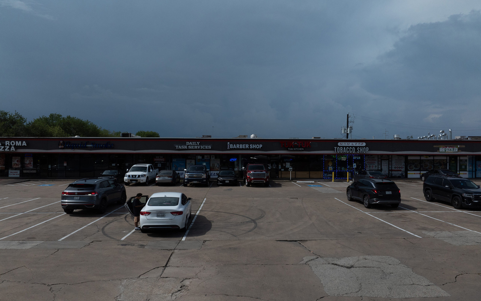
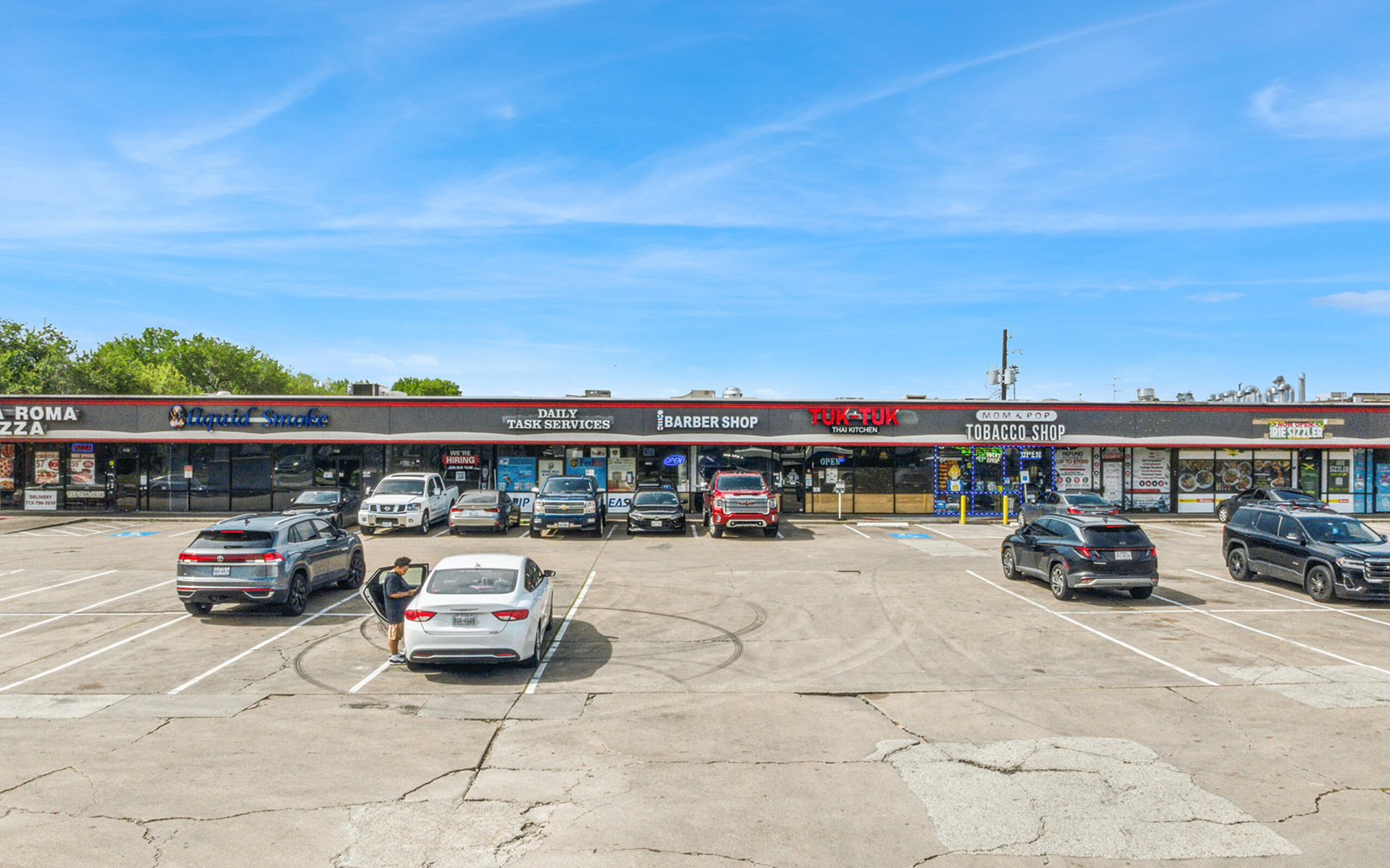
Applied to every single photo in your package. Dark, gloomy, or overcast skies are carefully replaced with bright, natural-looking blue skies that completely change the tone of a photo. Included free on every order we deliver.
View Blue Sky Samples »Hosted Property Gallery
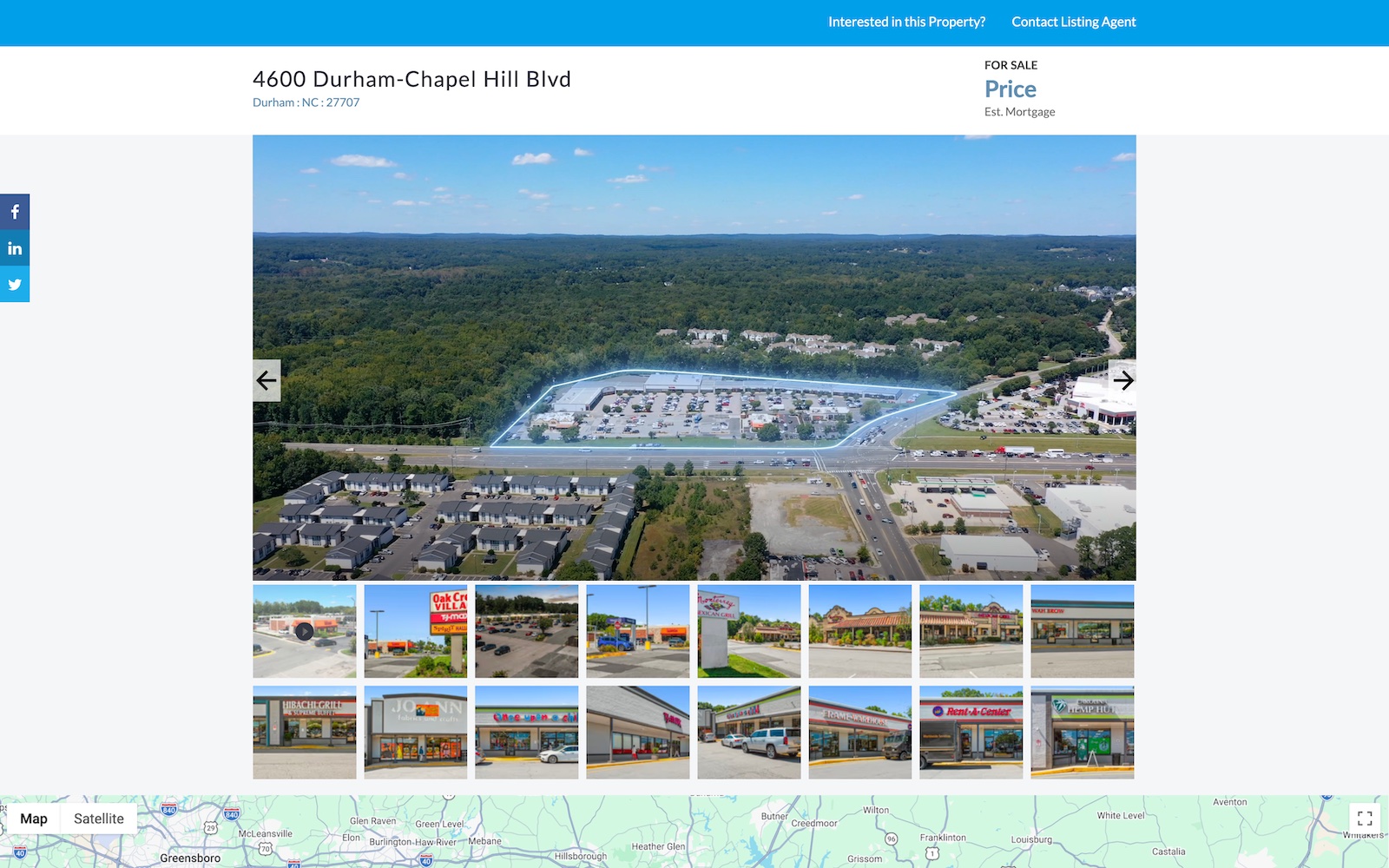
Every order includes a free hosted property gallery. One branded version with your logo and contact info, one unbranded version that is 100% MLS compliant. These pages are completely optional. You can always download the high-resolution photos and video directly.
View Gallery Sample »Our Customer Feedback Is Pouring In!
And they couldn’t be more pleased!
Aerial Photography Pricing
DroneVideos.com keeps aerial photography pricing straightforward. Photo packages start at $350 and photo plus video packages start at $700. Flat-rate pricing and zero travel fees apply nationwide, which makes budgeting easier for single properties and for larger multi-market assignments. Custom quotes are also available for recurring work, larger portfolios, and specialized projects.
Ground and Aerial
Blue sky replacement included
1 free Virtual Twilight
Free hosted gallery included
Ground and Aerial
Blue sky replacement included
1 free Virtual Twilight
Free hosted gallery included
Royalty-free music included
Property outline overlays
Branded and unbranded versions
Aerial Photography Process
The process is designed to remove friction. Many buyers of aerial photography do not want to manage aircraft sourcing, monitor permits, or coordinate multiple vendors. They want a reliable provider that can acquire the right images, edit them professionally, and deliver them fast. That is exactly what DroneVideos.com is built to do.
Enter Address and Select Package
The client enters the property address and selects the right aerial photography package for the assignment.
We Schedule and Capture
Our team schedules the flight based on location, weather, and sun angle. The assigned pilot captures the property using the right altitude and angle mix.
Professional Edit and Delivery
Images are professionally edited and delivered digitally in high resolution. Files are processed and delivered ready for immediate business use.
Why Choose DroneVideos.com for Aerial Photography?
DroneVideos.com is built for clients who want professional aerial photography without hidden fees, long quoting processes, or inconsistent quality. We provide nationwide coverage, fast scheduling, clean editing, and a straightforward ordering experience. That combination is valuable whether you are ordering one property or coordinating coverage across multiple markets.
Our aerial photographers and drone operators understand that different assignments require different methods. A retail property, a land parcel, a roof review, and a construction update do not all need the same story or the same camera positions. We choose the right angle, altitude, and composition for the assignment so the final package feels useful rather than generic.
Clients also value consistency. Professional aerial imagery should look polished and ready to use. Our editing process creates balanced color, strong contrast, clear skies, and clean presentation. High-resolution images and video are delivered in a format that works for websites, marketing packages, internal reporting, prints, and presentations. Experience matters, especially when multiple stakeholders rely on the final result. DroneVideos.com has worked with major brands and high-volume real estate and property-related assignments nationwide.
- FAA certified and fully insured on every shoot
- All 50 states covered, zero travel fees
- Photos delivered in 2 business days
- Videos delivered in 5 business days
- Blue sky replacement on every photo, free
- 1 free Virtual Twilight with every package
- Branded and unbranded MLS-compliant versions
- Free hosted gallery with every order
- Professional editing and color correction
- Full copyright ownership on all deliverables
- You do not need to be present
- 100% money-back guarantee and 24/7 support
Frequently Asked Questions About Aerial Photography
Browse answers to our FAQs below, or reach out to us at 1-800-303-1783 or visit our Contact Us page.