
The Important Role of Drones in the Mining Industry
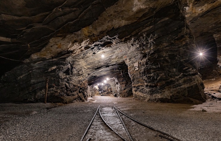
Drones can make an important contribution to nearly every US industry, but their role in mining may well be unique. Aerial mapping via drone is also critical in construction and farm management, but the survey work takes place outdoors. In mining, much of the work occurs within the darkness of the mineshaft and requires indoor flying and infrared imaging capabilities. Another notable aspect is workplace safety. Mine explosions and collapses as well as toxic exposures are an ever present threat and need to be mitigated. Drones adapted to mining conditions can help fulfill this purpose also.
While many construction companies are relative newcomers to drones, the global mining industry took to drones fairly early. Back in 2013, mining companies in the copper-rich nation of Chile deployed locally manufactured SisDef drones to conduct aerial mapping of the mines in the Atacama region, which included a vast open-pit mine that normally took days or even weeks to survey accurately. In 2016, two other companies Airobotics and Rocket Blast partnered to conduct more advanced surveying that included 3D mapping and ongoing monitoring of mine conditions, including volumetric estimates of blast displacement and identification of potential safety risks.
Chile’s indigenous drone industry may be something of an exception when it comes to mine inspections. There are several US-based companies that have come to specialize in indoor drone flying, especially for mining surveys as well as nuclear reactor inspections. Two of the most notable are Skydio and especially Flyability. The Flyability Elios 3 drone comes equipped with a dual thermal and 4K camera sensor and a 10K lumen dust proof lighting system which highlight a mineshaft’s contours and allows the drone to collect visual data over a continuous 10 minute period with ease.
In mining more than construction, the drones deployed for survey purposes are generally programmed to fly autonomously on a regular inspection schedule. Skydio offers a state-of-theart “drone-in-a-box” capability that allows a drone to automatically launch, inspect a mine, recharge its batteries and store itself in a locker without the need for remote piloting. In addition, mining drones are typically equipped with special sensors that detect mine walls and other obstacles, making collisions and crashes in tight interior spaces less likely. As an extra precaution, Flyability’s drones are encased in a circular metal structure – a spherical cage – that protects their propellers and allows them to bounce off of mine walls and other potential obstacles without incident.
A third UAV company that specializes in mine surveying and data collection is Wingtra, a relative newcomer with a rapidly expanding portfolio of mine projects, especially in Europe. Wingtra’s main competitive advantage is its design and use of VTOL drones. The company makes the bold claim that its WingtraOne drone surveys 5 times faster than traditional field surveyors but also more efficiently than either fixed wing drones or the multicopter drones (like those offered by Skydio and Flyability). The company also claims that a single drone flight of WingtraOne drone – equipped with a 42 MP Sony camera – can map almost two times more terrain than a conventional fixed-wing drone and approximately 10 to 14 times more terrain than available multicopter drones.
The WingtraOne VTOL flies at a higher altitude than other drones, allowing it to map a larger area while offering the same or better image resolution, the company claims. It should be noted, however. that this competitive advantage applies only to aerial surveying of open pit mines, not to the more specialized indoor drone surveying conducted by Skydio or Flyability.
Skydio and Flyability drones have one further competitive advantage: they can fly without GPS, which generally fails to function once a drone enters an indoor space, especially a mine. GPS-denied drones are able to fly and avoid obstacles using a mix of high-tech sensors that provide the drone with reference points regarding its altitude, attitude, and location. Flyability’s new Elios 3 drone uses a combination of visual sensors and LiDAR sensors to create 2D or 3D maps that are just as accurate as those compiled by human field inspectors, but conducts the work in far less time and with reduced safety risk.
Where is the mining drone market heading? Surveys of mining executives conducted by the research firm Global Data indicate that the share of mines that have made at least one investment in drones has increased from 44% in 2018 to 65% in 2022. Moreover, nearly a third (32%) of the respondents in the 2022 survey said they had either “fully” invested in drones or made a “considerable” investment. Mines in Australasia were the furthest advanced, with three-quarters of respondents saying that they had either fully invested or made a considerable investment in drone technology.
The global mining industry faces many challenges relating to environmental and labor concerns. At the same time, the need for mining of rare and precious metals including cobalt, nickel, lithium and others to fuel the ever-expanding energy and consumer electronics markets is also growing. Equipped with drones, mining companies the world over can ensure higher performance, reduced mining accidents, enhanced workplace safety and greater sustainability.
|