
Using Drones to Collect Avalanche Data, Mitigate Avalanche Risks and Assist Emergency Workers
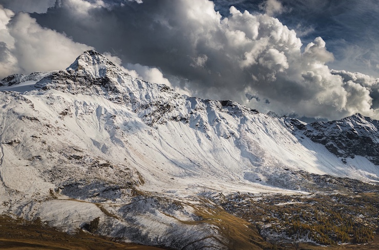
Stretching more than 3,000 miles from British Columbia in Canada down to New New Mexico in the US, the Rocky Mountains are the largest North American mountain range. The majority of the range’s highest peaks can be found in Colorado, followed by Wyoming, New Mexico, Montana, and Utah. Much of the Rockies are called backcountry regions, areas that are remote and underdeveloped, with pristine natural parks and reserves. Each year, millions of people travel to the Rockies for hiking, skiing, and other recreational adventures. Many of the people who live amongst the Rockies have a special relationship with the land, spending as much time as possible exploring the great outdoors.
One of the most popular recreational activities in the northern Rockies, especially Colorado and Utah, is skiing. Colorado has become world renowned for its ski communities, and Utah even boasts having the “Greatest Snow on Earth”. Those who love to ski or snowboard often feel passionate about the extreme sport. It is exhilarating and can make you feel in touch with nature. But any proficient skier knows that the sport comes with inherent dangers, particularly avalanches. According to the National Avalanche Center (NAC), 15-30 people die in avalanches in the US each year. Unfortunately, this year has been one of the deadliest avalanche seasons in over 100 years.
Simon Trautman of NAC said that there has been an influx of people venturing out to backcountry skiing this year. People are trying to spend more time outdoors, yet avoid the long waits because of social distancing at established slopes. “In the past seven days we have had 15 avalanche fatalities in the US and many close calls that could have resulted in more deaths and serious injuries,” he said earlier this week. On Saturday, February 6, 2021, 8 local skiers headed out to Millcreek Canyon near Salt Lake City, Utah for some backcountry skiing. Just before noon, the skiers triggered an avalanche, only 4 people survived. The victims, who were all in their 20s and 30s, were experienced skiers and were all wearing avalanche beacons, well aware of and prepared for the risks. NAC and other avalanche organizations are constantly working to educate people about avalanche safety. They are dedicated to providing emergency services in the event of an avalanche. They also spend a lot of time and resources studying avalanches and way to prevent them.
Over the last few years emerging technologies have made learning about, responding to, and preventing avalanches easier. One tool in particular that has been very useful is drones. In 2012, Brent Holbrook, Warren Linde, and Robert Blank moved to Colorado intending to unite their passions for skiing, nature, and technology. What they came up with is Mountain Drones, a company that collects avalanche data, helps mitigate avalanche risks, and assists emergency workers. By putting an avalanche beacon on a drone, they could be used to help register tremors that lead to avalanches. The drones can also be used to locate victims, even bringing them medical supplies and tools for victims to dig themselves out while awaiting a rescue crew.
But Mountain Drone’s primary focus became to find a way to prevent life threatening avalanches. Ski patrols regularly set off explosions along common trails and backcountry trails to ensure that mountain slopes are stable, especially after fresh snowfall. One method is to use retired WWII howitzer cannons to shoot a missile into a mountainside snowbank to trigger a controlled avalanche. Sometimes the explosives are dropped from helicopters or small planes. Other times, individuals have to carefully trek along a trail and manually place charges to be detonated. While all of these methods work, they are either very expensive or extremely risky to human lives.
With a drone, the risk to human lives can be eliminated, the cost minimized, and dangers still mitigated. But as the team from Mountain Drones learned, proper avalanche mitigation could go beyond setting off charges at perspective avalanche start zones. They reached out to Boise State University Associate Professor, Dr. Hans-Peter Marshall, an expert in using Frequency-Modulated Continuous Wave Radar (FMCW) to measure snowpack. With Dr. Marshall, Mountain Drones came up with a plan to place an FMCW transceiver on a drone to pinpoint the exact conditions of the snowpack and whether or not there is a risk of an avalanche occurring.
Using the data collected from an FMCW equipped drone, the two-person team that is needed to operate the drone will know the best location to place any charges. They can then use a specially designed pneumatic launcher to deploy explosives without a person ever having to traverse the potentially dangerous avalanche zone. The services that companies like Mountain Drones provide are still within their infancy stage as drone technology and regulations continue to progress. As Simon Trautman said, “Current avalanche information, rescue gear, and training are all essential for safe trips to the backcountry.” As North America is seeing record snowfall this season, being aware of avalanche conditions is vital before heading out to enjoy some fresh air.
|