Using Drones to Monitor Wildfires
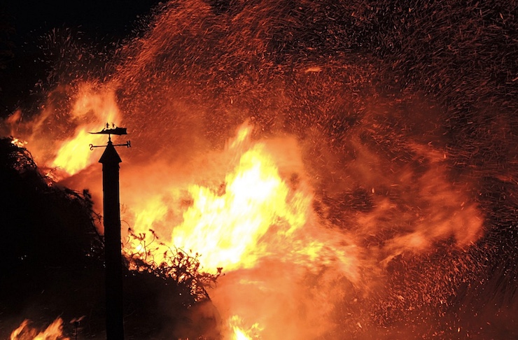
With the degenerative effects of climate change, wildfires are becoming more common than ever. On December 30, 2021, a wildfire in an unlikely location broke out. Boulder County, Colorado, best known for its pristine snow trails, became the site of a rare wildfire event. An unusually warm spring led to an abundance of grass growth, followed by a dryer summer that turned the grass into perfect kindling. What caused the fire to ignite has yet to be determined, but with the addition of strong mountain wind gusts, the Marshall Fire quickly spread, destroying over 1,000 suburban structures. People had only minutes to evacuate their homes as the winds rapidly drove the fire to consume 6,200 acres of land.
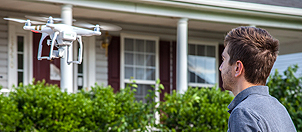
The strong winds proved too powerful for firefighting efforts, but luckily a heavy snowfall that night subdued the flames. Once it was safe to enter the burn zone, the Weather Channel sent up a drone to capture images of the devastation. The drone footage showed the husks of hundreds of homes hidden beneath ashy colored snow. In the wake of the Marshall Fire, the Geotechnical Extreme Events Reconnaissance (GEER) team, which is funded by the National Science Foundation, was called in to assist. Their job is to investigate and document events like earthquakes, volcano eruptions, and extreme storms. The Marshall Fire was the first wildfire GEER had been called in to investigate.
A collaborative team of GEER researchers from the University of Colorado Boulder (CU), Oregon State University (OSU), and Purdue University joined up to use drones to document the effects of the Marshall Fire. Brad Wham from CU, who was evacuated from his Louisville home during the Marshall Fire, explained that their initial job was to use the drones to preserve any perishable evidence from the fire, evidence that would be destroyed by coming storms or reconstruction. “We are very interested in the characteristics of how hot some of these structures burned,” said Brad. “Which is useful for us to understand how the fire spread, whether it was from building to building, or through the grassland areas past trees.”
Brad’s colleague, Erica Fischer, a Civil & Construction Engineering assistant professor from OSU, explained that using drones to document an event like the Marshall Fire can have huge impacts. She explained that communities like Louisville haven’t been investigated by civil engineers that can determine how structures react in extreme scenarios. The drones will also test for dangerous chemicals and compounds that could act as fuel for fires. By using the drones, Brad and Erica hope to determine the factors that contributed to the progression of the wildfire. This report will give reconstruction teams an idea of how to build to prevent repeat disasters.
After the Marshall Fire, a rare winter wildfire, the Department of Agriculture stated, “Wildfire season has become longer based on conditions that allow fires to start and to burn— winter snows are melting earlier and rain is coming later in the fall. What was once a four-month fire season now lasts six to eight months.” By using drones, researchers like those from GEER can help develop preventative and reconstructive plans. But for Brad, who experienced the fear of the Marshall Fire first hand, being part of the GEER drone project is personal. “The only way I know how to respond to something like this,” Brad said, “is to learn something from it, so that the hurt that everyone has experienced goes to something that is as productive as possible.”
|
Previous Drone News:
« It’s Important to Know the Laws and Regulations Before you Fly a Drone
Oceanside Police Department in San Diego County, CA Using Drones With Zoom to Help Keep Their Officers Updated With a Live Drone Feed During Emergencies »