
Weather Stations to Begin Using Drones To Track Tornadoes and Storms
There is an old joke that goes, “Fool me once, shame on you. Fool me twice, shame on me. Fool me 350,000 times, you are a weatherman”. When weather forecasters predict clear sunny skies, and it ends up being a cloudy rainy day, it can prompt people to question what it is that meteorologists do. The fact is, meteorologists are constantly trying to gather information to help them better predict the weather, a science that can save lives.
During World War II, radar operators began to notice a strange phenomenon. They were picking up echoes caused by rain, snow, and sleet. When the war ended, military scientists developed radar systems that would amplify these echoes, eventually leading to the Doppler Weather Radar systems that are used today. A Doppler radar system can locate and measure precipitation, identify the types of precipitation, and predict the movements of precipitation events. It is not an exact science, but one that is constantly changing which is why the National Oceanic and Atmospheric Administration (NOAA) dedicates billions of dollars each year to weather science.
In recent years, NOAA has added drones with highly sensitive sensors to their weather researching capabilities. With drones, NOAA researchers can get closer than ever to storm systems to gather data. Previously, the closest researchers were able to get to a storm system was by dangerously flying over them in a specially designed plane. With the advancement of drone technology, inexpensive drones can be dropped from the plane into the storm to remotely gather data. With the data collected by the drones, NOAA can develop better predictive models that will prepare people for extreme weather events.
This past spring, researchers from NOAA and The Cooperative Institute for Mesoscale Meteorological Studies (CIMMS) used drones to gather data on tornadoes. CIMMS was established in 1978 by NOAA with the University of Oklahoma. Their website states that their mission is to “Promote collaborative research among University and NOAA scientists on problems of mutual interest to improve basic understanding and to help produce better forecasts and warnings that save lives and property.”
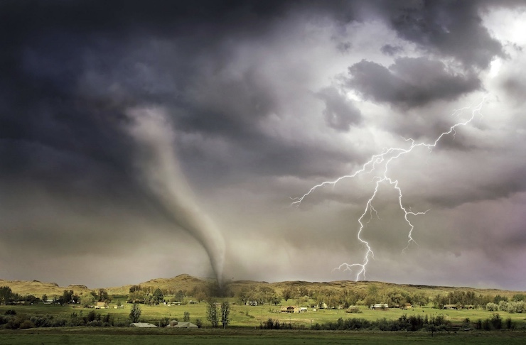
The team did not send a drone into a tornado but used them to collect post-storm data. On March 17, 2021, a tornado outbreak occurred from Wayne County, Mississippi to southern Marengo County, Alabama. Then a week later, on the 25th, another outbreak occurred in the same area. On the 17th, 21 tornadoes were reported in the Birmingham, Alabama region. There were another 4 tornadoes that same day in other parts of Alabama, including ones that touched down in Louisiana, Georgia, and Florida, all from the same storm system. On the 25th, a severe tornado warning was issued for the Birmingham region with predictions of cyclones reaching a 5 out of 5 severity threat.
That day there were a total of 10 tornadoes that swept across the state. NOAA’s Birmingham office reported that ” The most stunning tornado of the event was the long-track tornado that carved a path of damage spanning 80.38 miles over its 98 minute lifespan from Hale to Shelby Counties. This was a single tornado, putting it at #7 for the longest single tornado track in the state of Alabama.” The tornadoes left massive swaths of damage, unfortunately causing injuries and even fatalities. With the warnings sent out from predictive research, many lives were saved as people found safe shelter.
In April, NOAA and CIMMS sent up drones to gather images of the tornado’s path. The images show vastly different scenes. The tornadoes cut a wide, winding path that looks like a debris filled, dried out river bed. Surrounding the path is a landscape that looks untouched, green, and lush. While the tornadoes swept through residential areas, destroying homes and structures, they also passed through hard to reach forested areas. Using drones to collect data in remote areas was particularly beneficial.
The data collected by the drones has sped up the process for insurers and emergency workers to start cleaning up the debris fields. The information will also be used by researchers to understand how a tornado travels across the land surface, and its impact on different types of vegetation. Alex Sizemore, a meteorologist at the NWS Birmingham Weather Forecast Office is grateful that they will be receiving drone supported weather data. “This imagery could be a huge benefit to our office as we will be able to provide more detailed documentation of these impacted areas to other core partner government agencies,” he said. “It also would allow us to get the information much more quickly, saving us time.” With drones, weather forecasters will be able to make more informed predictions on tornado events. This information, though it will never be exact, could help save lives.
|