In 2019, Hawaii’s public electric company said it would conduct drone surveys across all of the state’s five islands to identify areas vulnerable to wildfire and to determine the best course of action to protect the public, as well as electrical infrastructure.
One of the islands to be inspected, of course, was Maui, scene of last week’s horrific blazes that killed more than a 100 people, with the death toll expected to rise substantially in the weeks ahead.
But those surveys never happened.
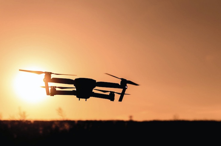
The utility of drones for fire-fighting prevention, prediction and mitigation is now widely acknowledged. While conventional aircraft, including fixed wing aircraft and helicopters, are still widely used to fight fires and to rescue their victims, pilot-less battery-powered drones have many competitive advantages: greater airborne maneuverability; increased access to remote difficult-to-reach topography; reduced fuel, labor and operational costs, lower safety risk, and lessened environmental impact.
Drones are also highly versatile: while unable to transport passengers, they have unparalleled aerial surveillance capabilities: they can be fitted with advanced sensor and data collection technology to estimate wildfire vulnerability due to evolving land use and storm and weather patterns. And they can also be inserted directly into fire-fighting operations to predict blaze trajectories, spray fire retardants, resupply fire-fighting crews and search and rescue blaze victims. And with infrared thermal imaging cameras, they can perform these operations day and night, while traditional aircraft must cease their operations at sundown.
Not all state and local firefighting agencies have adapted themselves to deploying drones. The fire department of Menlo Park, California, was one of the first to do so back in 2019, and nearly 200 fire-fighting agencies nationwide have followed suit. In addition, public utility companies in fire-prone states – aware of the fire risks posed by sparks from energy grids and power lines – have prepared their own wildfire mitigation plans, to include drone surveillance and inspections of their infrastructure. For example, San Diego Gas & Electric in California, under special authority of the FAA, pioneered drone deployments for this purpose as far back as 2015.
Hawaii was well aware of these initiatives. In 2019, Hawaiian Electric, Maui Electric and Hawaii Electric Light evaluated the wildfire mitigation plans filed by all of the major utilities in California and even studied Hawaii fire ignition maps to determine where the greatest risks were in order to provide a basis for their own wildfire prevention and response planning.
It’s just not clear what, if anything, happened to their plans. Apparently, Hawaiian power authorities failed to follow through, a symptom of the larger wildfire mismanagement that has plagued the Maui disaster from the beginning.
Drones are available for fire-fighting in Hawaii on a more limited basis in more densely populated parts of Hawaii – but not on Maui, where the resident population is relatively small (pop. 165,000). For example, the Honolulu Fire Department (HFD) on the heavily populated island of Oahu (1 million residents, with 81% living in the city), deploys a small fleet of drones for urban fire-fighting – the kind that occurs year round in response to accidental industrial or residential fires.
These drones don’t generally conduct aerial surveillance to predict seasonal wildfires; instead, they respond to 911 calls to establish the situational intelligence that allows urban fire-fighting teams to anticipate their tactical and resource needs.
Last September, the HFD doubled the size of its drone team – and not just for fire-fighting, but for an expanded range of missions, including 3D mapping of construction sites on public building projects. “Our capabilities are just limited by our imagination to use them,” HFD Battalion Chief John Pacheco told Hawaii News. Maui, by contrast, never saw the need to build a drone force, not even for local fire support — or simply lacked the resources.
Modern fire fighting isn’t just about putting out fires. Today, public safety agencies have tools available to predict, prevent and mitigate these blazes with more precision and safety than in decades past. With data from fire-fighting drones, states can estimate wildfire threats, warn their residents about them, take precautionary measures, and when blazes do occur, work to minimize unavoidable damage while conducting search-and- rescue and disaster relief operations.
Sadly, while extensive plans for drone-based wildfire mitigation were on the table in Maui and elsewhere in Hawaii, those plans never bore fruit. Without advance warning, and left to rely on more conventional methods, tiny Maui was quickly overwhelmed and partially consumed by one of the worst wildfire disasters in modern U.S. history. In the weeks ahead, many will be asking why.